Denver’s Airport City
Rethinking the airport's role and place in the city's future
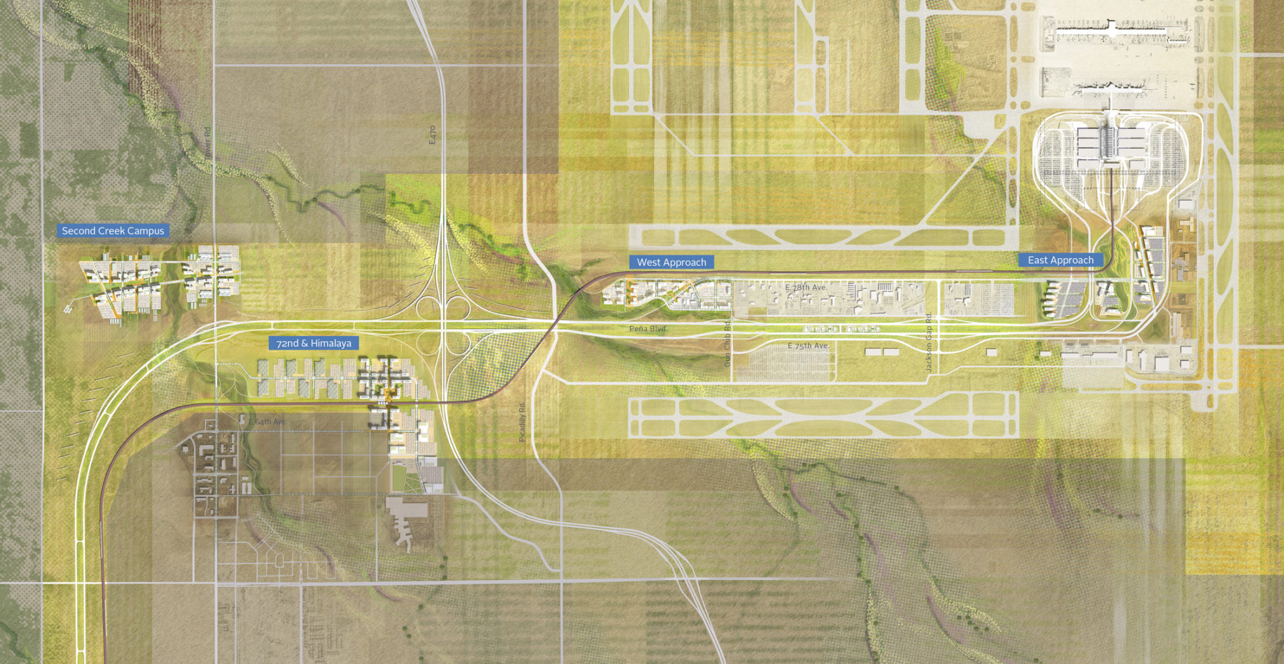
The Strategic Development Plan creates four distinct districts on approximately 1,000 acres along the airport's main access road, Peña Boulevard, each with a unique character and relationship to the surrounding landscape
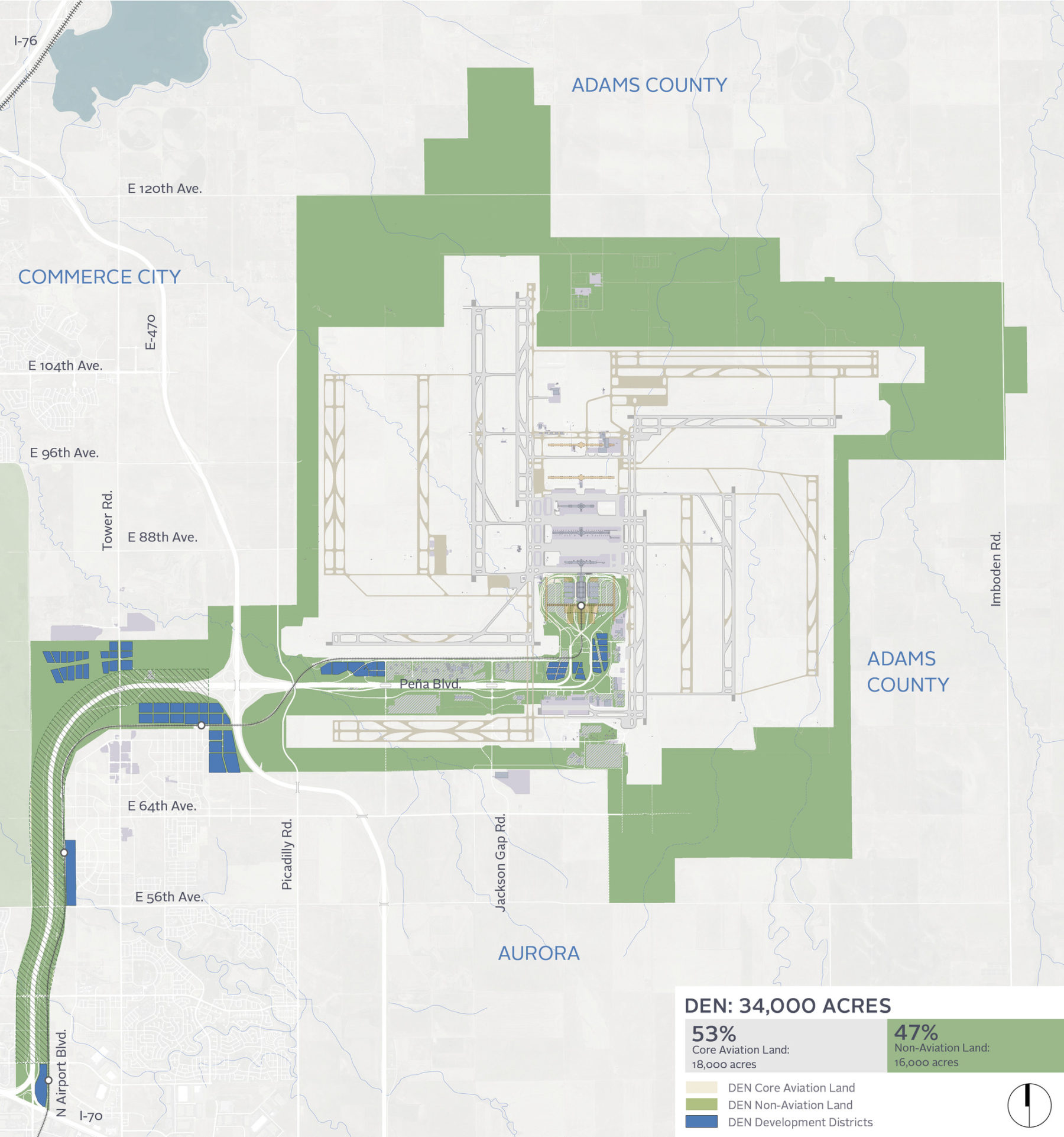
The Denver International Airport (DEN) aspires to build a world-class airport city of diverse commercial uses on its 16,000 acres of non-aviation property. Sasaki’s interdisciplinary design team is collaborating with the airport’s real estate division to create a Strategic Development Plan that establishes a comprehensive long-range planning framework, development strategy, and design standards to realize DEN’s vision.
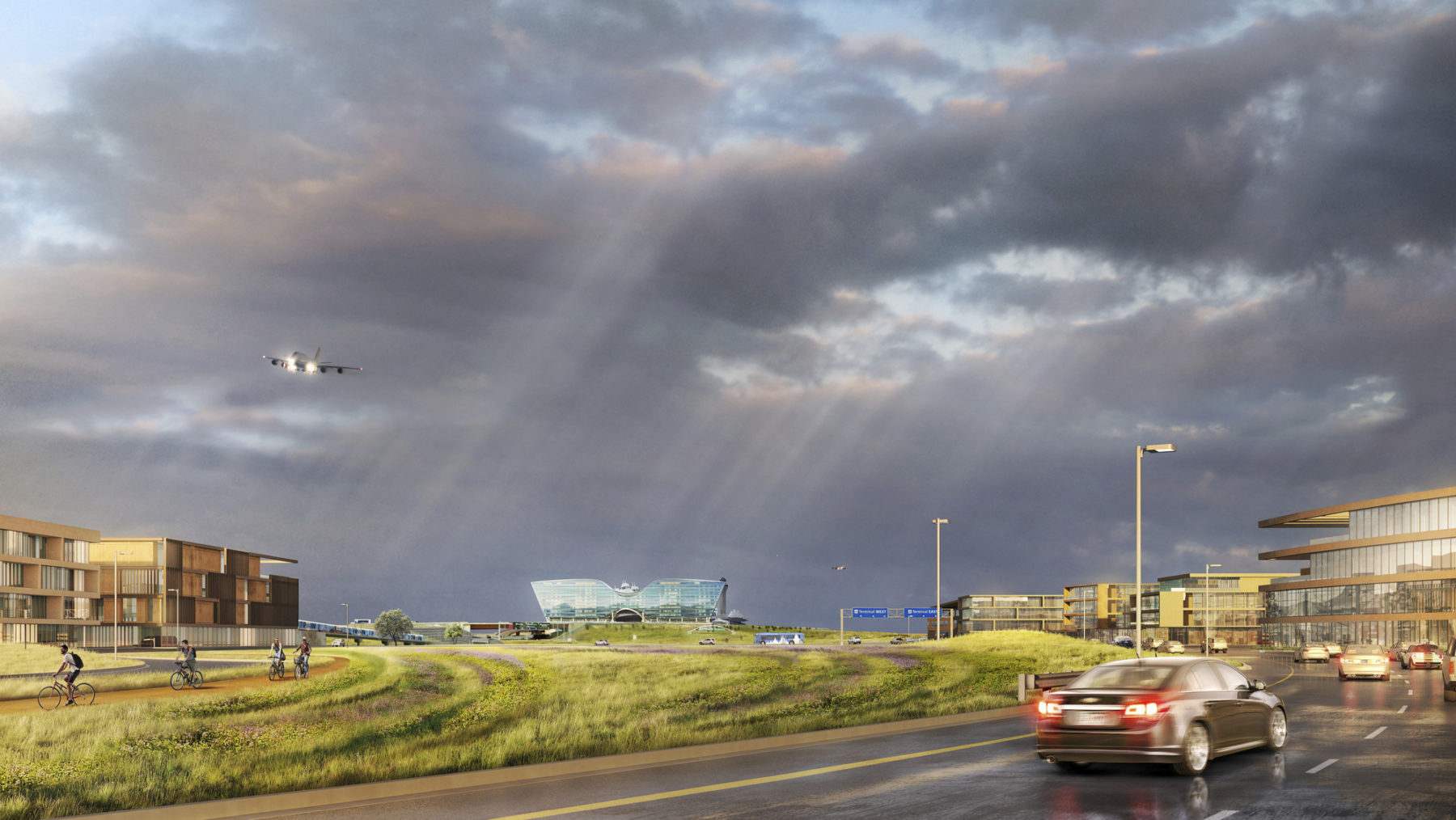
The Strategic Development Plan transforms DEN’s non-aviation land into a series of concentrated, vibrant development districts designed to serve a spectrum of national and global businesses. Focused initially on approximately 1,000 acres along the airport’s main access road, Peña Boulevard, the plan celebrates an identity that is distinctly DEN and uniquely rooted in the Colorado landscape. Each development district capitalizes on the property’s unique landscape amenities, views of the rolling prairie and Front Range, and seamless international airport access.
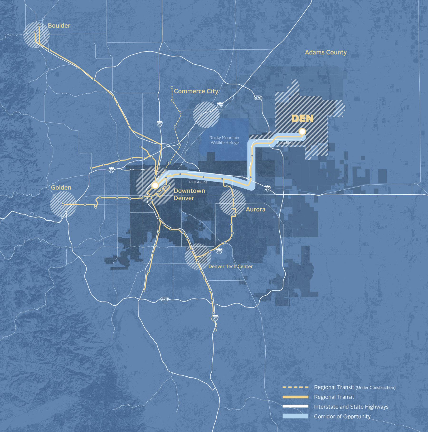
Covering approximately 53 square miles, Denver International Airport is the second largest airport landowner in the world. The recently completed commuter rail connects DEN to downtown Denver in 40 minutes. DEN’s plans include several transit-oriented development opportunities.
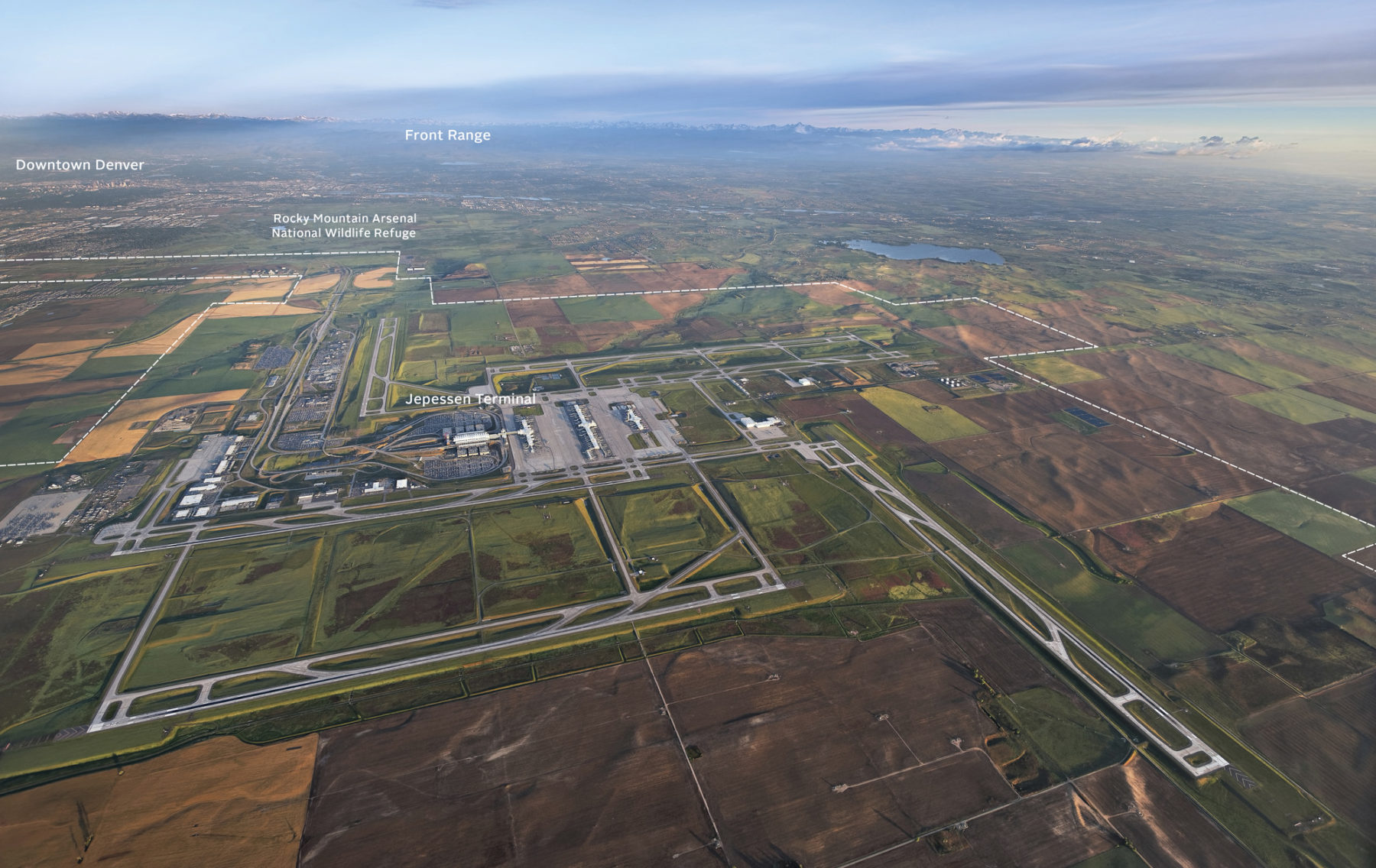
Serving over 61 million passengers annually, Denver International Airport (DEN) is the largest economic driver in the state of Colorado, fueling more than $26 billion in annual economic benefit
The plan’s conceptual land use strategy organized DEN’s property into three categories: Peña Boulevard corridor, urban edge, and rural edge
The plan supports the airport’s core aviation mission by leveraging DEN’s size, capacity for growth, and central location, both nationally and globally, to envision sustainable, economically-beneficial development. With approximately 53 square miles of land area, DEN is the second largest airport landowner in the world. At its current size, DEN serves over 58 million passengers annually and is the largest economic driver in the state of Colorado, fueling more than $26 billion in annual economic benefit. DEN has the land area available to cost-effectively expand its airfield from its six existing runways to twelve runways at full buildout, with the ultimate ability to serve over 100 million passengers.
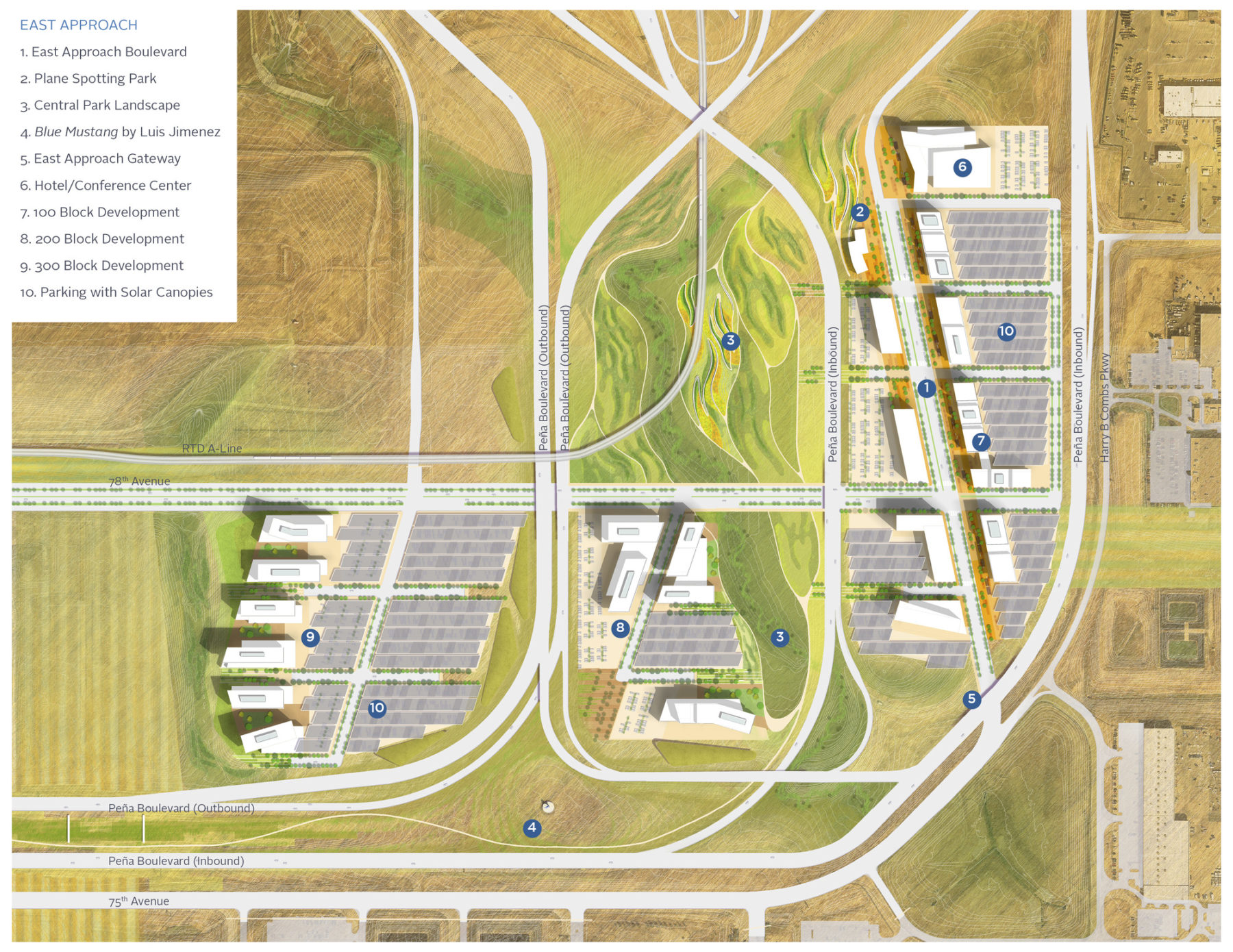
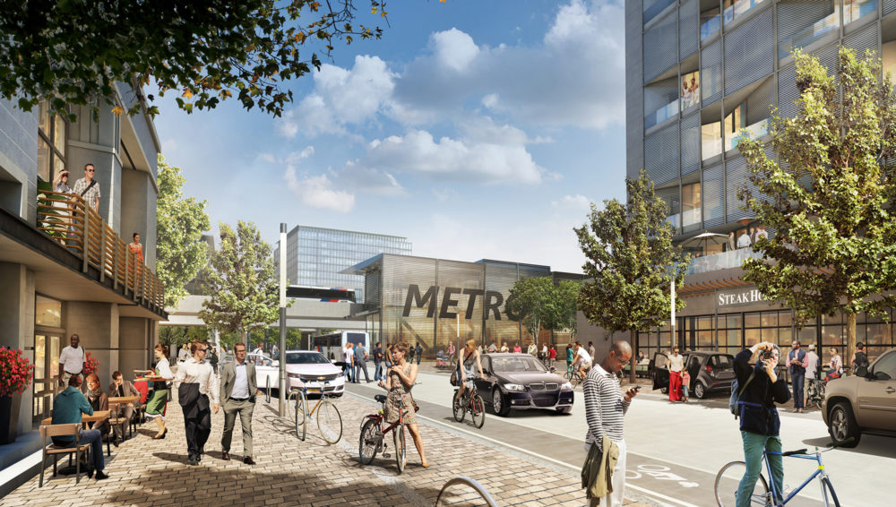
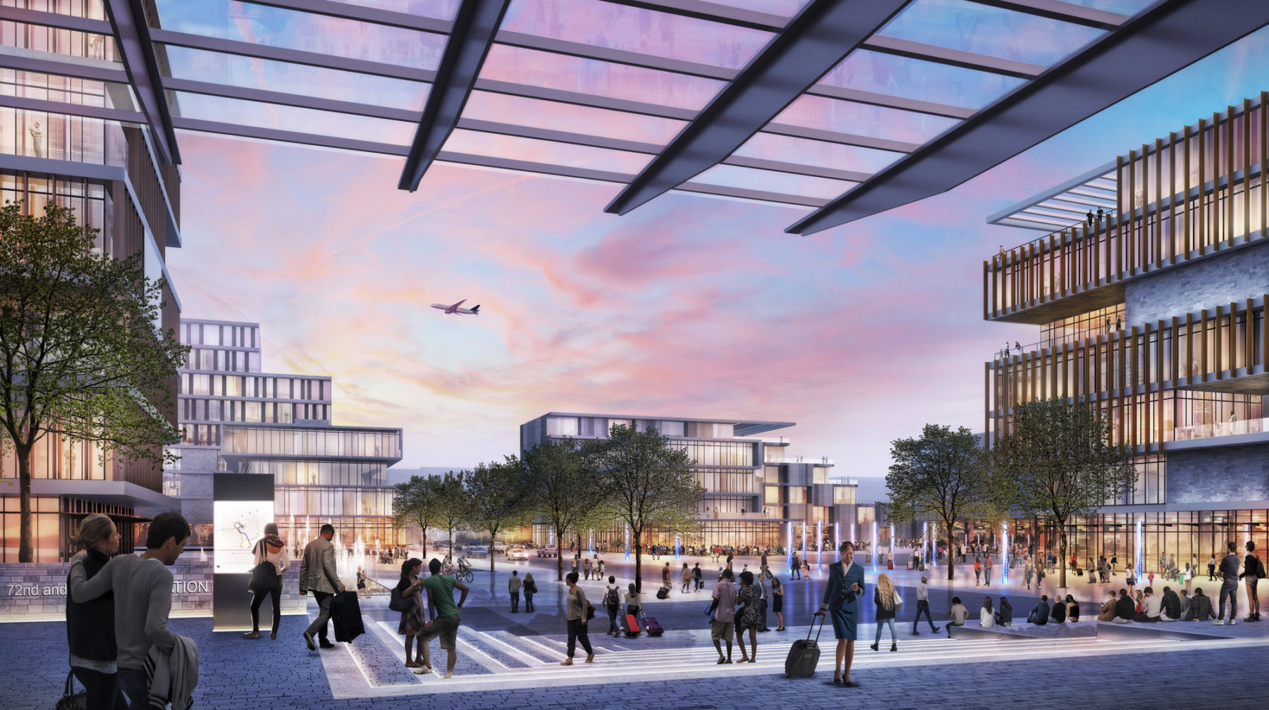
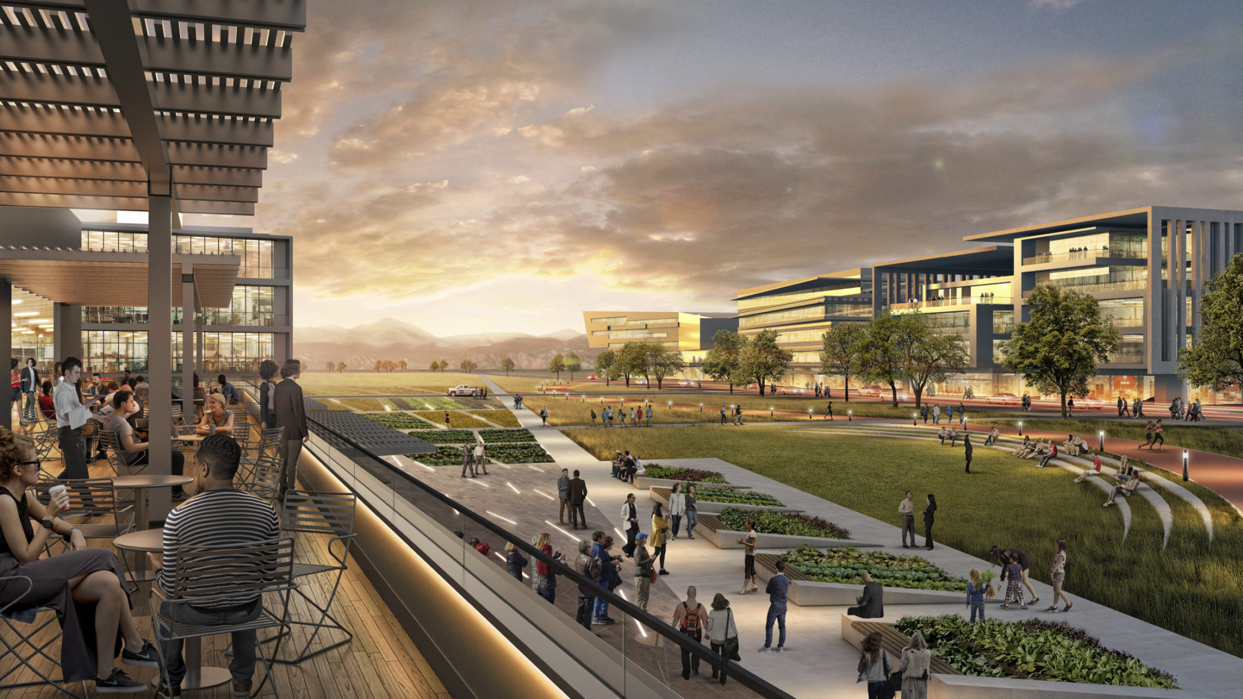
The plan organizes the district into three clusters of development. A circulator transit system and pedestrian and bicycle paths link East Approach to the terminal and DEN’s other proposed development districts. The streets, public spaces, and architecture of East Approach frame dramatic views of the terminal and airplanes as they taxi, take off, and land.
The vision for DEN’s airport city builds on the distinct architecture of the iconic Jeppesen Terminal, vast prairie landscape, and breathtaking views of the Rocky Mountains. A newly constructed passenger rail line connects DEN to Union Station in downtown in about 40 minutes. Stopping at several transit-oriented development sites, this new transit line forms what Mayor Michael Hancock refers to as Denver’s Corridor of Opportunity. The network of regional, national, and global connectivity—combined with DEN’s extensive land resources, the natural beauty of the surrounding prairie and Rocky Mountains—provides the context and inspiration for the Strategic Development Plan.
The DEN Strategic Development Plan creates a roadmap for transforming non-aviation airport land into a series of vibrant development districts that serve local, national, and global commercial and institutional purposes
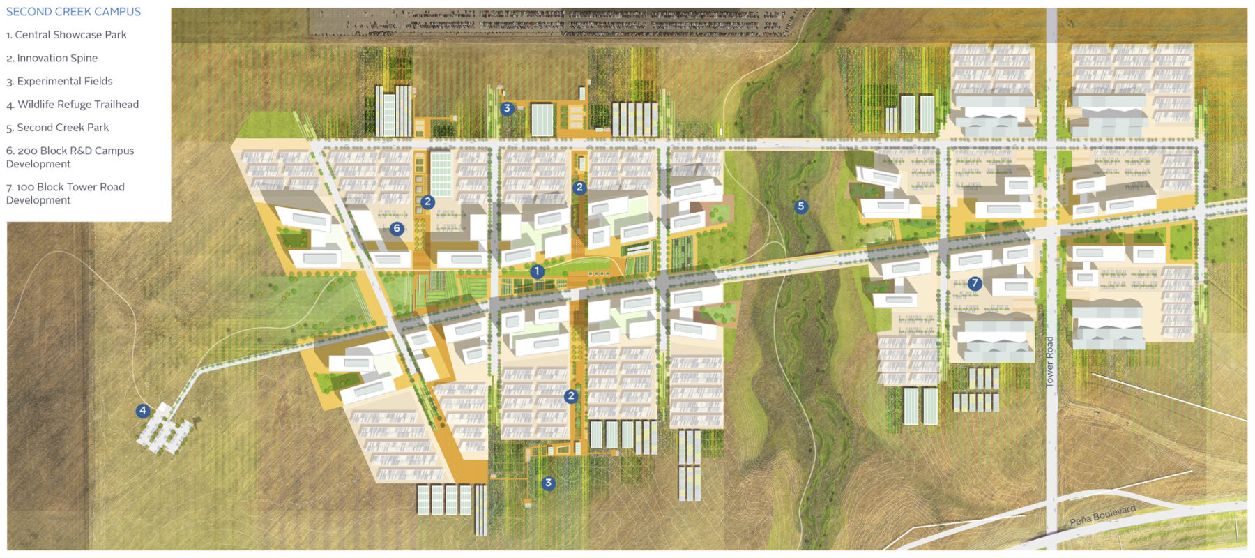
Second Creek Campus plan
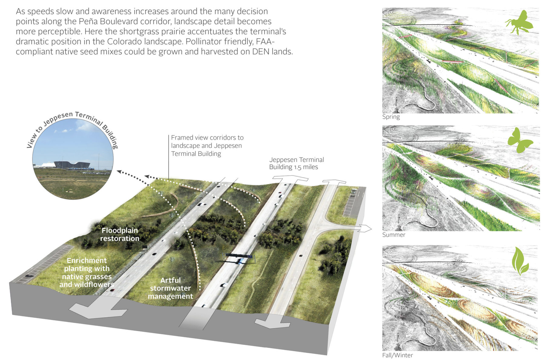
Landscape strategies
The DEN Strategic Development Plan creates a roadmap for transforming non-aviation airport land into a series of vibrant development districts that serve local, national, and global commercial and institutional purposes
Second Creek Campus plan
Landscape strategies
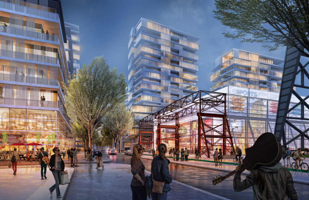
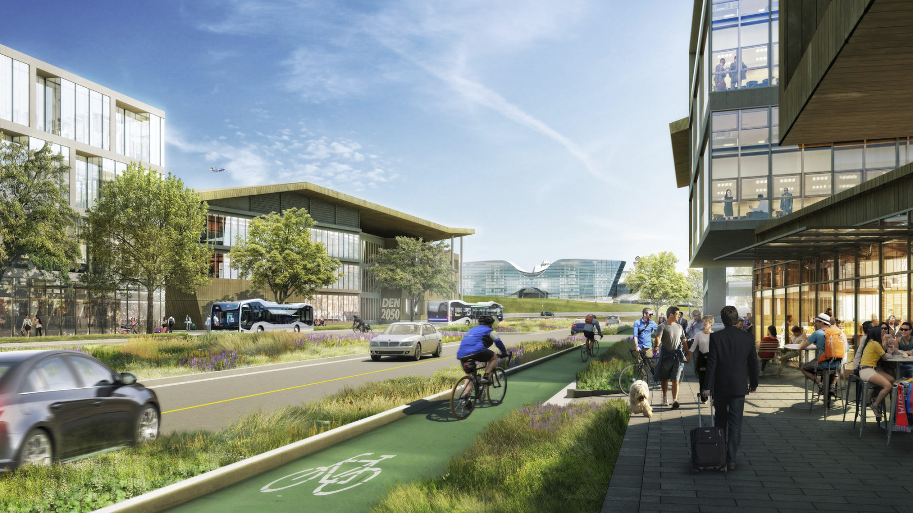
Each of the plan’s priority development districts has a signature character derived from its relationship to the airport terminal, landscape context, and connection to regional transportation networks. The districts are founded on a framework of streets and public spaces designed to balance flexible growth and evolving technologies with the creation of attractive, human-scaled places. DEN’s development districts are conceived as destinations to attract innovative local, national, and international businesses as well as the broader regional community. The plan anticipates a diverse mix of uses including hotel, conference, and other hospitality functions; destination and local retail; commercial office space; research and development; and manufacturing.
The East Approach district connects directly to the airport terminal and the recently-opened Westin hotel and conference center
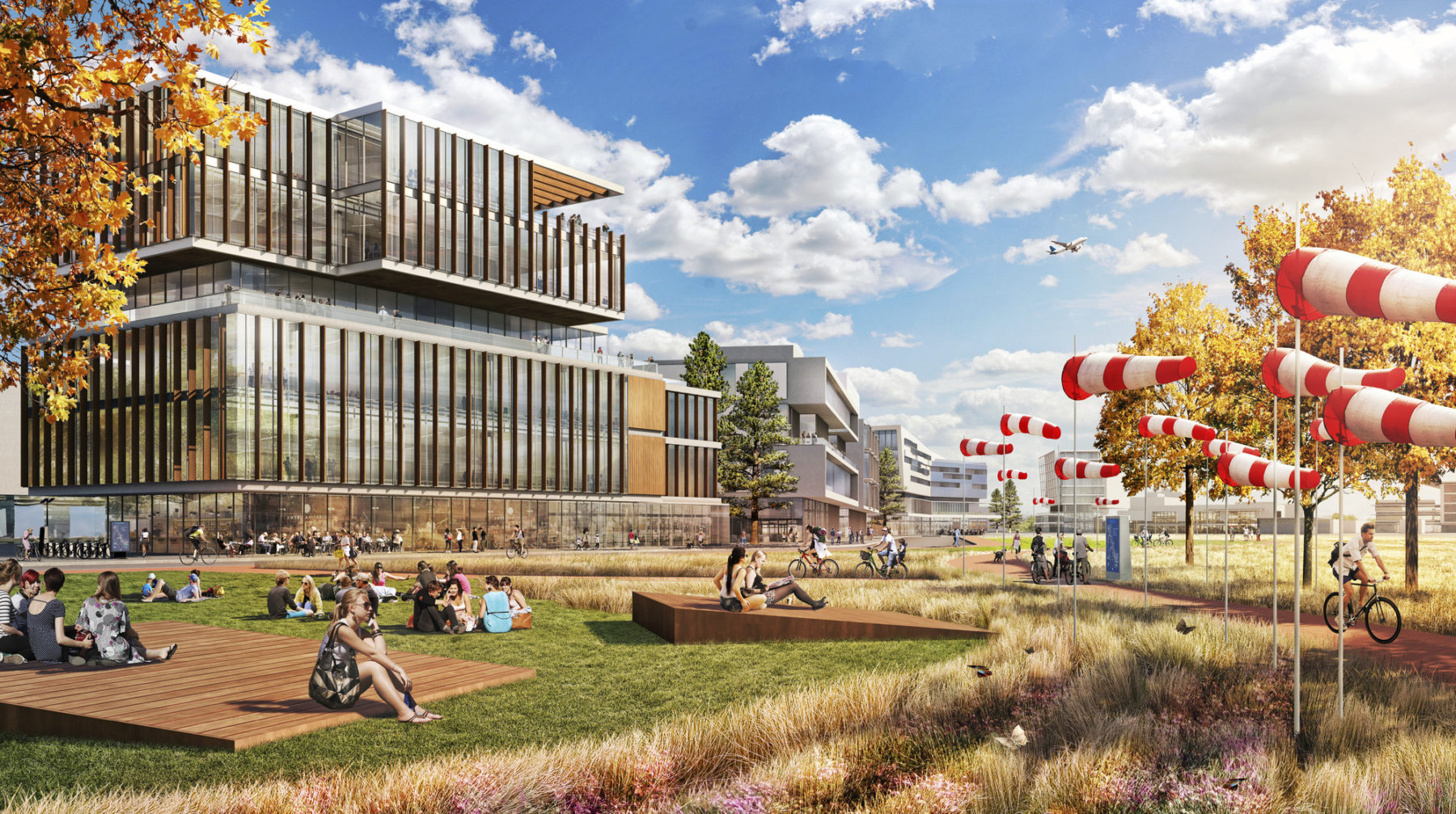
Second Creek Campus is a hub of research, development, education, and manufacturing located in a spectacular natural setting adjacent to the Rocky Mountain Arsenal National Wildlife Refuge. With an initial development capacity of four to five million square feet on approximately 360 gross acres, Second Creek Campus is organized around a central landscape composed of social and research spaces, dramatically oriented toward the Rocky Mountains.
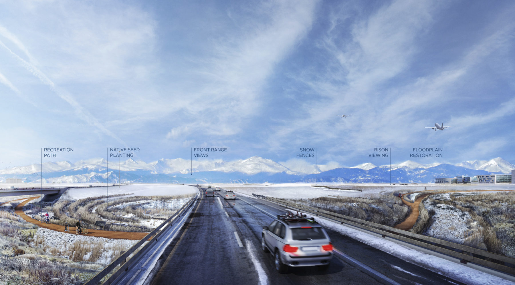
The Strategic Development Plan’s distinctive landscape strategy considers four levels of user experience. Characterized as unobstructed, transitional, immersive, and aerial, these levels of experience dictate scale-appropriate interventions based on the typical speed and position at which one experiences the landscape, be it on foot or bicycle, or in a car, train, or airplane. This strategy is uniquely appropriate to the tens of thousands of visitors and employees whose perspective varies depending on when and how they travel through DEN’s landscape. Underlying the landscape experience is a commitment to contextualize development in the high plains ecoregion, minimize intensive landscape maintenance, and utilize landscape as an integrated medium for DEN’s commitment to public art.
The Immersive Landscape
The Transitional Landscape
The Unobstructed Landscape
The Immersive Landscape
The Transitional Landscape
The Unobstructed Landscape
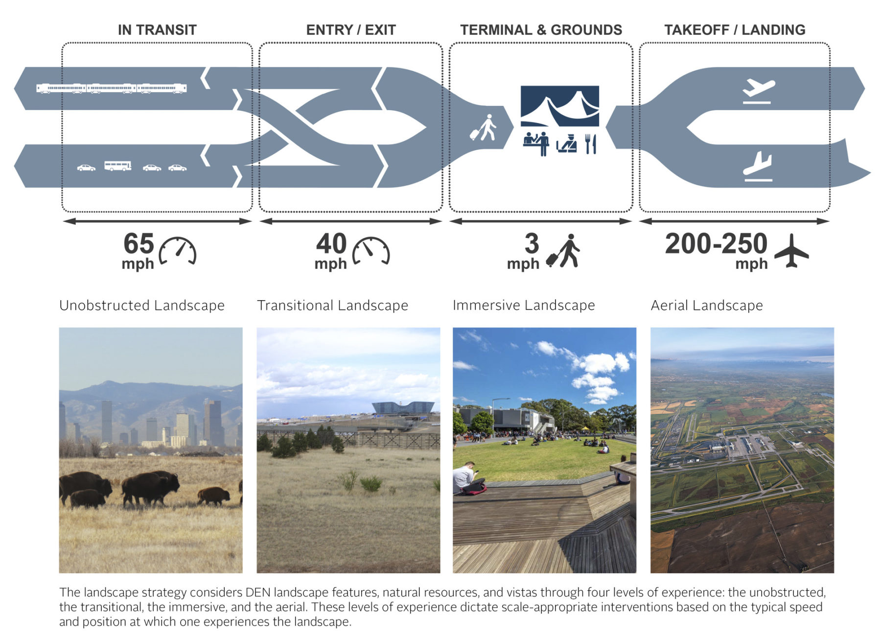
For those in transit, at 65 mph, the unobstructed landscape will focus on geographic features viewed from a distance. At slower speeds of 40 mph, for entry and exit of the airport, transitional landscapes will display artful interpretations of utilitarian landscape elements to highlight local heritage. For those transitioning into immersive landscapes on foot, interactive elements like installations and exhibits will encourage lingering, interaction, and education. Lastly, the aerial landscape viewed at takeoff and landing will feature seasonal changes and crop rotations to yield dynamic expressions of the changing regional landscape.
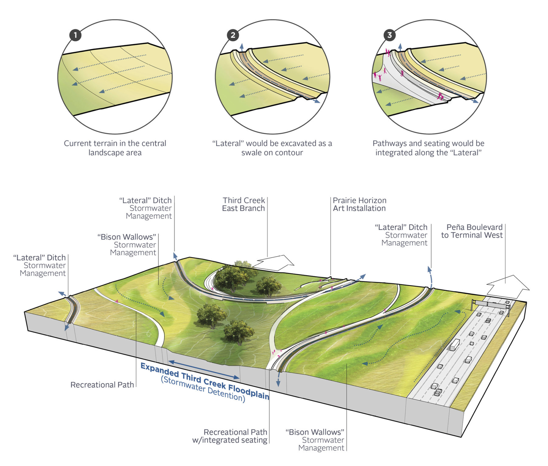
Underlying the landscape experience is a commitment to contextualize development in the high plains ecoregion, minimize intensive landscape maintenance, and utilize landscape as an integrated medium for DEN’s commitment to public art
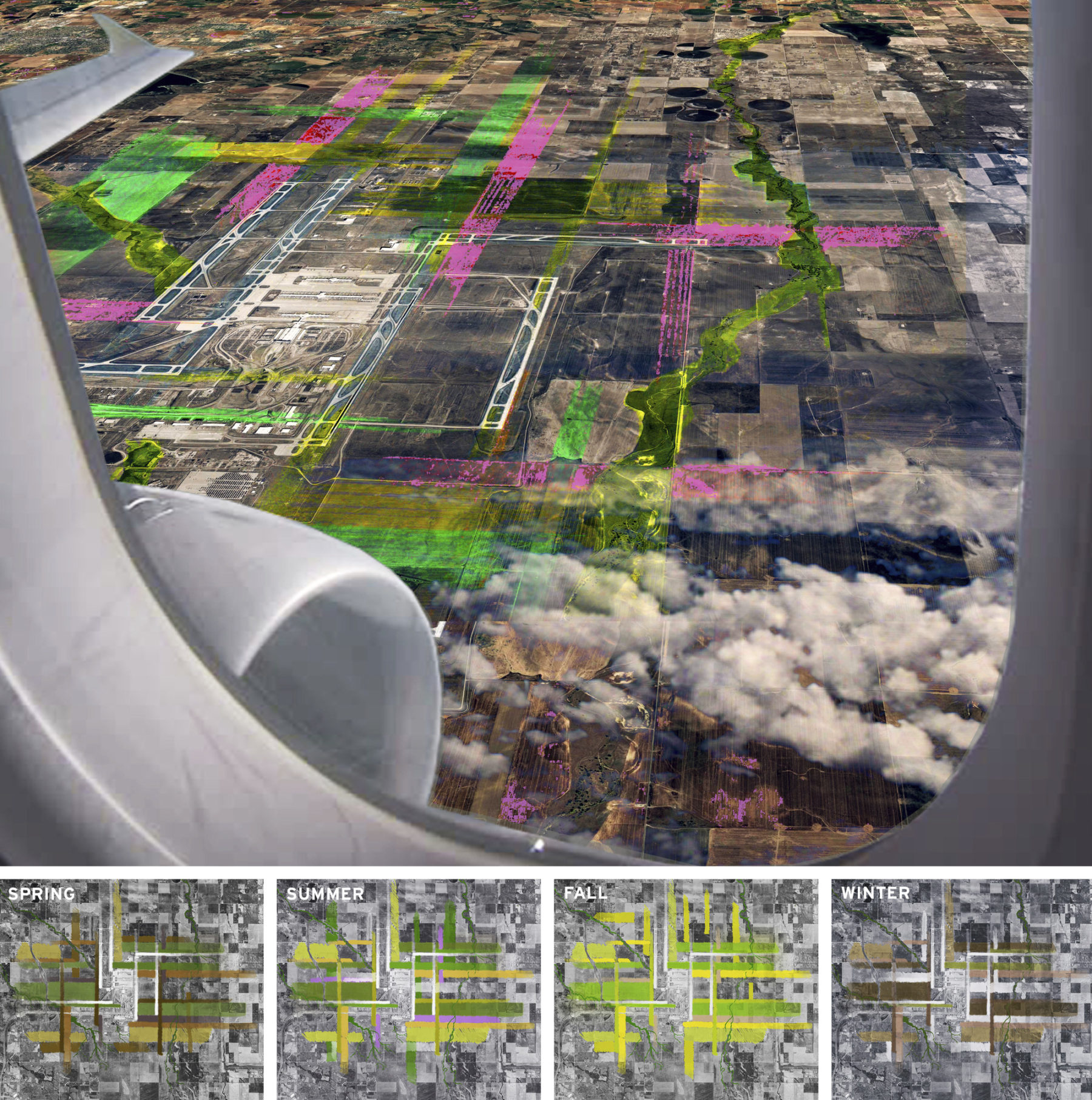
The planting palette remains dynamic throughout the year, no matter the season
The planning process is engaging a cross-section of airport leadership and divisional expertise, as well as stakeholders from the City of Denver and neighboring jurisdictions. Sasaki is collaborating with HR&A Advisors, Matrix Design Group, Peter J. Park, PGAL, HDR, and VHB to develop the plan.
For more information contact Fred Merrill or Joshua Brooks.