Wuhan Yangtze Riverfront Park
Wuhan, China
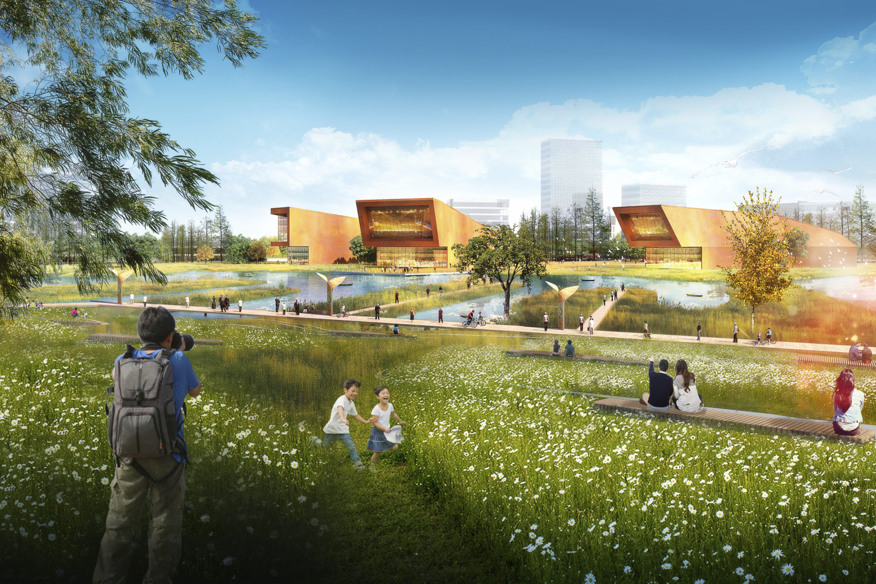
Wetland park
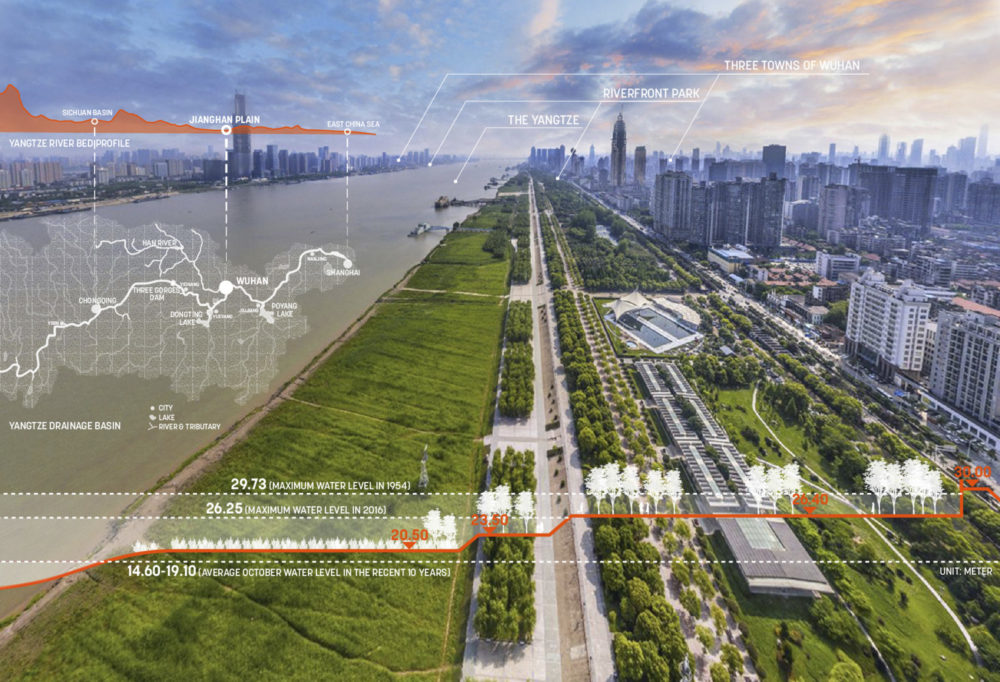
The Yangtze River is the world’s most active freshwater shipping route and the closest major river to the 23 million people of greater Shanghai. Its estuary is a critical feeding ground for migratory birds, and one of the most fragile and threatened ecosystems in the world. As China’s urbanization continues, rethinking strategies for development along the Yangtze is critical to the economic and ecological success of the region.
Xincunsha represents a new relationship between development and the river. Privatized landscapes are repositioned as public parks for recreation, habitat creation, and nature-based education. Infrastructure focuses on resilience rather than restraint. Urban design encourages walkability and access to open space. The result is a new urban district that links to Shanghai via transit, prioritizes the landscape, promotes social engagement, and offers a diverse park system that connects the community to the region’s landscape heritage.
The mouth of the Yangtze River is one of the most fragile and threatened ecosystems in the world
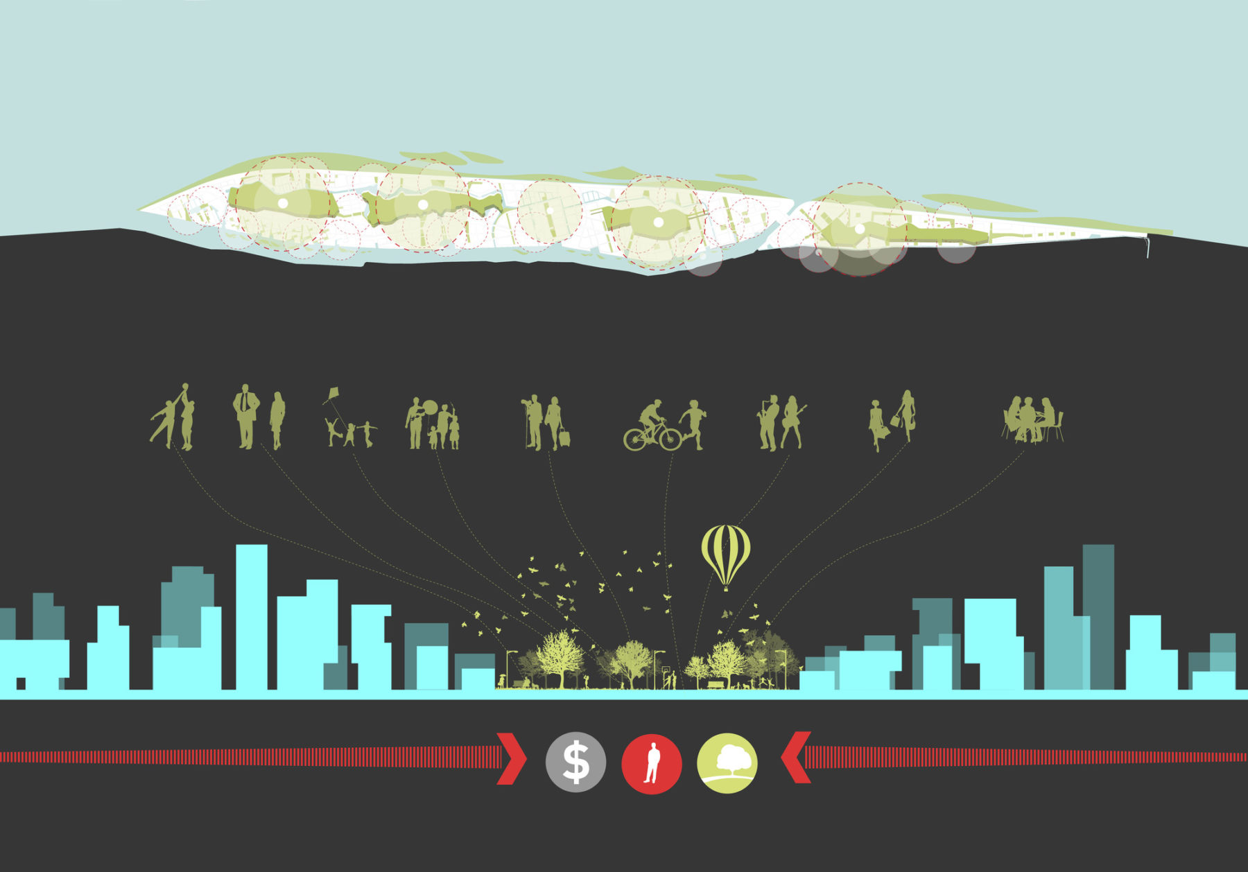
Central parks are hubs of activity
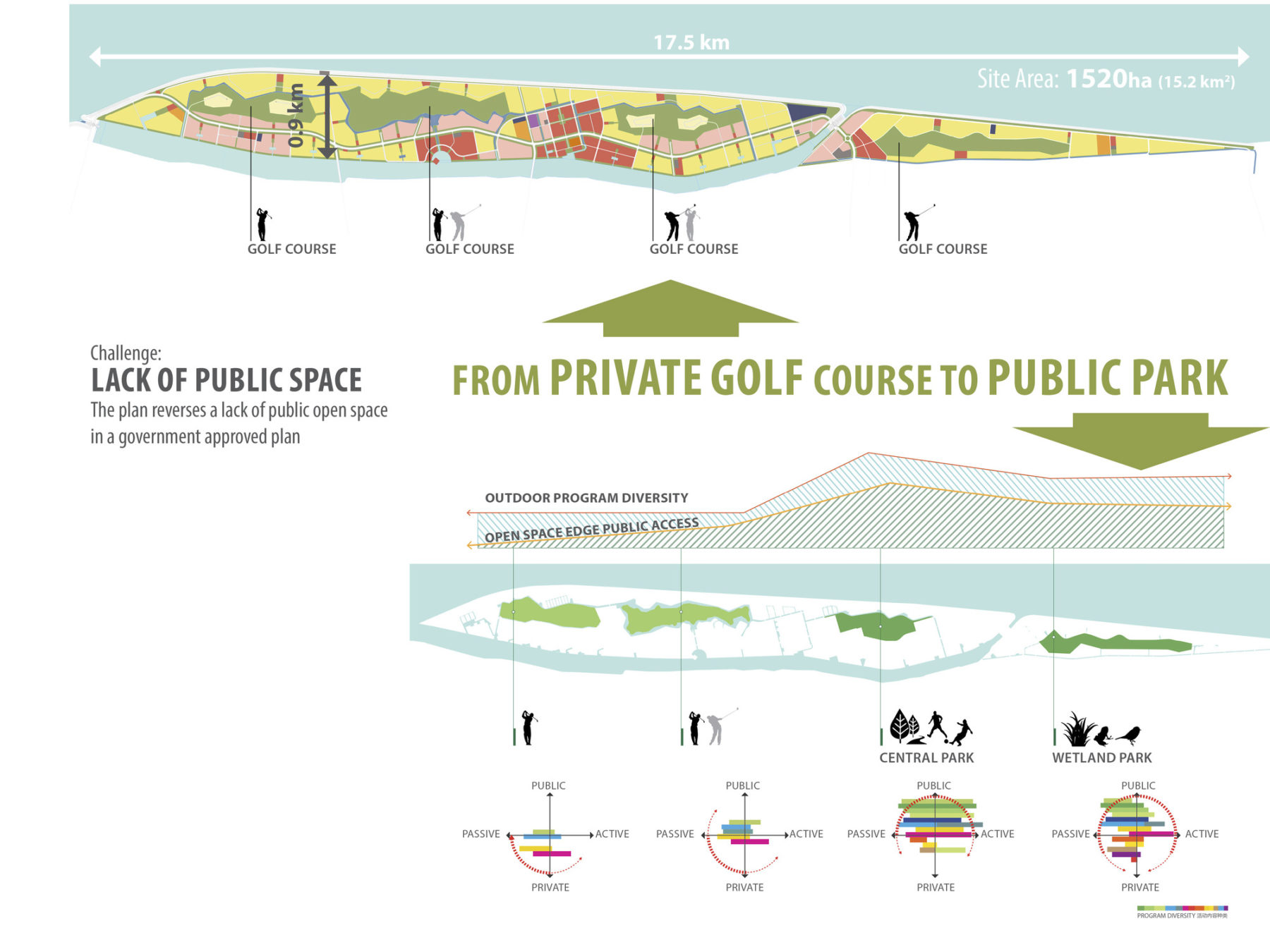
The plan reverses a lack of public open space in a government approved plan
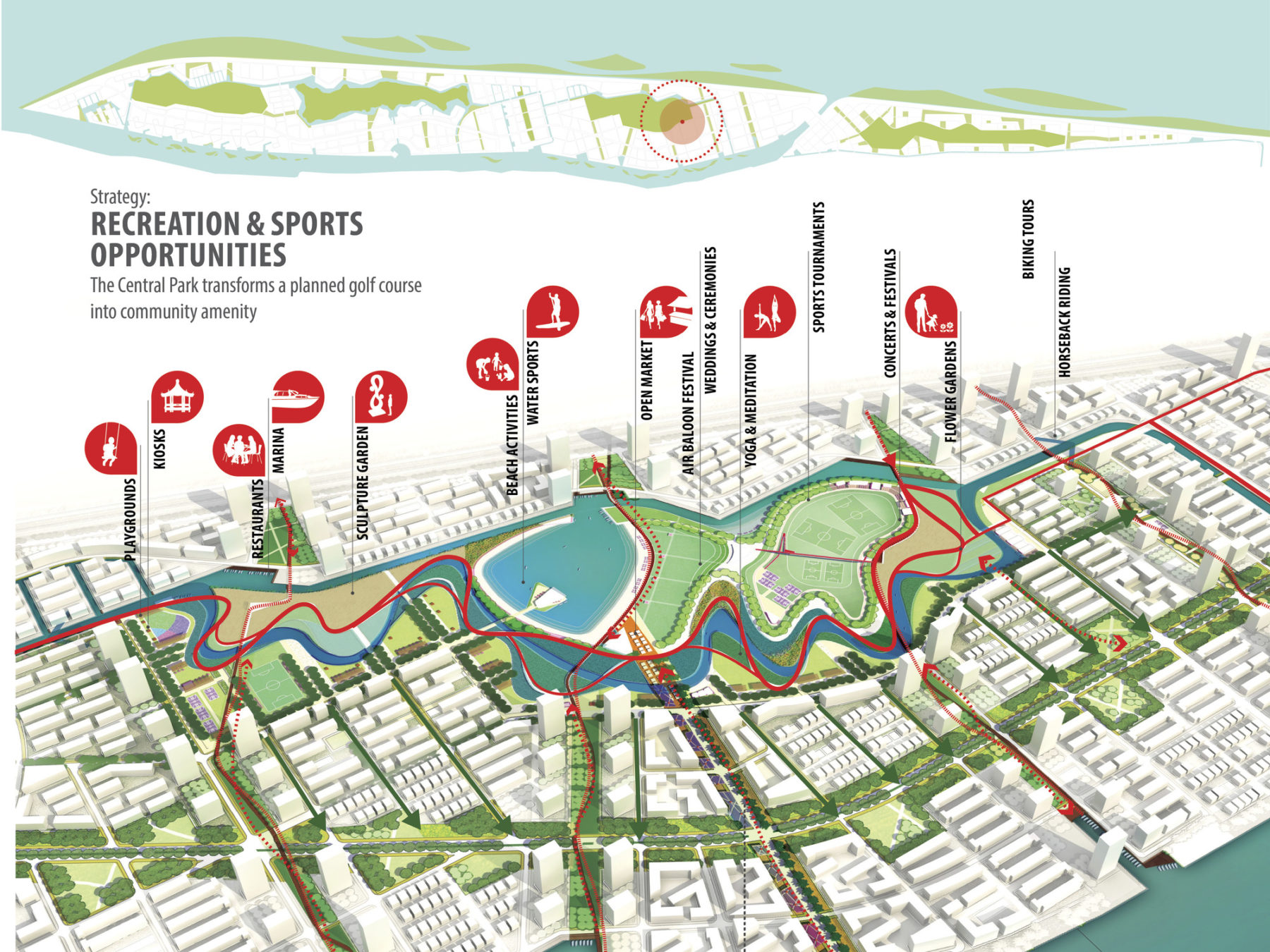
The Central Park transforms a planned golf course into a community amenity
Central parks are hubs of activity
The plan reverses a lack of public open space in a government approved plan
The Central Park transforms a planned golf course into a community amenity
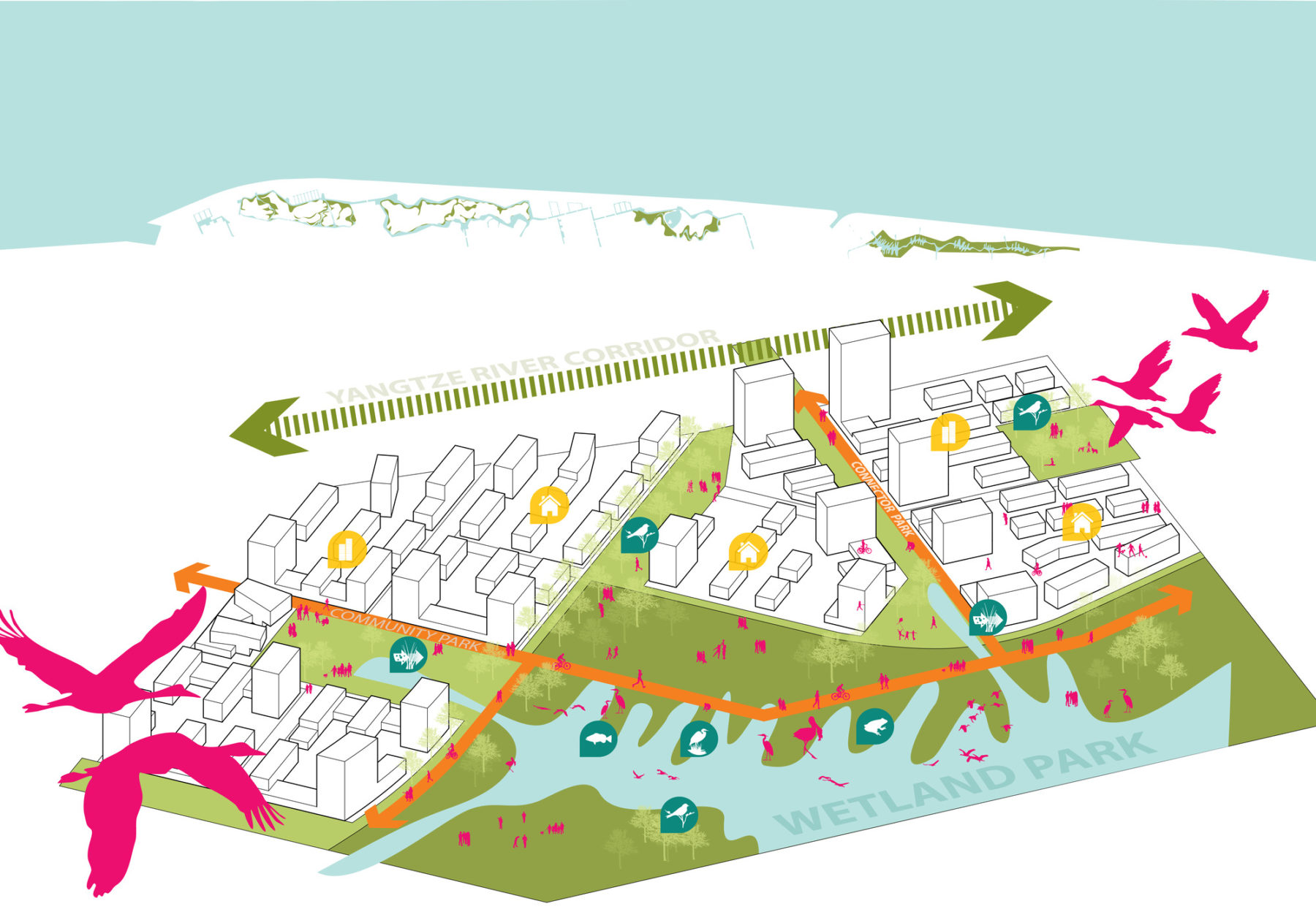
Prior to Sasaki’s involvement in the project, a previously approved master plan for Xincunsha established a legal framework for its development regarding land use, parcel boundaries, roadway networks, and other guiding elements. Unfortunately, this plan disregarded key site features and overlooked multiple opportunities that could result in a more sustainable development approach. Beyond simply ignoring the ecological significance of the site, its four main open spaces were designated as private land uses (in the form of four golf courses) enveloped by low density residential development. This approach not only blocked views and limited community access to these significant open spaces, but also restricted the potential for hydrological connections and wildlife movement.
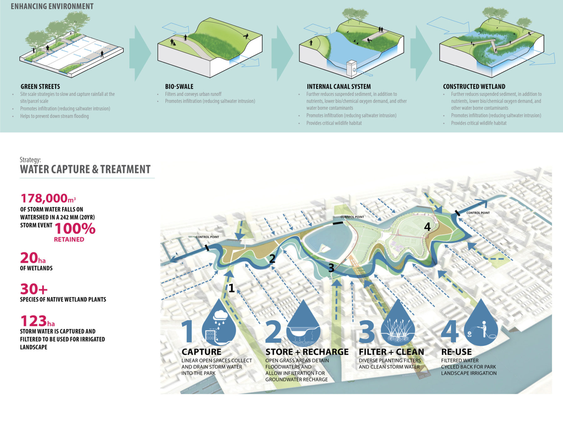
Water capture and treatment strategy
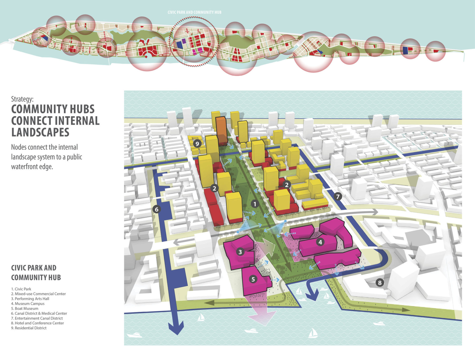
Nodes connect the internal landscape system to a public waterfront edge
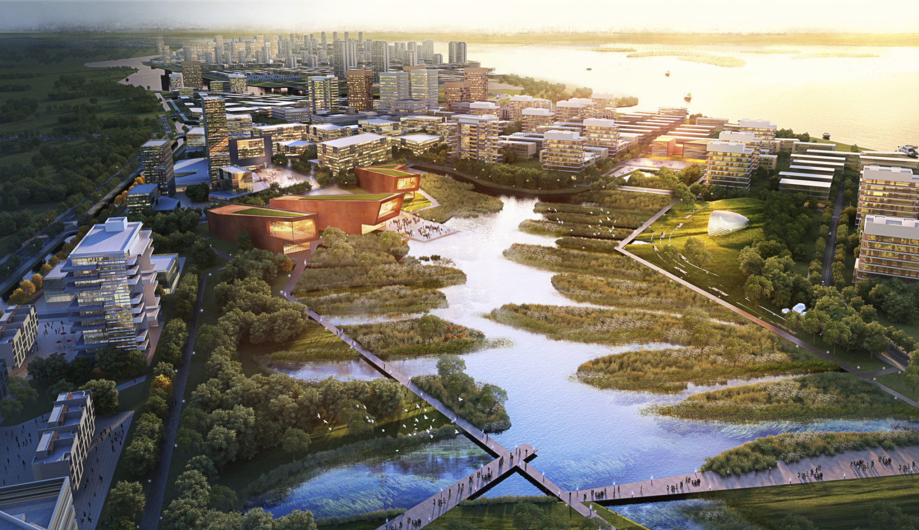
Although commissioned to work within the existing framework, the Sasaki design team felt the missed opportunities were too significant to overlook, and began a campaign to illustrate a more thoughtful approach to the overall plan. The process started with a study to connect the four internal open spaces, as well as to link them to the waterfronts at the edges of the development. This created a landscape system with a contiguous public realm in the center of the Xincunsha development as well as along its entire waterfront, resulting in 100% of the riverfront edges designated for public use. Additionally, two of the four internal landscapes were completely transformed, replacing the privatized golf courses with a civic park that includes a multitude of recreational amenities and a wetland park for nature-based education and experience.
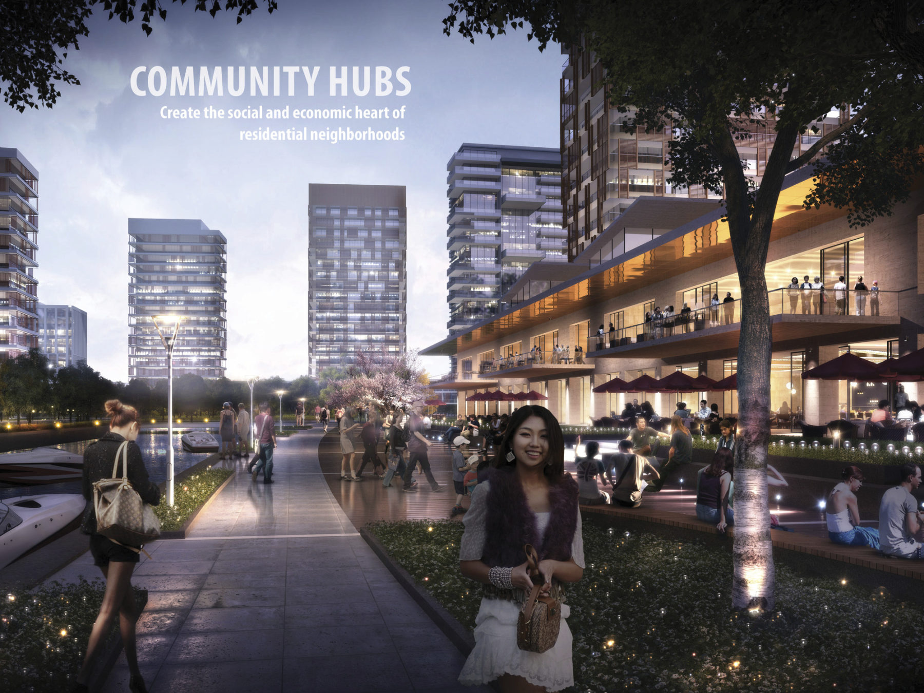
Community hubs create the social and economic heart of residential neighborhoods
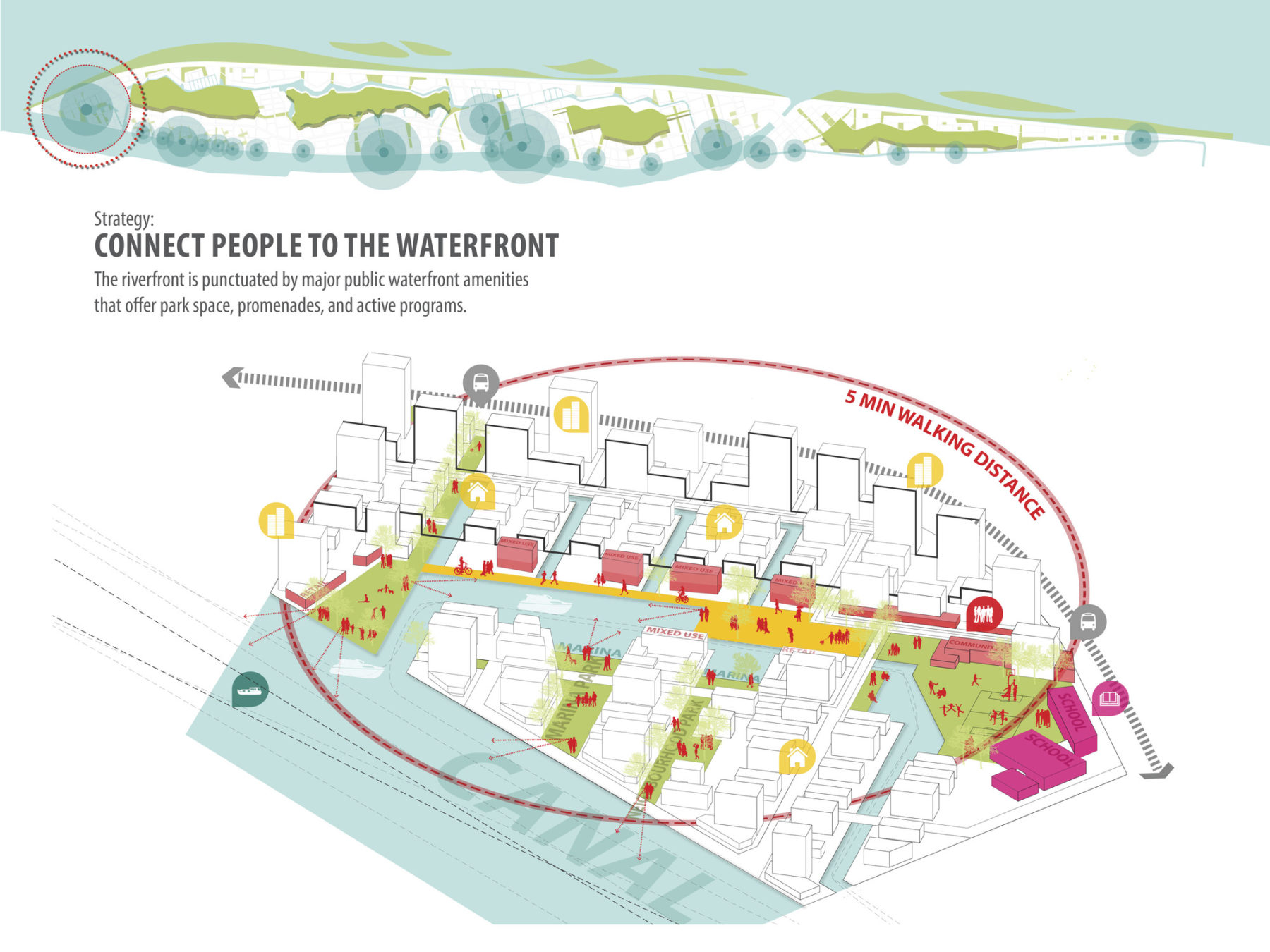
The riverfront is punctuated by major public waterfront amenities that offer park space, promenades, and active programs
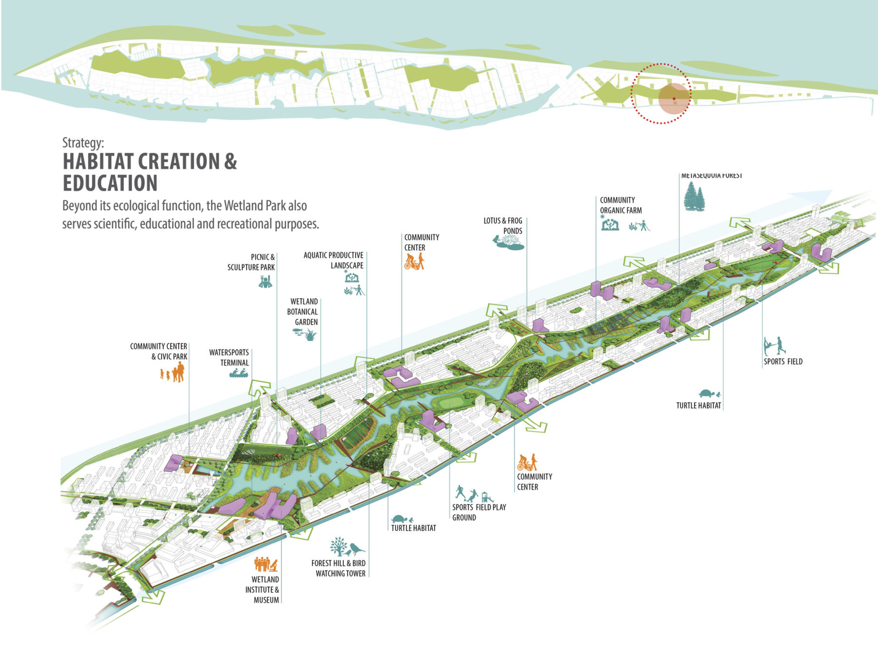
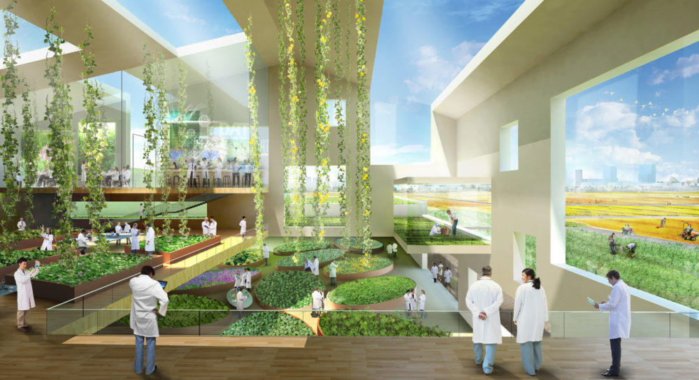
Beyond its ecological function, the Wetland Park also serves scientific, educational, and recreational purposes
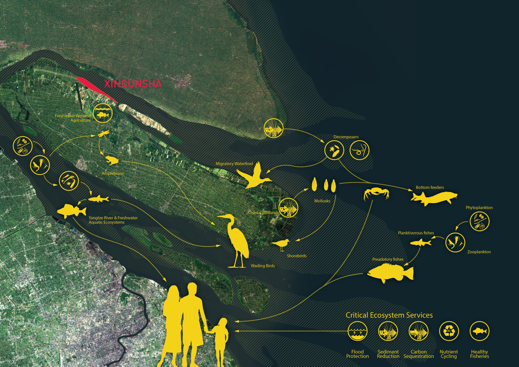
The site is home to a range of animals
The riverfront is punctuated by major public waterfront amenities that offer park space, promenades, and active programs
Beyond its ecological function, the Wetland Park also serves scientific, educational, and recreational purposes
The site is home to a range of animals
In the revised master plan for Xincunsha, the new system of interconnected landscapes enhances the economic value of the larger community by providing greater access and views to open space. Ecologically, the reconceived landscapes provide necessary habitat for the river’s diverse ecosystem and function as green infrastructure to receive and treat stormwater, resulting in a more resilient development approach.
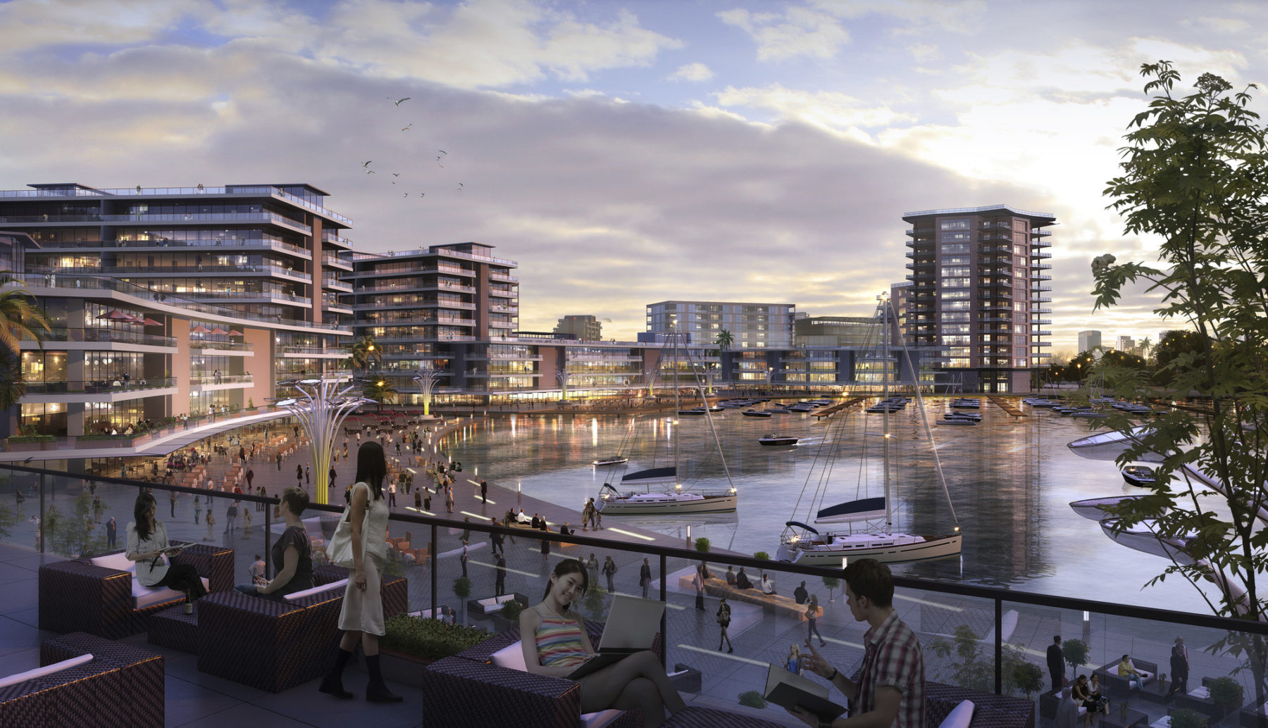
A view of the riverfront
Park spaces and active programs celebrate access to the water
For more information contact Michael Grove or Tao Zhang.