Creating a connected heart along the river out of the last undeveloped waterfront parcel in Portland, Oregon
Zidell Yards Master Plan
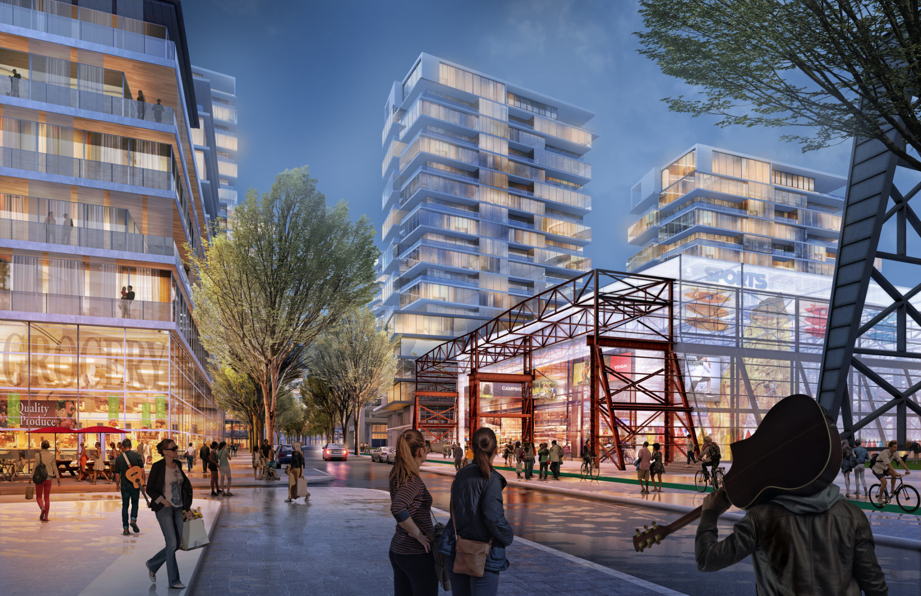
Zidell Yards wants to make artists and musicians central to its plans for a new 33-acre, multi-use development
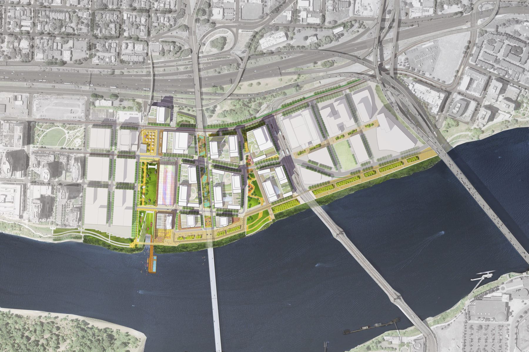
With a focus on innovation, quality of life, development opportunity and public life amenities, the Zidell Yards plan creates a 21st century district that will provide a different type of working, living, and recreational experience for Portland. Over the past decade the area surrounding Zidell Yards has seen remarkable change, with the development of high rise condos, an aerial tram, streetcar, and a rapidly expanding medical university, OHSU. The Zidell Yards site is the largest and last undeveloped parcel in central Portland and its location within a rapidly developing district creates a multitude of opportunities for creating a connected heart along the river.
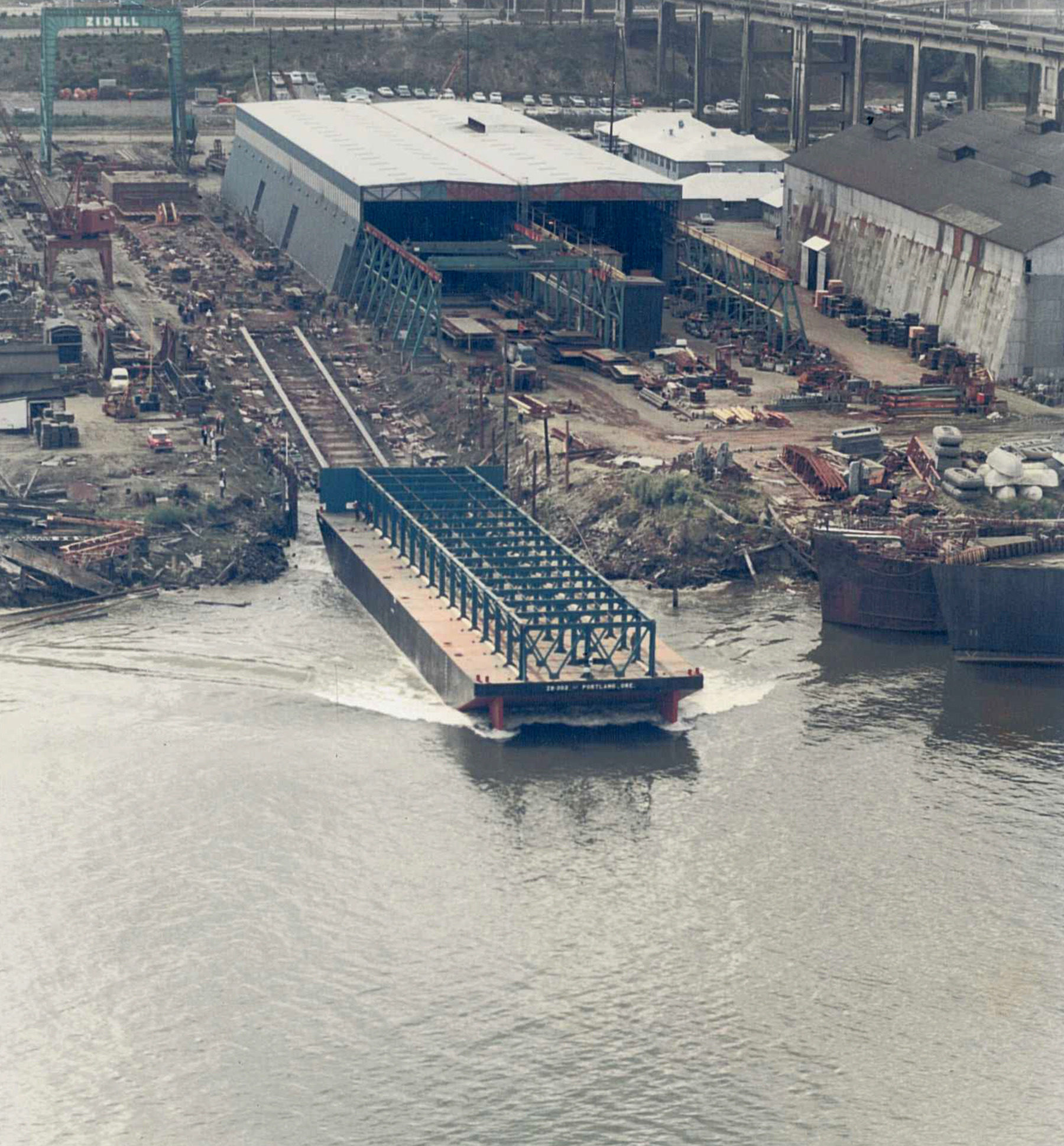
The industrial parcel is one of the last remaining undeveloped waterfront parcels. The barge building is integrated into the plan and will become a key focus of the new district.
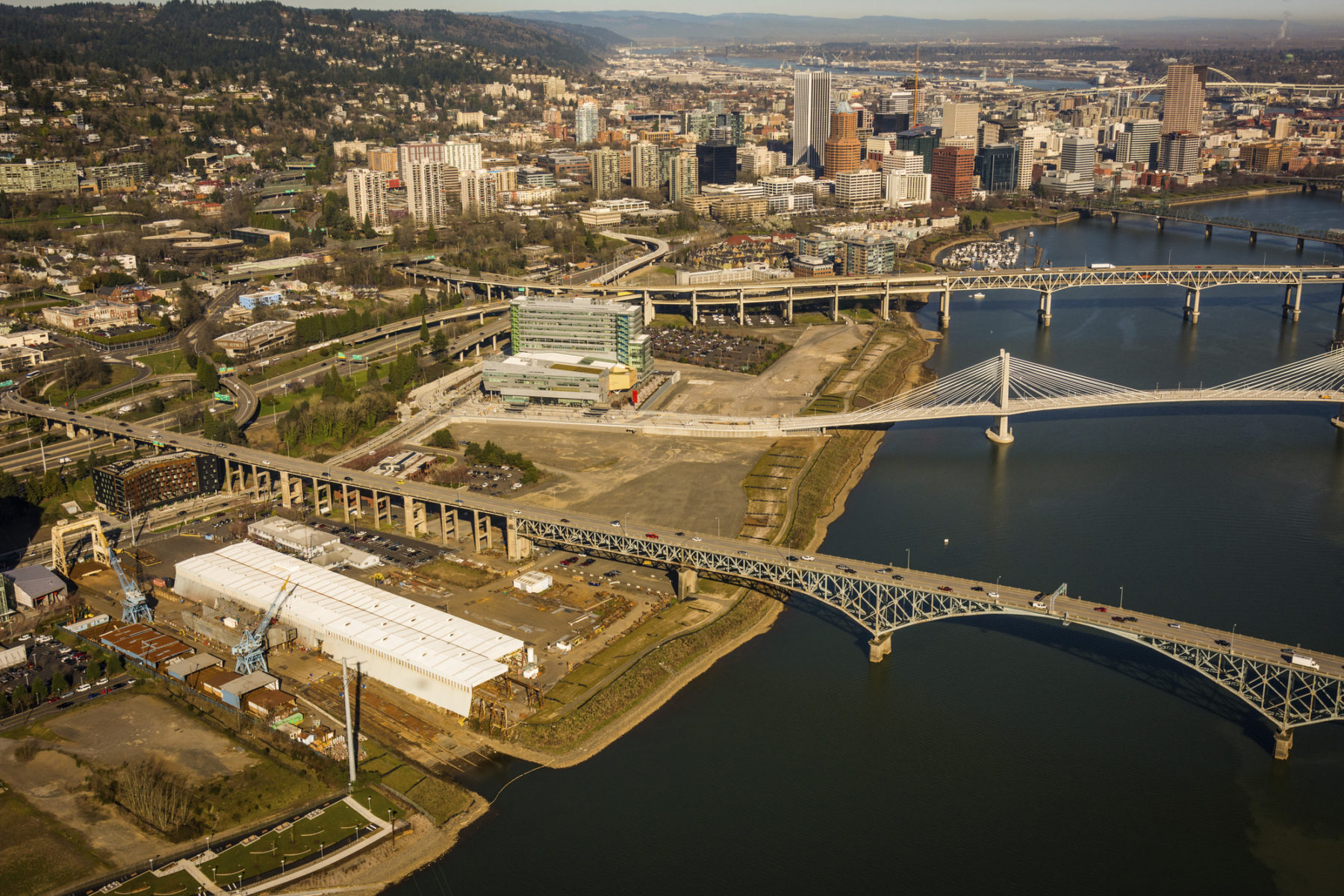
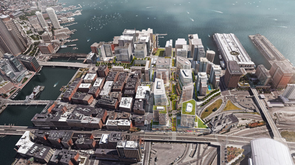
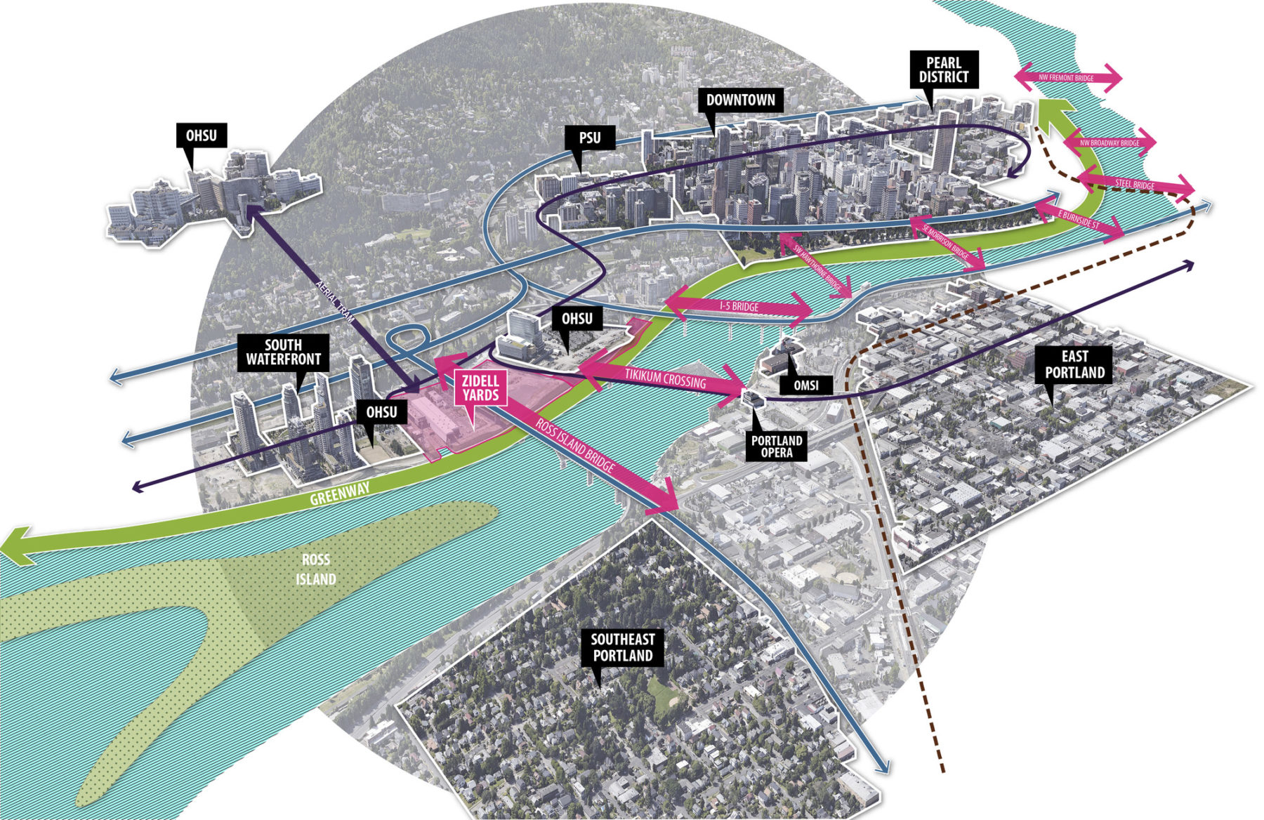
Zidell Yards spreads beneath the Ross Island Bridge between the Tillikum Crossing and Oregon Health and Science University (OHSU). In its existing condition, the brownfield site abutting downtown Portland has yet to capture its full potential.
Zidell Yards is about a mile from Downtown Portland, nestled within the southern edge of the Central Waterfront. The once largely industrial, “working” waterfront is now largely composed of residential and medical high rises and is well connected to the downtown and across the Tilikum Crossing by streetcar, by aerial tram to the west, and in the future by bike along the South Waterfront Greenway. Occupying thirty-three acres in the evolving, vibrant South Waterfront neighborhood, the Zidell Yards site is poised to transition from a manufacturing center on the Willamette River to an equally important component of Portland’s next era.
The once privatized industrial edge becomes a destination place along the newly created greenway along the riverfront. The industrial heritage is drawn into the setting as the place evolves into a new mixed-use district.
Sasaki led the charge for a comprehensive new vision for the long term redevelopment of Zidell Yards. The Zidell Yards master plan sets a clear vision for a new district that will become the social heart, the retail hub and the creative center of the South Waterfront district.
The 35-acre site has the potential to become a district center for Portland’s emerging south waterfront area
The plan lays out new streets and bikeways that connect Zidell Yards into the growing and changing South Waterfront, including the Oregon Health and Science University (OHSU)’s expanding campus and the Central District’s residential neighborhood.
The framework plan connects and integrates the various nearby districts while creating a series of public spaces accessible to all
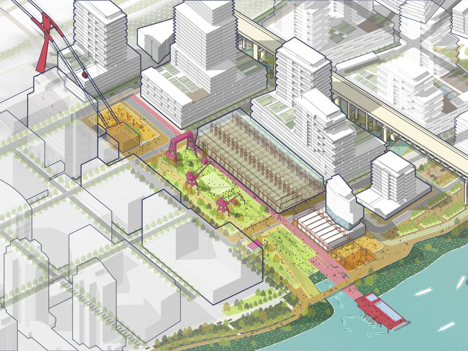
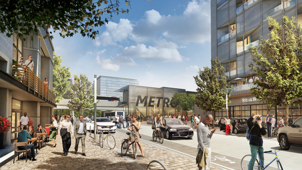
A cultural park next to the barge building connects the slip at the river up to Gantry Plaza, a transit hub serving the whole district
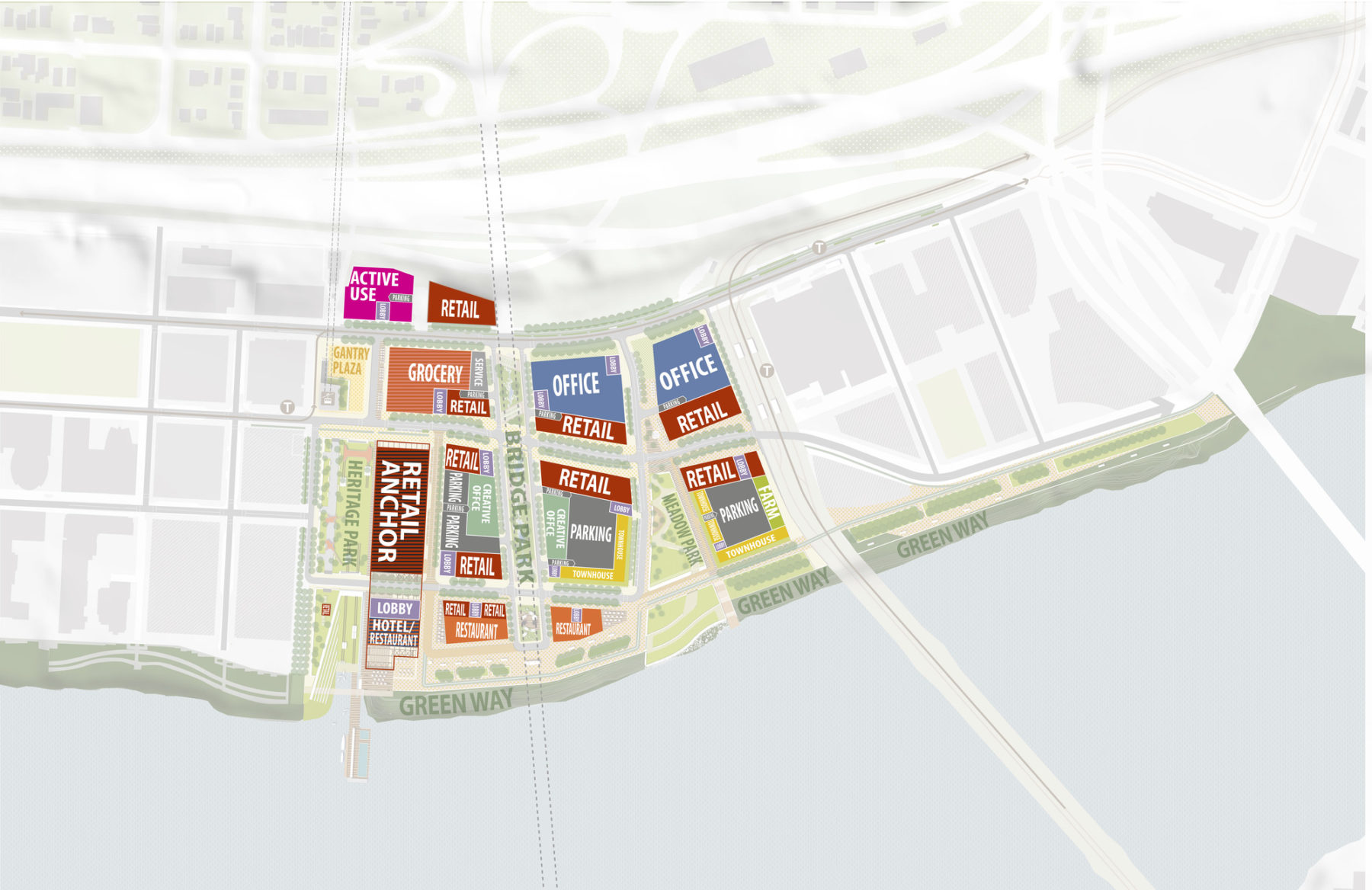
How the multi-use space will be developed according to Sasaki’s master plan
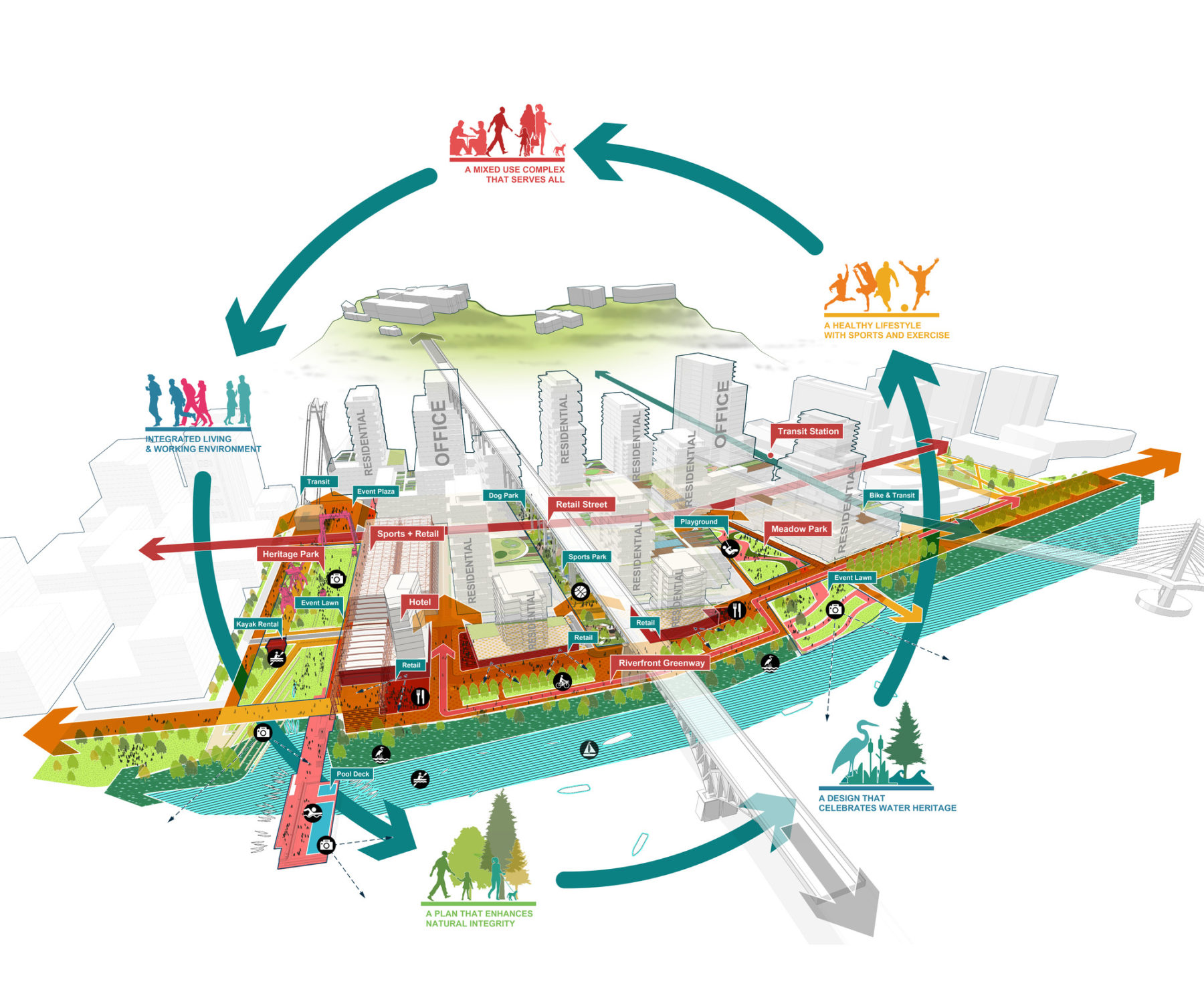
The district framework is structure by three diverse new public spaces
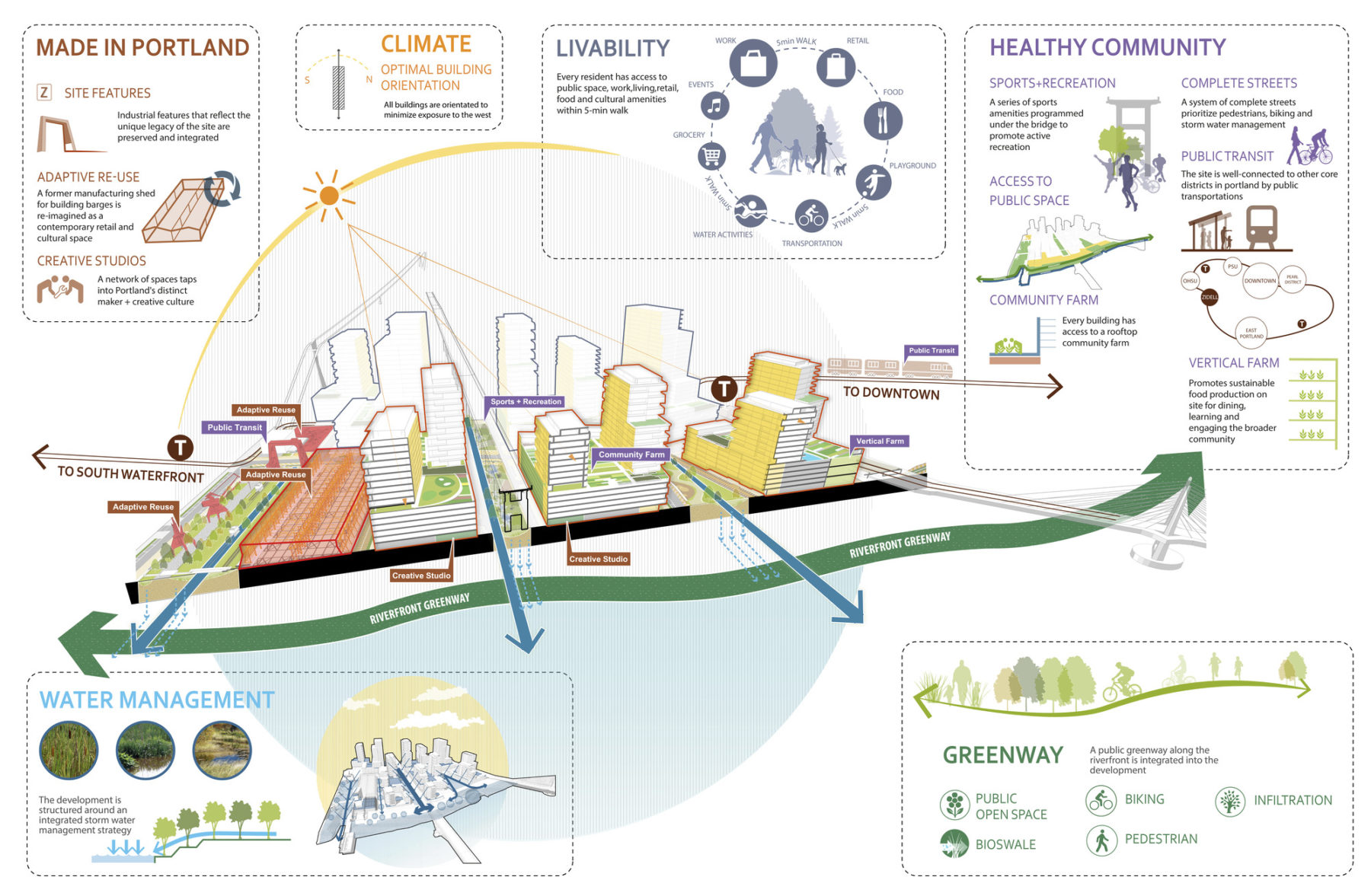
Multiple sustainable design strategies are employed to make the evolving district a model of forward looking urbanism in Portland
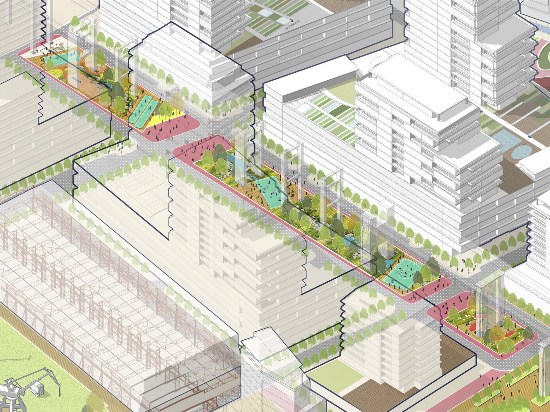
The space below the existing elevated Ross Island Bridge will be a linear park connecting Moody Street with the riverfront. Sports and recreation are a focus of activity.
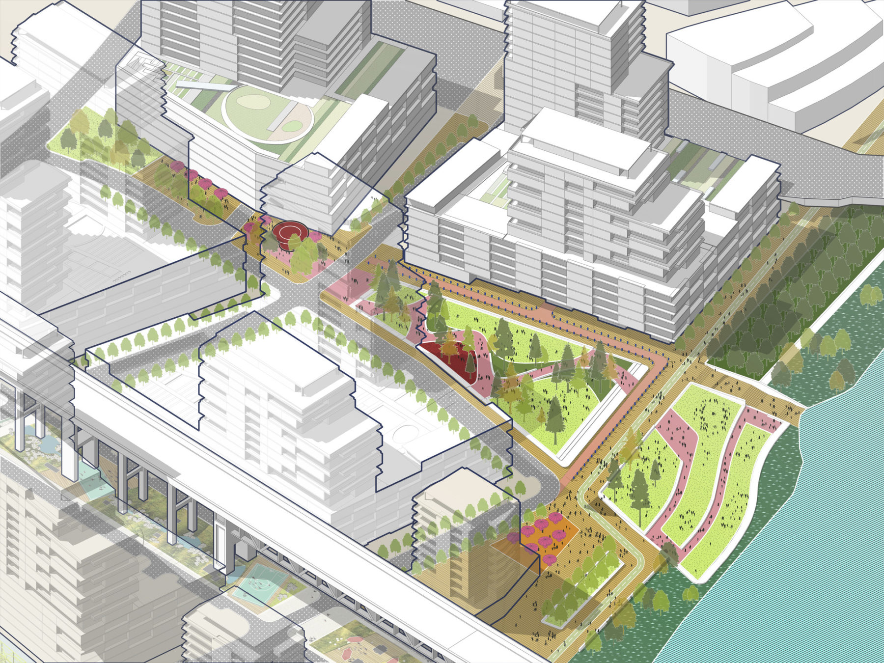
Meadow park forms a link from a second transit hub at the new Tilikum Transit Bridge to the riverfront. The park is a public space providing a focus for the new neighborhood.
A cultural park next to the barge building connects the slip at the river up to Gantry Plaza, a transit hub serving the whole district
How the multi-use space will be developed according to Sasaki’s master plan
The district framework is structure by three diverse new public spaces
Multiple sustainable design strategies are employed to make the evolving district a model of forward looking urbanism in Portland
The space below the existing elevated Ross Island Bridge will be a linear park connecting Moody Street with the riverfront. Sports and recreation are a focus of activity.
Meadow park forms a link from a second transit hub at the new Tilikum Transit Bridge to the riverfront. The park is a public space providing a focus for the new neighborhood.
The plan imagines the development of approximately five million square feet of mixed use retail, residential and office space in the coming years, bringing with it new jobs, thousands of residents and daily visitors. Finally, it honors Portland’s strong parks and open space legacy through the creation of a sequence of multiple parks, plazas and linear greenways that each offers its own unique public space activities, waterfront access and daily experience.
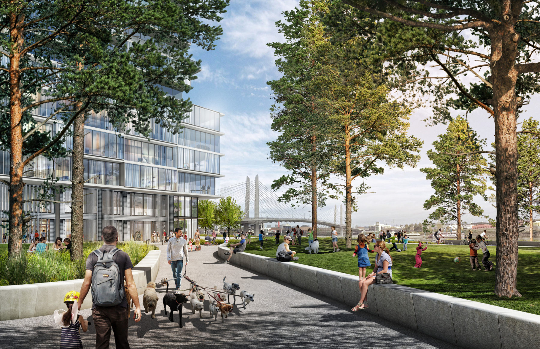
Walking in Meadow Park with a view toward the Tilikum Transit Bridge
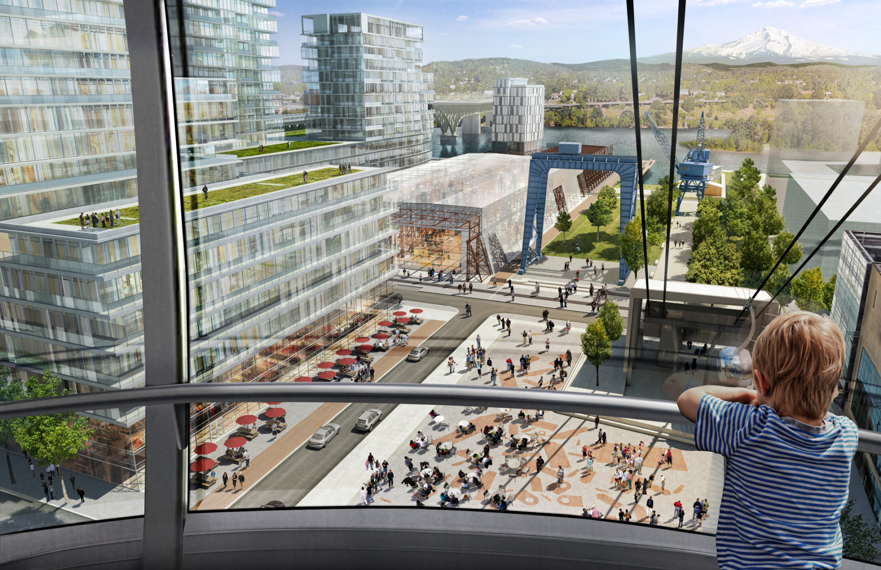
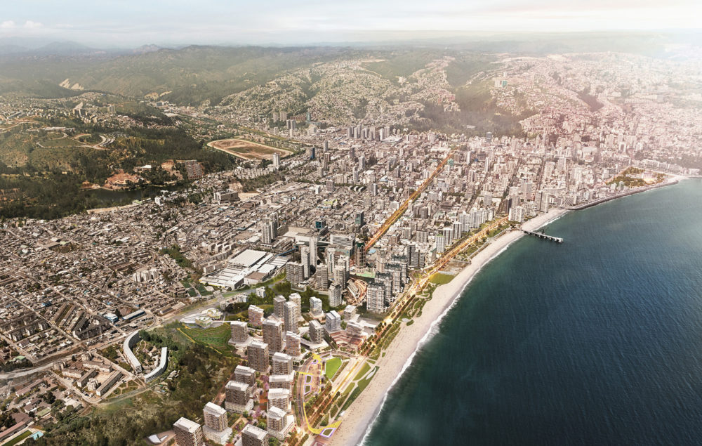
View from the cable tram that currently links the OHSU hospital with the transit next to the proposed Gantry Plaza. In the distance is Mt. Hood
Five important concepts underlie the Zidell Yards master plan; to create a new heart for Portland’s South Waterfront district, to honor the history and legacy of the Zidell community and land, to be a regional destination that offers unprecedented access and activation of the Willamette River’s edge, to focus on a high quality pedestrian realm, and to foster innovation and sustainability.
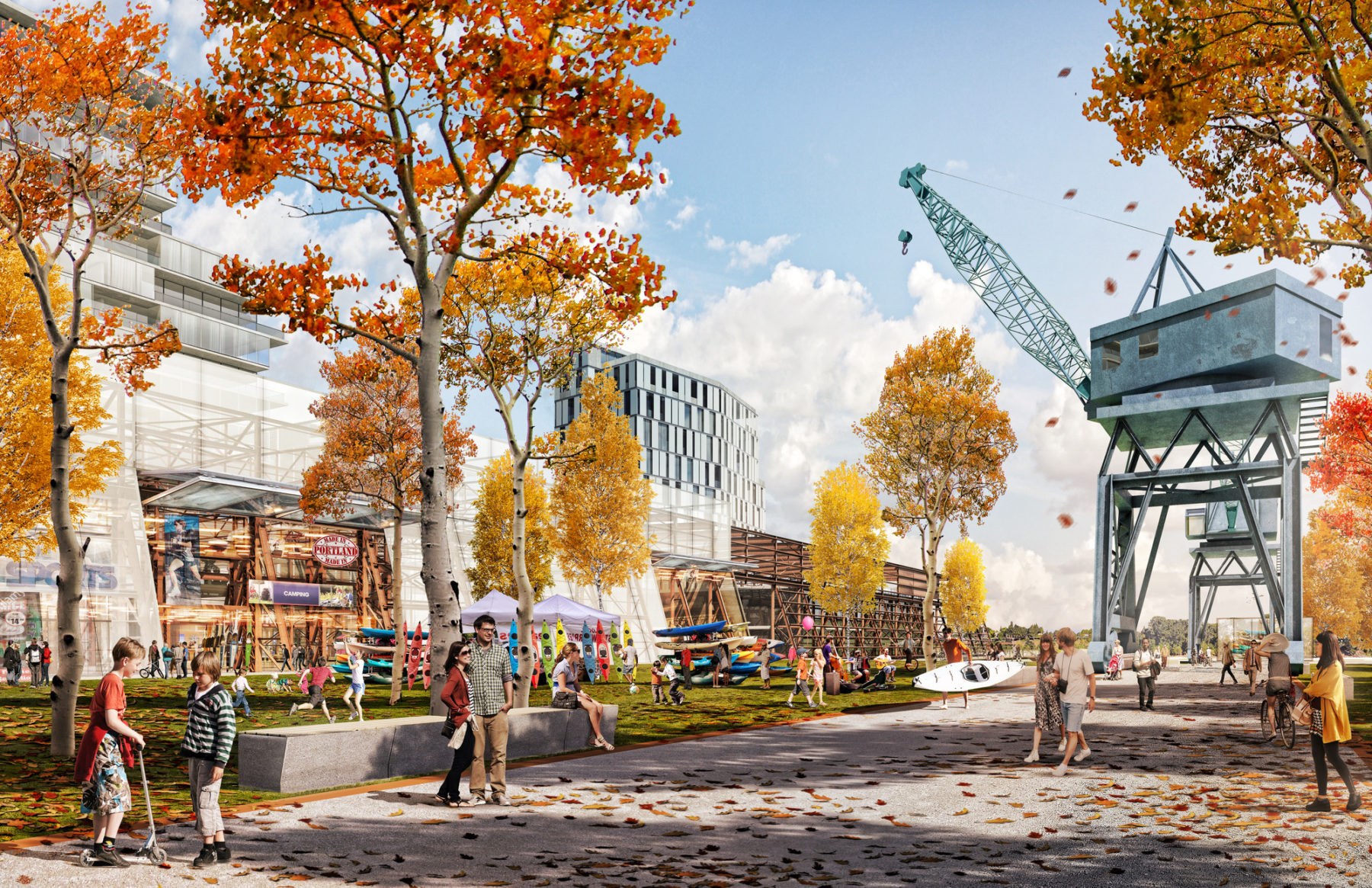
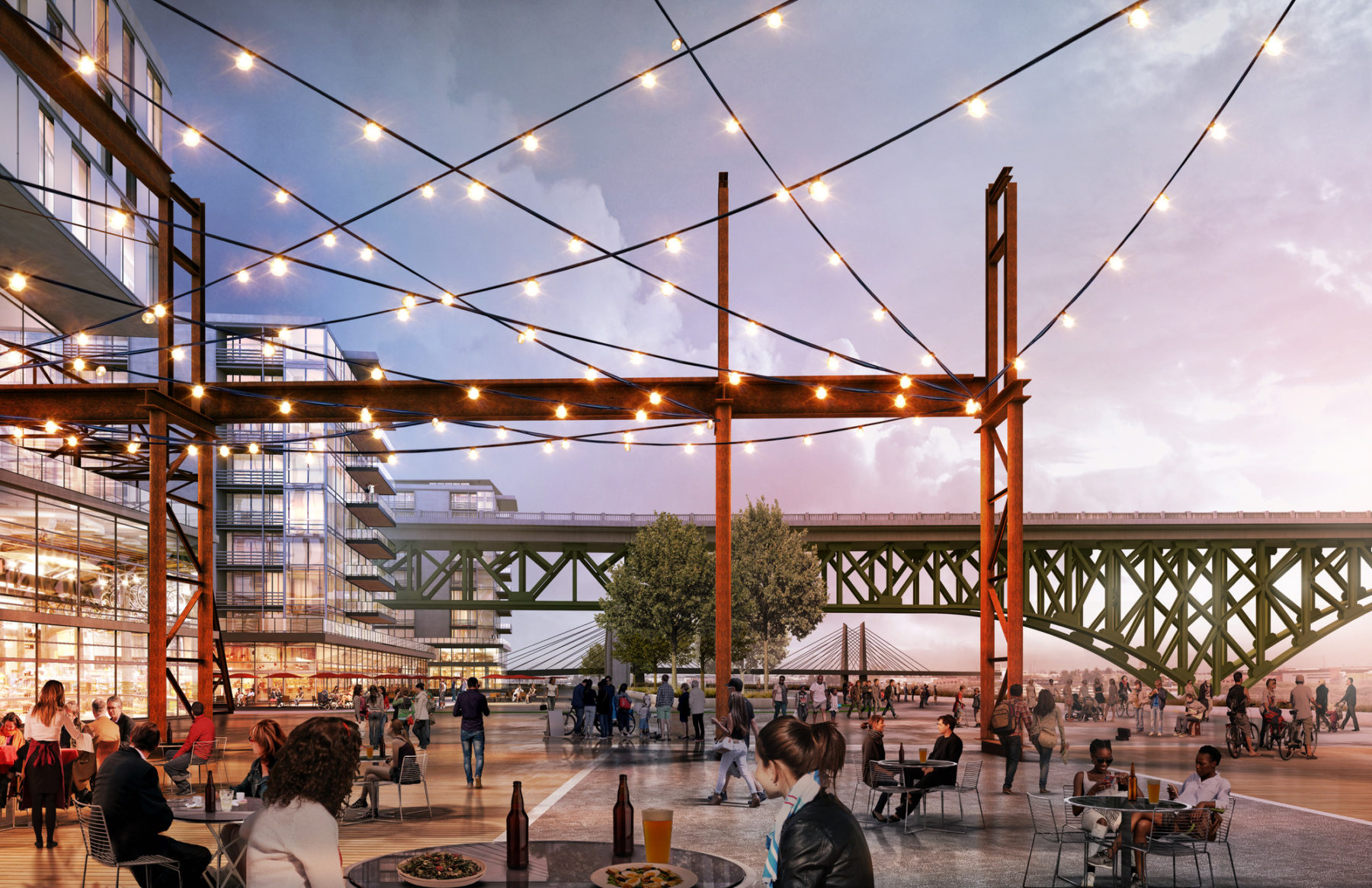
The cultural park integrates cranes and infrastructure of the previous industrial uses as part of the new public realm
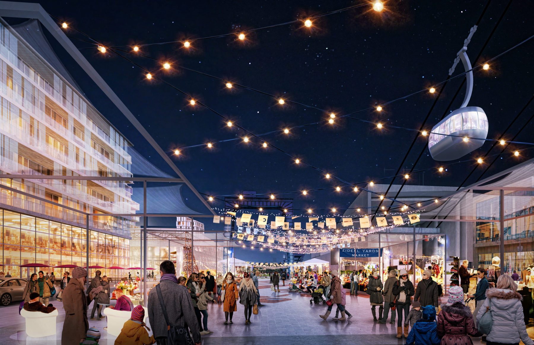
Evening market at Gantry Plaza
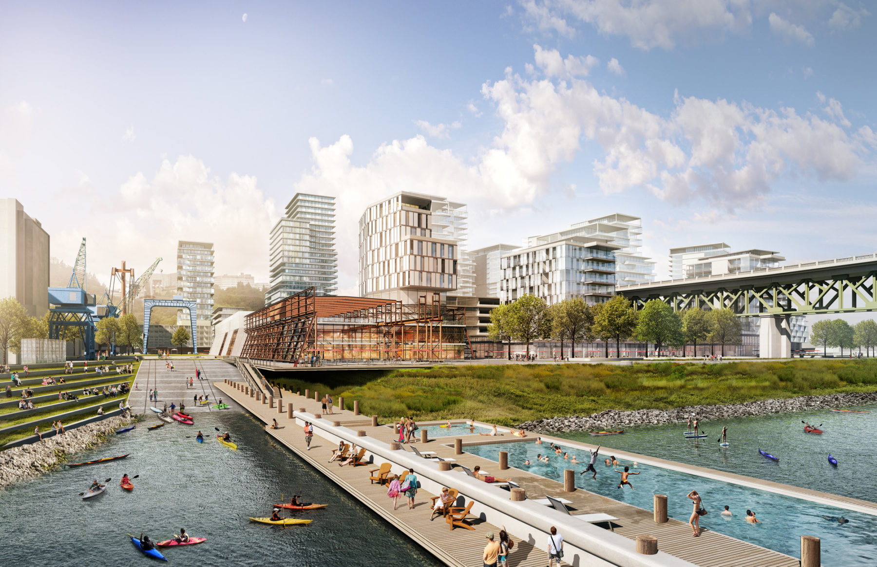
The once private riverfront edge becomes a new public space for events, canoe launches, dining and entertainment—all accessible by pedestrians, cyclists, and boats
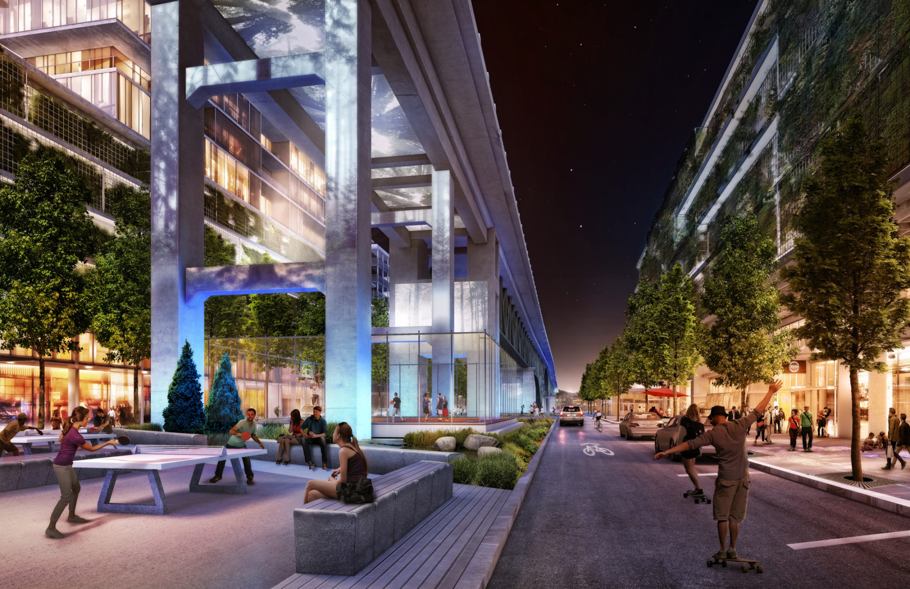
Parkway under the Ross Island Bridge
The cultural park integrates cranes and infrastructure of the previous industrial uses as part of the new public realm
Evening market at Gantry Plaza
The once private riverfront edge becomes a new public space for events, canoe launches, dining and entertainment—all accessible by pedestrians, cyclists, and boats
Parkway under the Ross Island Bridge
For more information contact Dennis Pieprz or Romil Sheth.