Reconnecting to the waterfront as a 21st century engine for urban growth
Saigon Riverfront
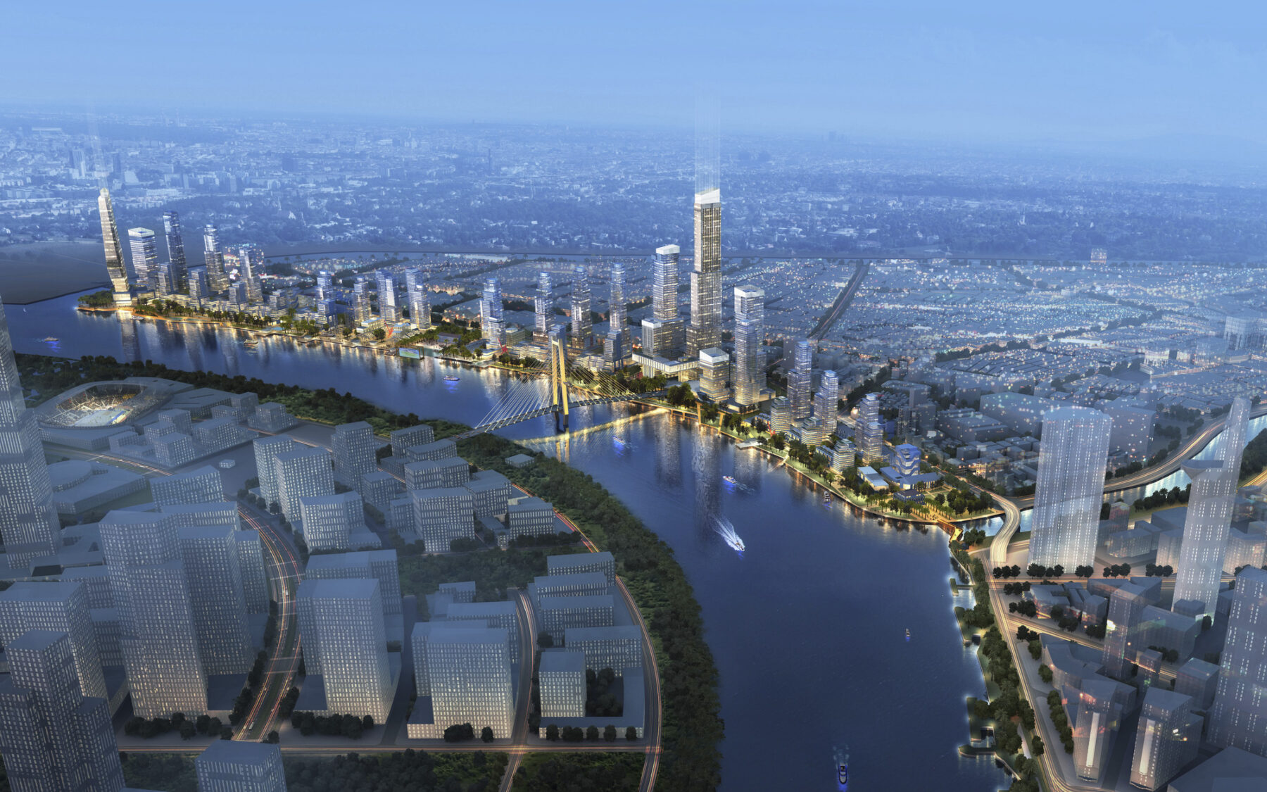
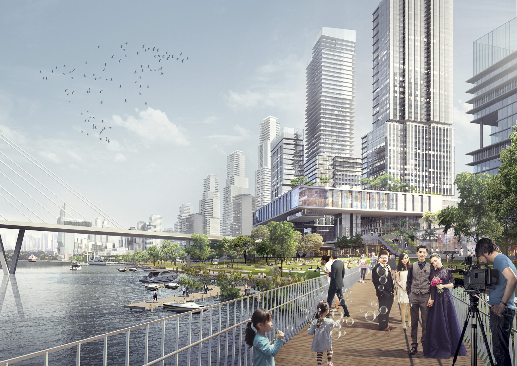
The Saigon Riverfront is transforming into a dynamic urban destination
Throughout human history, the waterfront was where news from distant places was shared, where locals met foreigners, and where sailors sought entertainment. These exchanges made waterfronts the lifeblood of cities, representing our first strides towards globalization. Since 1863, the Port of Saigon was essential to Vietnam’s fluid identity as a French colony, an independent nation, and a contemporary regional powerhouse.
As the modern metropolis grew around the port and the advent of larger container ships rendered it obsolete, this storied piece of land in the center of Ho Chi Minh is beginning a new chapter. Reclaiming its title as the heart of the city where cultures meet, ideas are exchanged, and city-dwellers seek recreation, the Saigon Riverfront is transforming into a dynamic urban destination. The adaptive reuse of French-colonial customs buildings, warehouses, and port infrastructure celebrates the site’s industrial heritage in a new mixed-use waterfront district. Fenced off for generations, the riverfront is reconnecting to the city with an expansive public park that integrates native ecosystems and safeguards the city from sea-level rise.
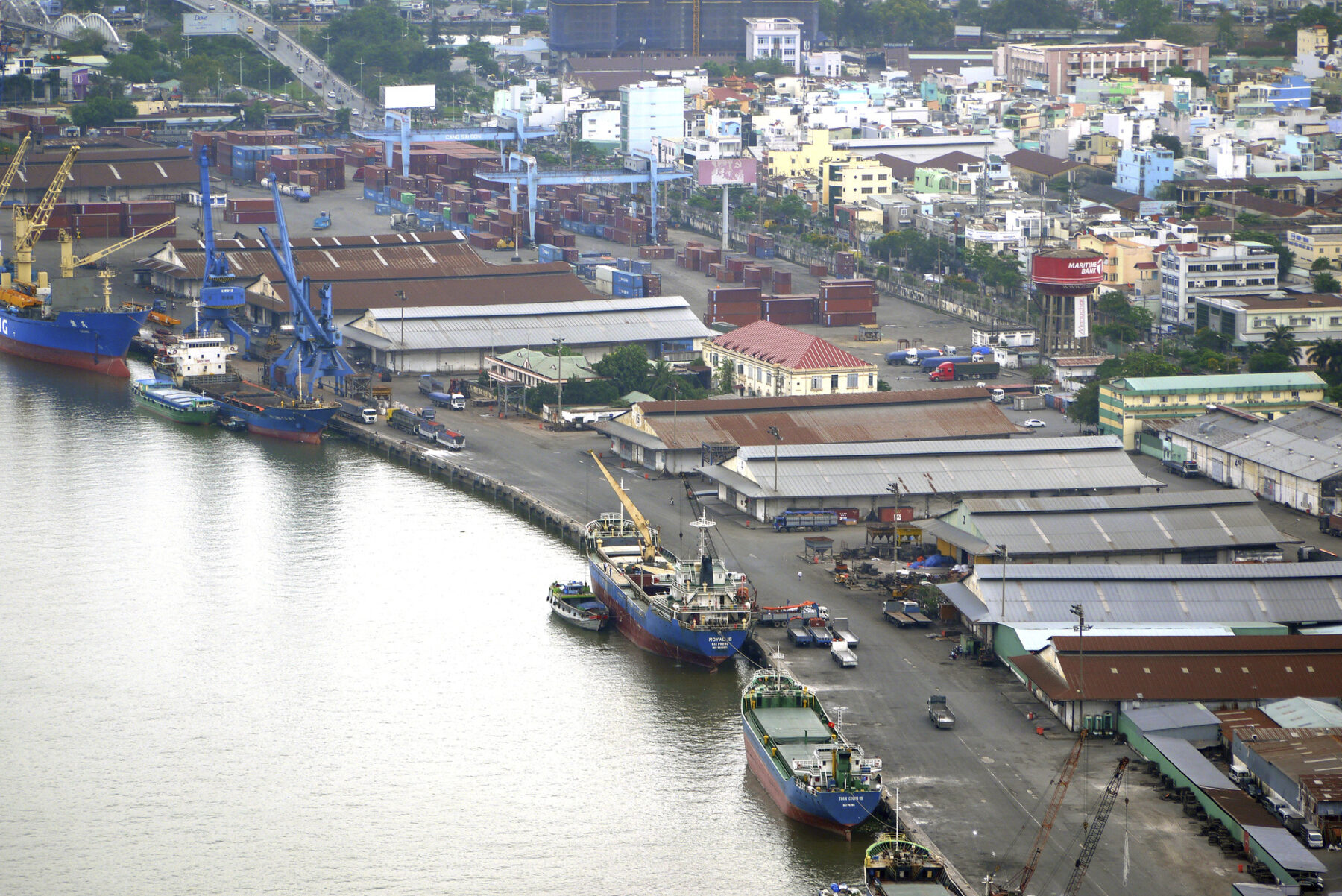
The former port is an industrialized landscape of hard edges, historic customs houses, warehouses, and port infrastructure
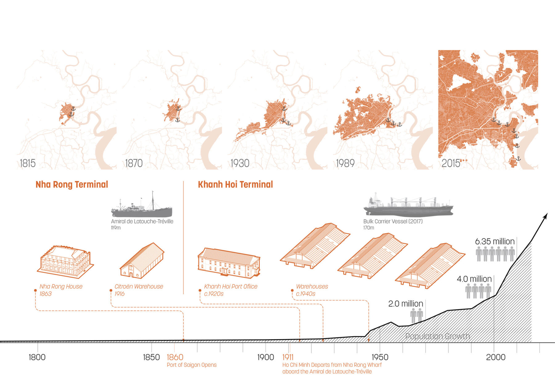
The port played a significant role in the development of Ho Chi Minh City
Port activities have prevented the adjacent neighborhood from accessing the river for generations, leading to an inwardly-focused community lacking connections to the water with significantly less open space than other districts
Contemporary Context
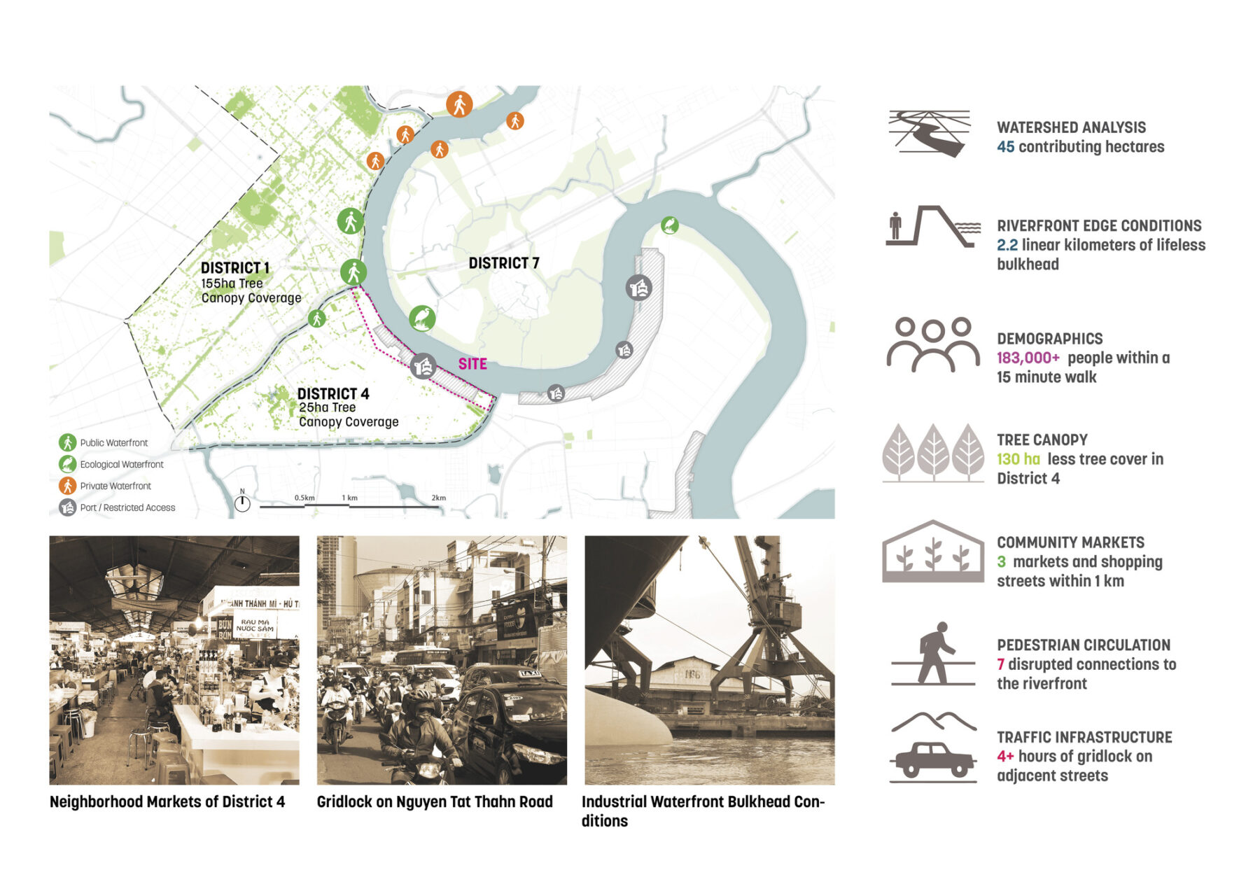
Once on the outskirts, by the early 21st century, the port occupied prime waterfront land in the geographic center of the burgeoning city of 10 million. Existing port facilities were undersized for today’s modern container ships, truck traffic from port operations was negatively impacting adjacent communities and contributing to gridlock, and pressure was mounting to reclaim the port’s development potential and civic value as a publicly accessible waterfront. The port became an obvious barrier to the community’s desire to connect Saigon’s bustling street life of outdoor cafes and markets with the energy of the river’s floating markets, sightseeing boats, and recreational possibilities.
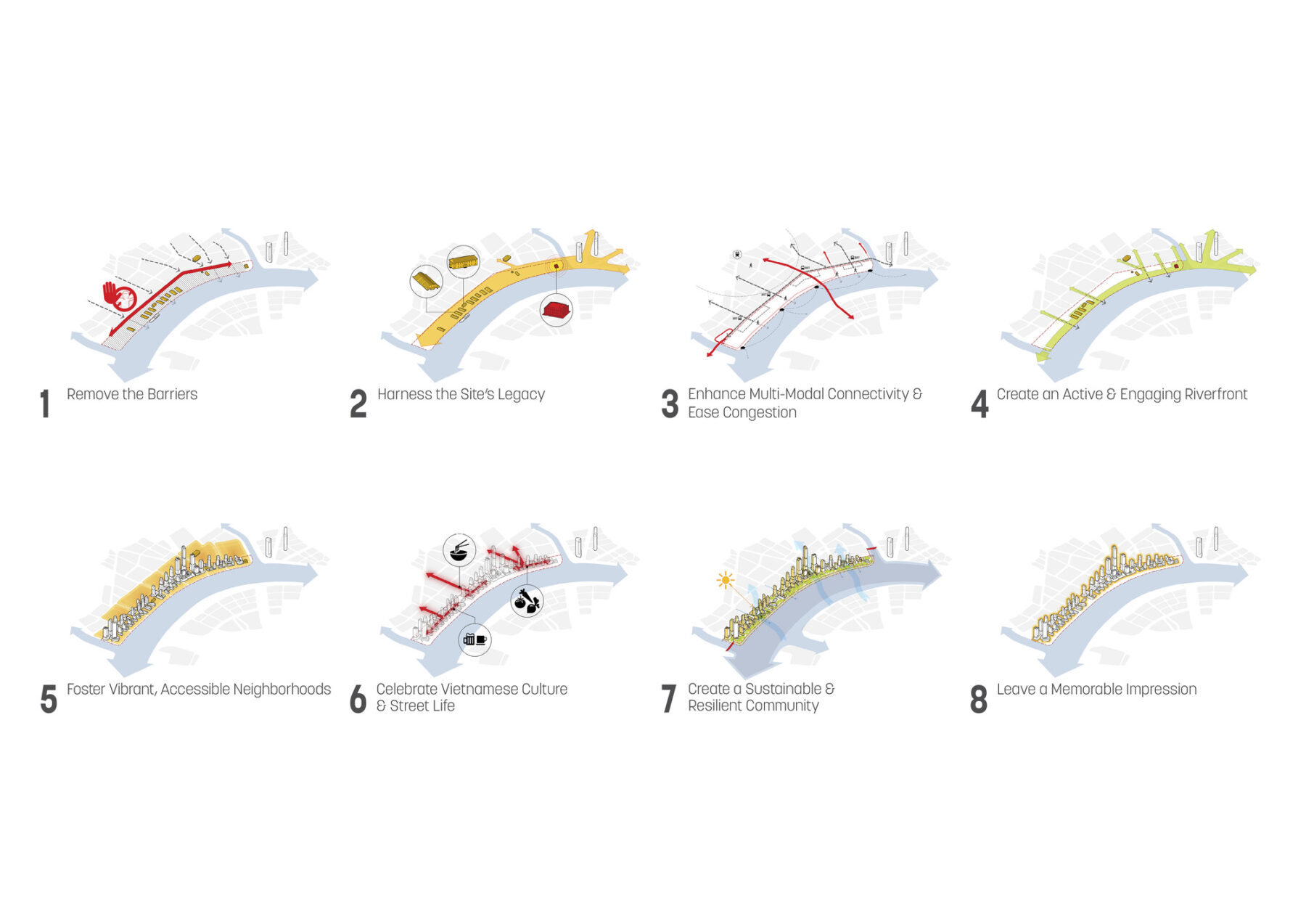
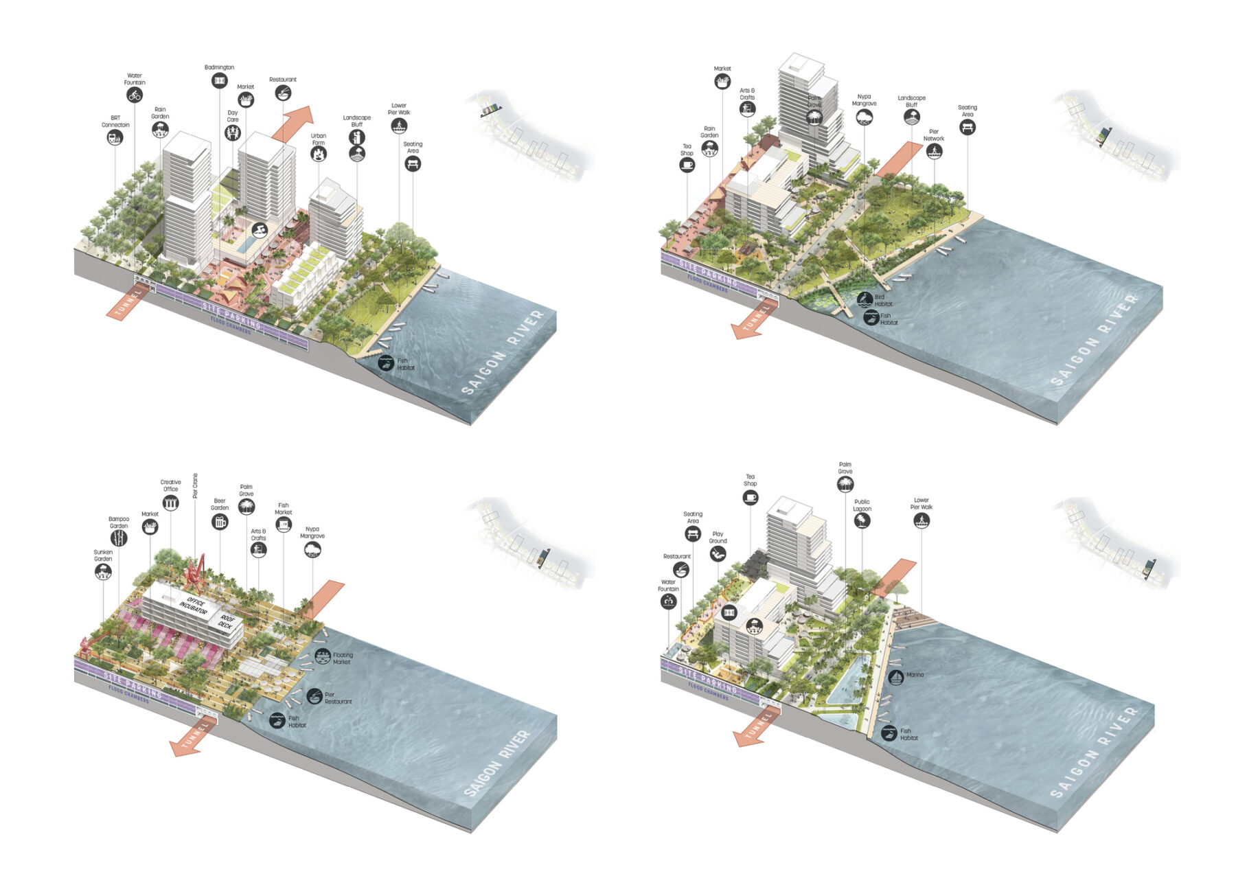
Rigorous analysis of existing physical and social assets, demographics, transportation, climatic conditions, and native ecologies provided foundational data, influencing a series of design principles
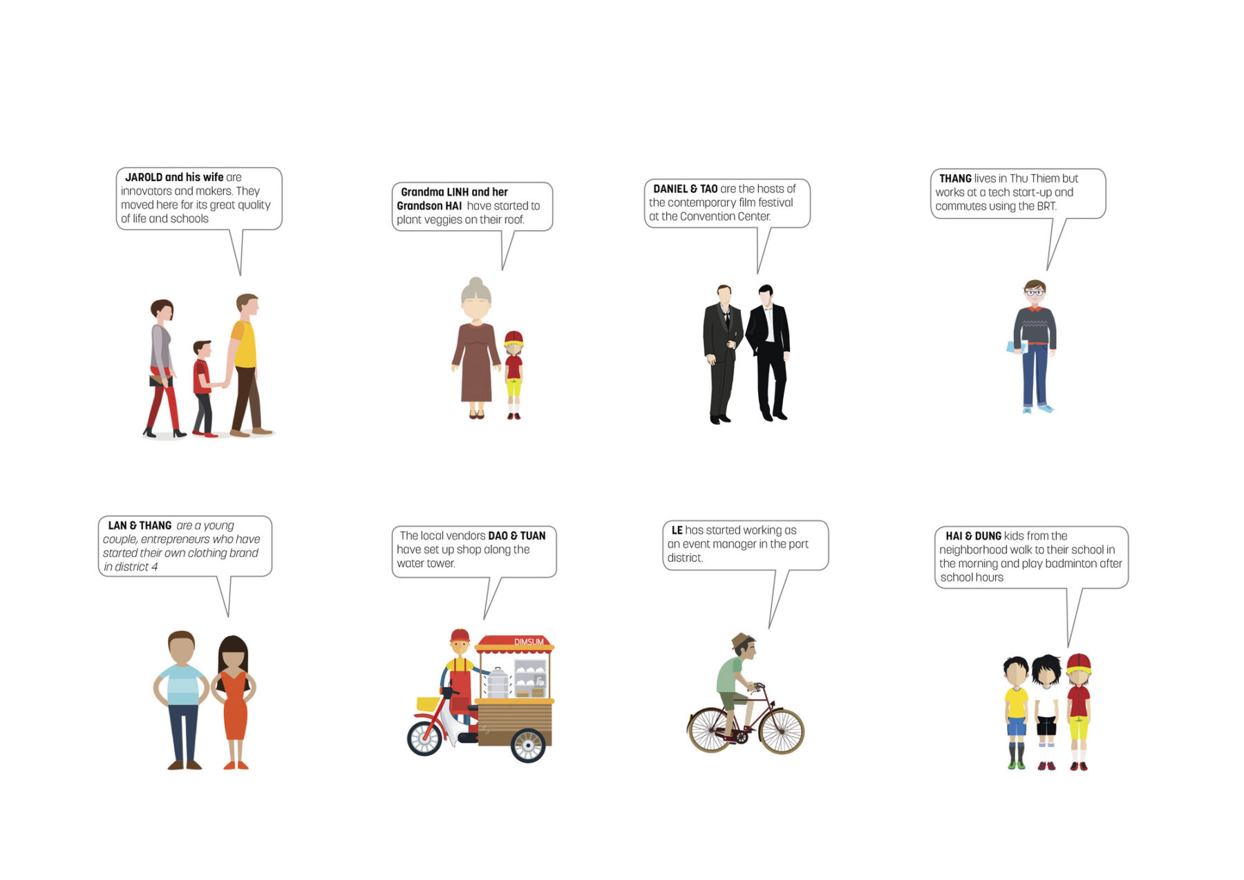
A series of avatars representing community members help tell the story of daily life in the new district and benefits to existing social networks
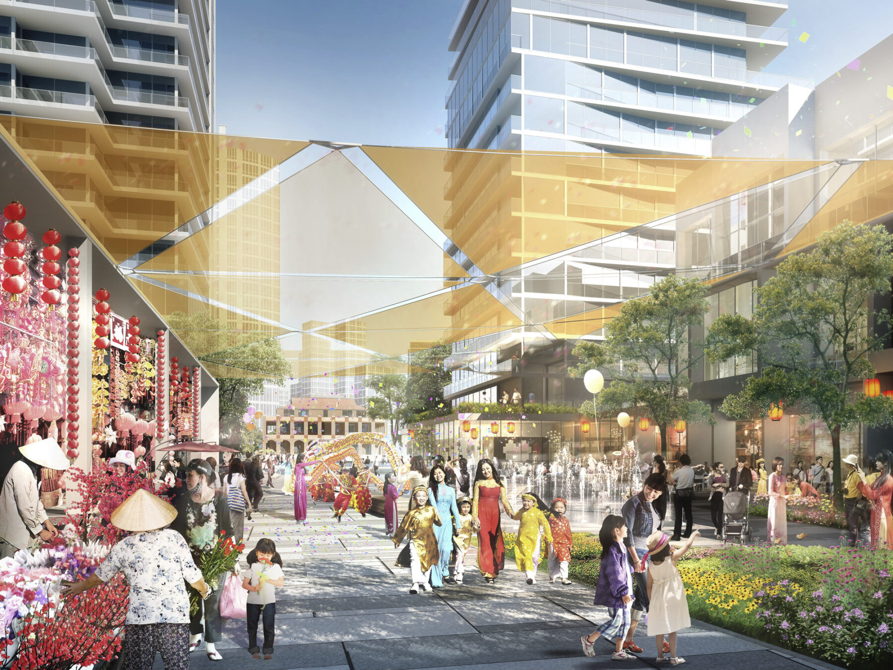
Market plazas create space to trade, gather, and celebrate and can be used for large events or simply to catch up on daily happenings
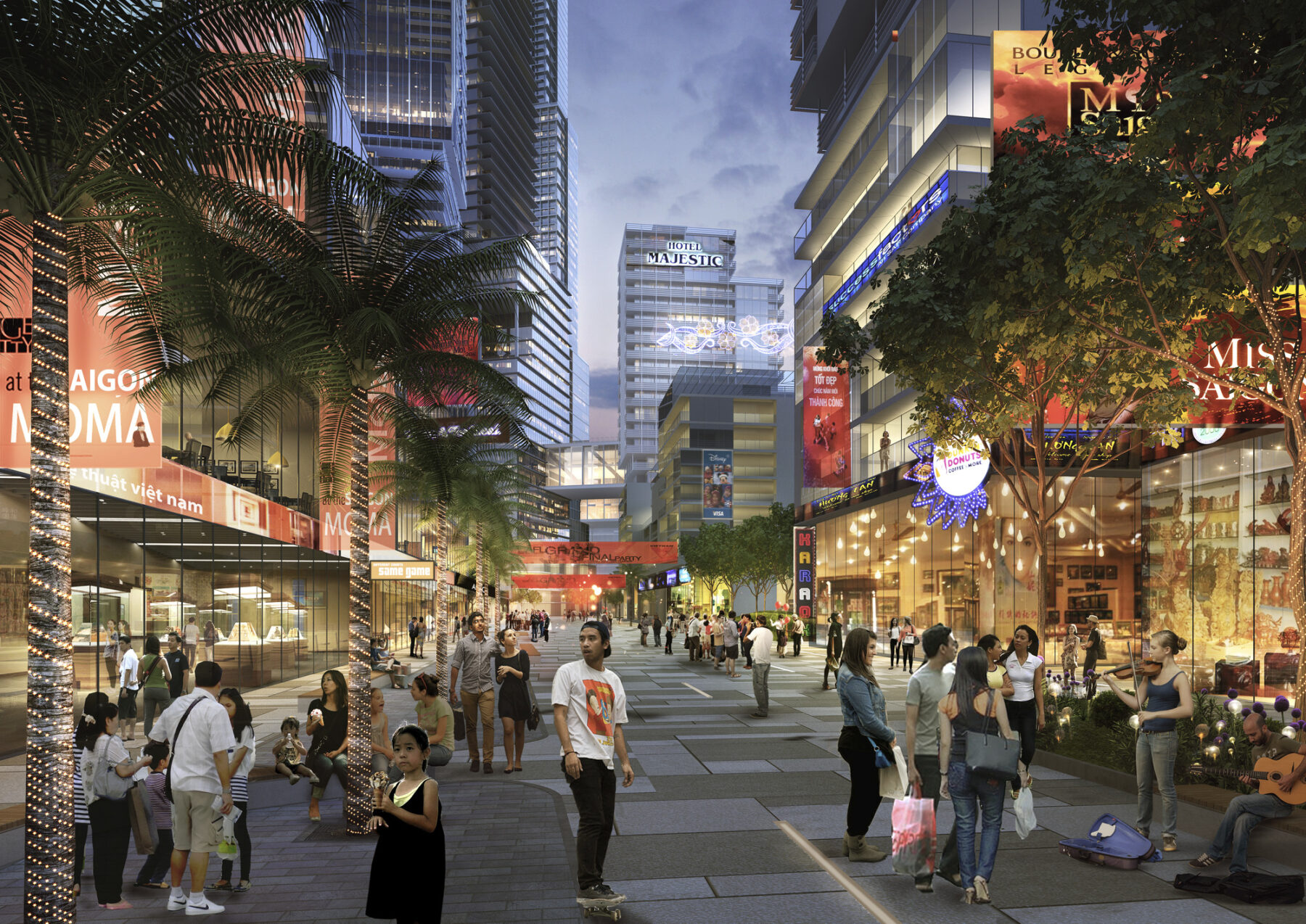
Interior streets serve as pedestrian corridors with ground floor retail and outdoor cafes that recall Saigon’s bustling street culture
Street Life, Culture, and Public Space
A distinct hybrid of French and Southeast Asian cultural influences, street life in Ho Chi Minh City is robust, frenetic, and vibrant. The former port is situated at the confluence of two of the city’s most distinctive neighborhoods – District 1 and District 4. District 1 is the historic center of the city, known for its wide sidewalks, outdoor cafes, and cultural institutions. District 4 is home to many of Saigon’s indoor market halls and outdoor market stalls. While District 1 thrived, in part because of views and accessibility to the river, District 4 failed to gain similar momentum with the port acting as a physical barrier to the water.
A series of edge treatments respond to a variety of existing and proposed conditions
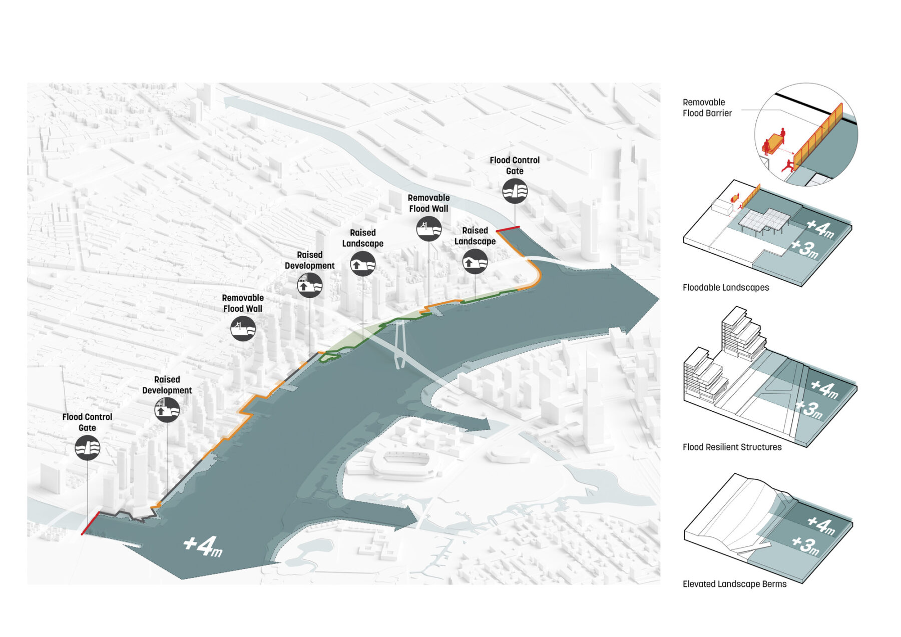
The site’s evolving riparian zone required a matrix of solutions to tactically combat increased seasonal flooding due to climate change
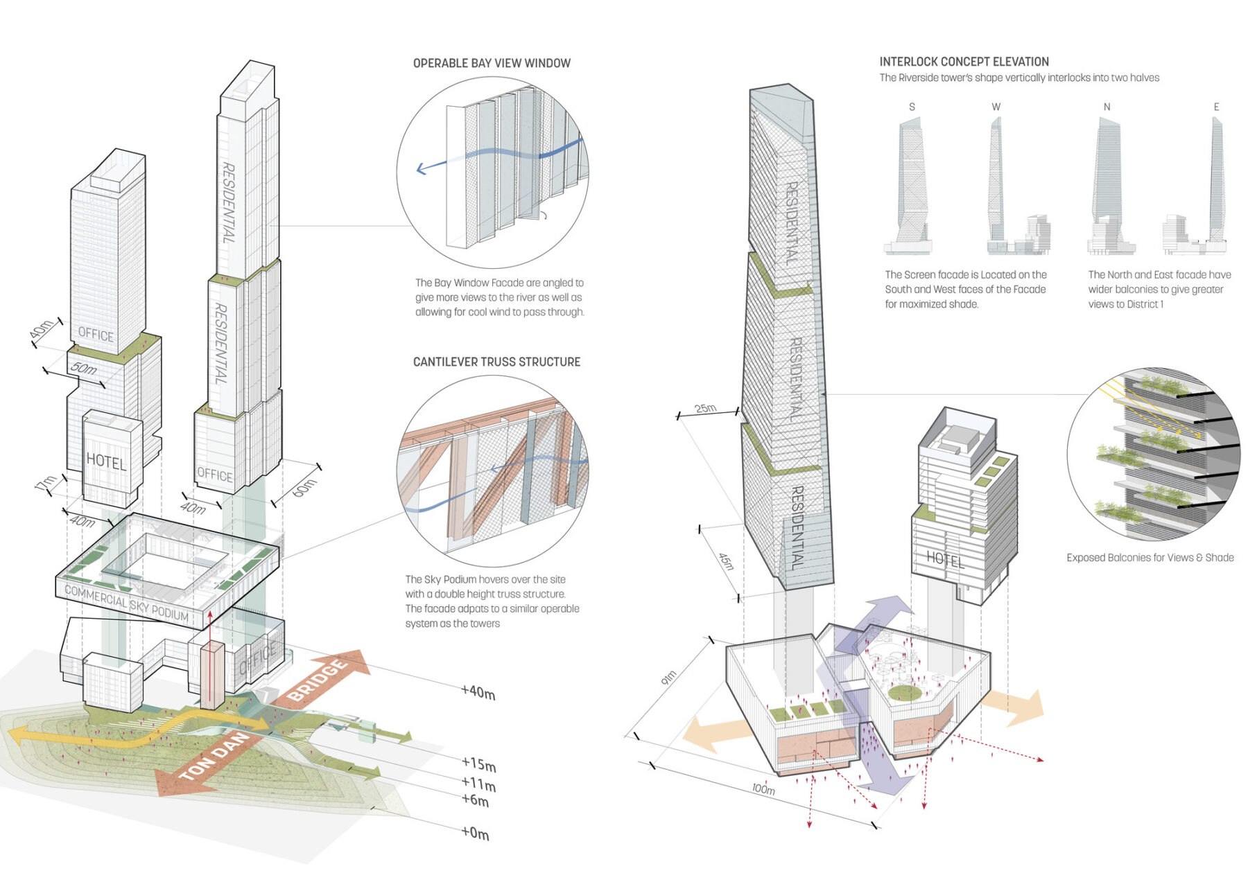
Architectural guidelines inform a phased implementation strategy while ensuring adherence to key design principles
A conscientious process of social analysis, including conversations with local residents and detailed observation of the city’s successful public spaces, offered suggestions for how to overcome the former port’s disruption to the city’s fabric. These recommendations included emphasizing connections to the water by linking the street grid of District 4 to the river via a series of pedestrian-oriented streets, designing plazas to maximize shading from adjacent buildings, and reducing the government-mandated 50 meter riverfront setback in key areas to allow for a diversity of edge conditions.
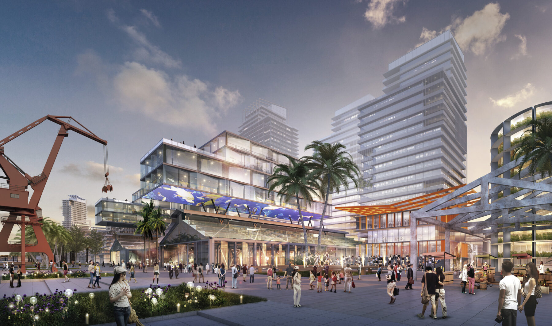
Heritage buildings are repurposed as museums, warehouses are adaptively reused to promote cultural exchange and incubator space, and overhead gantries and cranes recall the site’s industrial legacy
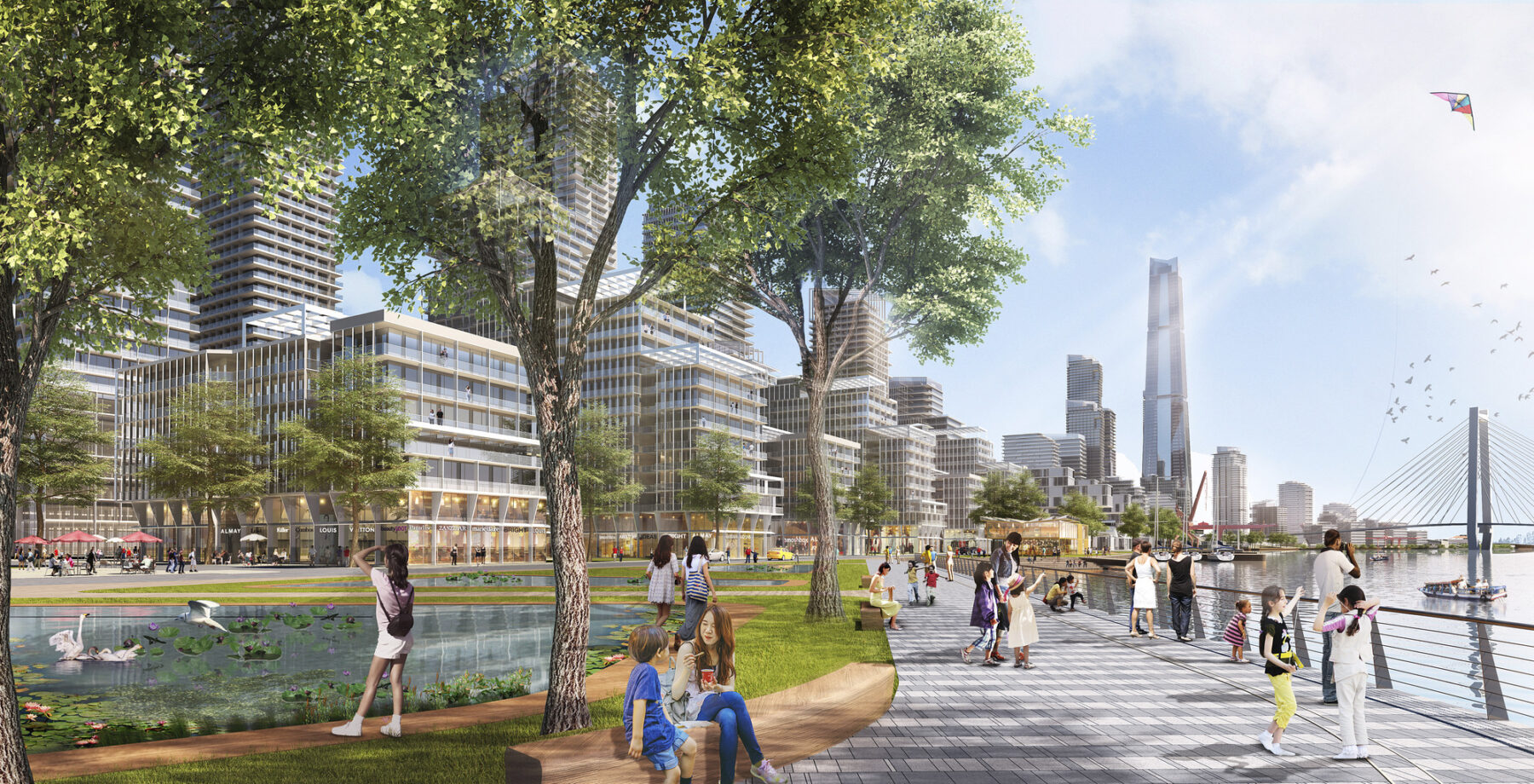
Existing walls and fences were removed to reveal a porous waterfront connected to the adjacent existing neighborhood via view corridors, pedestrian-focused streets, and unimpeded public access
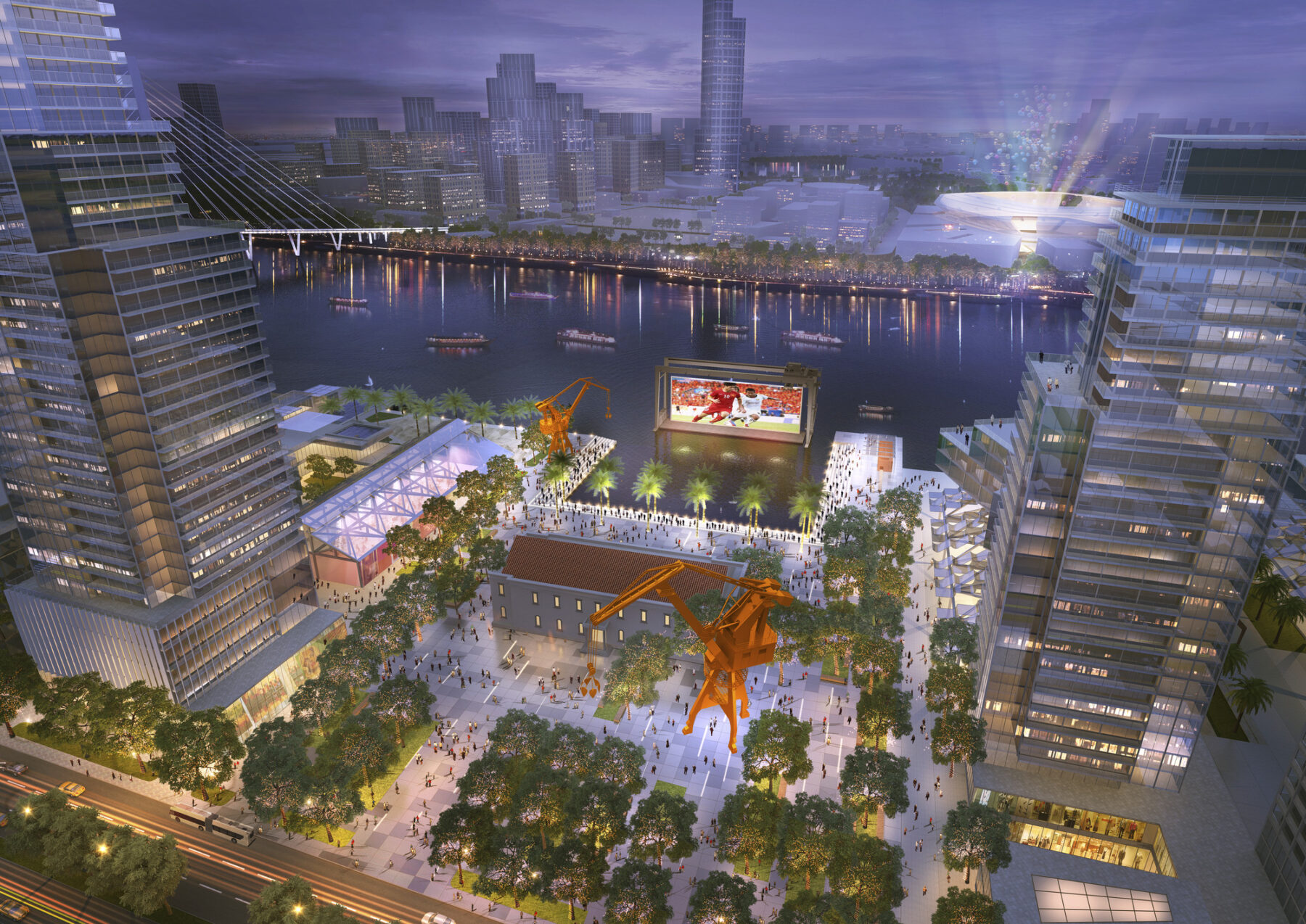
A new waterfront plaza with a floating screen allows for outdoor movies or sporting events to be broadcast in a public, celebratory setting
Changes in the Ecoregion
Located at the confluence of three distinct ecoregions – a dry evergreen forest, the Indochina mangroves, and the Mekong delta – the opportunity for rich habitat diversity exists, though must be tempered with an understanding of how these landscapes will be impacted by future shifts in the climate. According to a 2010 study by the Asian Development Bank, Saigon is ranked among the top 10 global cities vulnerable to climate change, with sea levels projected to rise by about 24-26 centimeters. Environmental conditions are compounded by urbanization, with urban heat islands increasing average temperatures by 2 degrees Celsius.
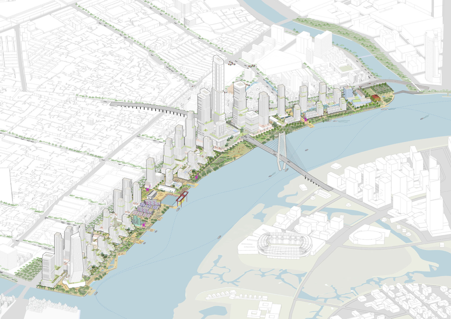
The master plan envisions a more equitable connection to Ho Chi Minh City’s riverfront, alleviating development pressure from the historic core while creating a significant amount of accessible public space
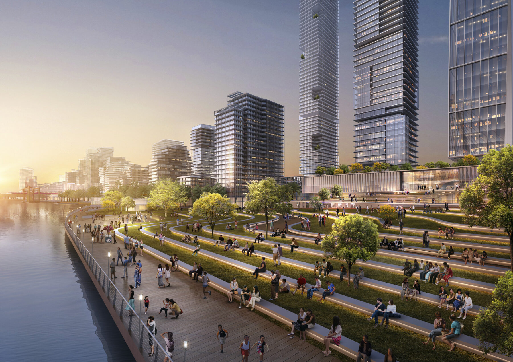
A gradually ascending riparian zone accommodates anticipated future water levels 24-26 centimeters above the current high tide line
With 90% of Saigon’s annual rainfall occurring over a 6 month period urban flash flooding has increased, compounded by undersized stormwater infrastructure. To address these realities, redevelopment of the port maximizes water-receiving landscapes and reevaluates the riverfront as an opportunity to protect new development, creating a flood barrier for the neighborhoods beyond.
The landscape works in tandem with architecture to future-proof the site against rising sea levels

Streetscapes were designed as water-receiving landscapes, diverting rainwater into cisterns and bioswales
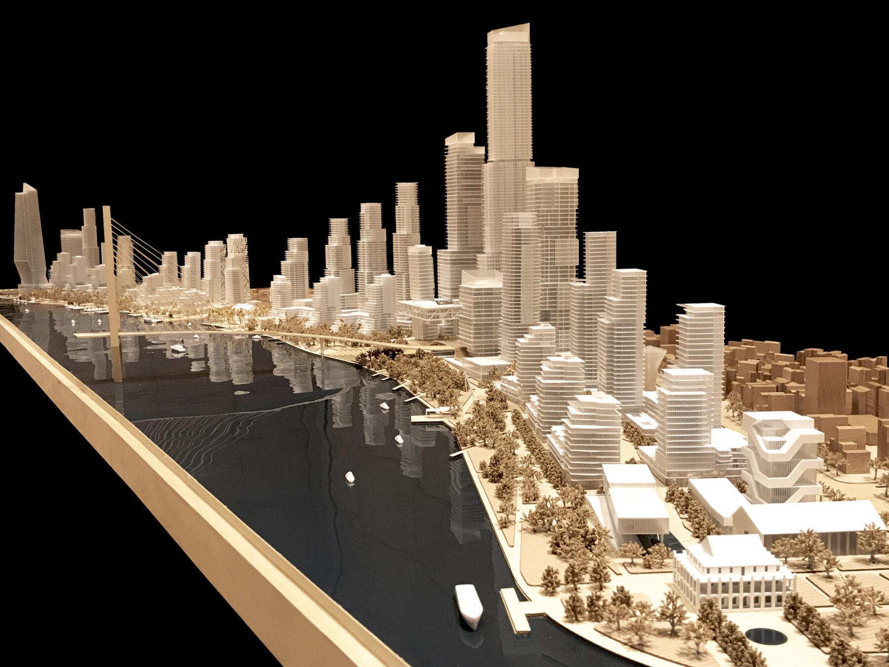
Higher density development is concentrated adjacent to public transit, while lower height limitations respect existing historic building
For more information contact Michael Grove.