智利比尼亚市的城市规划和生态复育,在公众意见的基础上创新发展
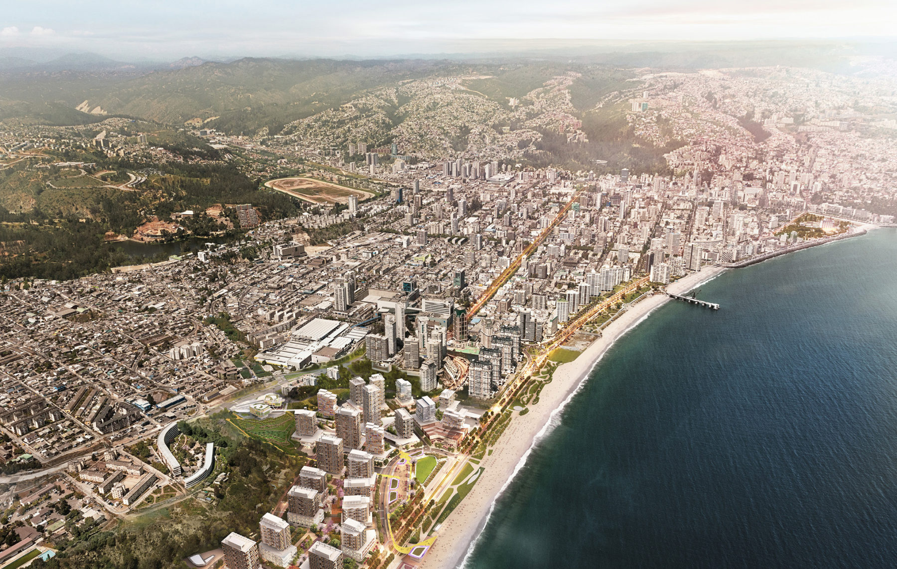
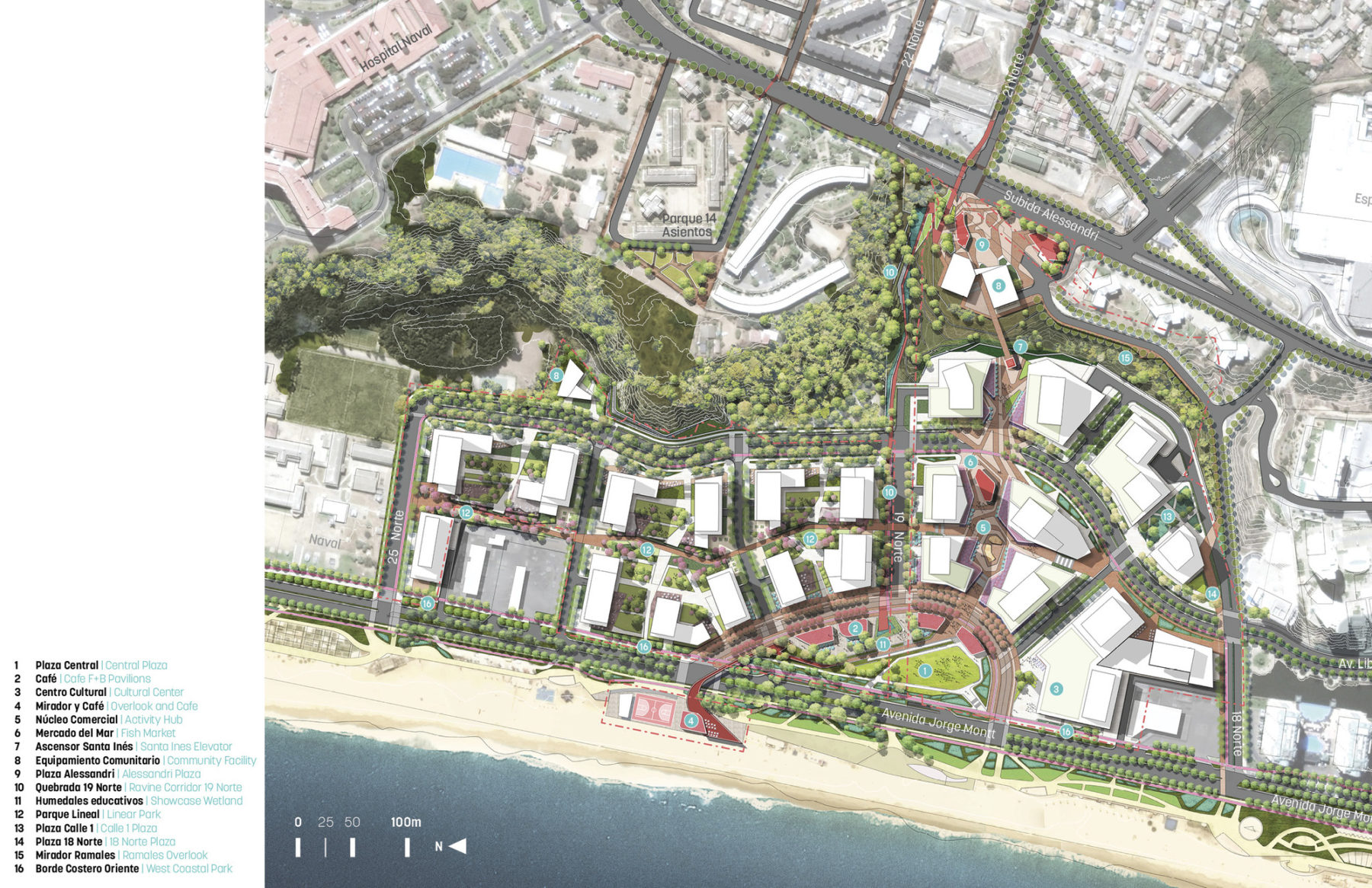
拉斯萨利纳斯总体规划
Las Salinas redefines development practices in Chile by transcending the boundaries of the site and revitalizing a brownfield condition into a 21st century sustainable district. The regeneration of the local ecology and re-engagement of the community to its seafront with new public spaces will have a lasting legacy in contemporary Chilean urbanism.
位于智利的拉斯萨利纳斯开发区呈现了一种大胆创新的规划设计方式。项目凭借棕地的转型改造,带动比尼亚德尔马市的城市发展和生态系统复苏。
政府早年为应付瓦尔帕莱索市日益扩张而规划了比尼亚德尔马市。绿树林荫的道路以及规划合宜的公园令这个昵称为“比尼亚”的地方成为举国闻名的花园城市,然而经过数十年发展,昔日令人向往的城市生活已然不复存在。由于市内的生态基础设施不受重视,当地的城市森林环境以及山地和沟谷的原生栖息地屡屡受损;欠妥善考虑的城市规划造成倚重车辆交通的出行方式,导致公共空间的质量大大降低;短期和封闭性的开发项目也使街区变得枯燥乏味,活力倍减。
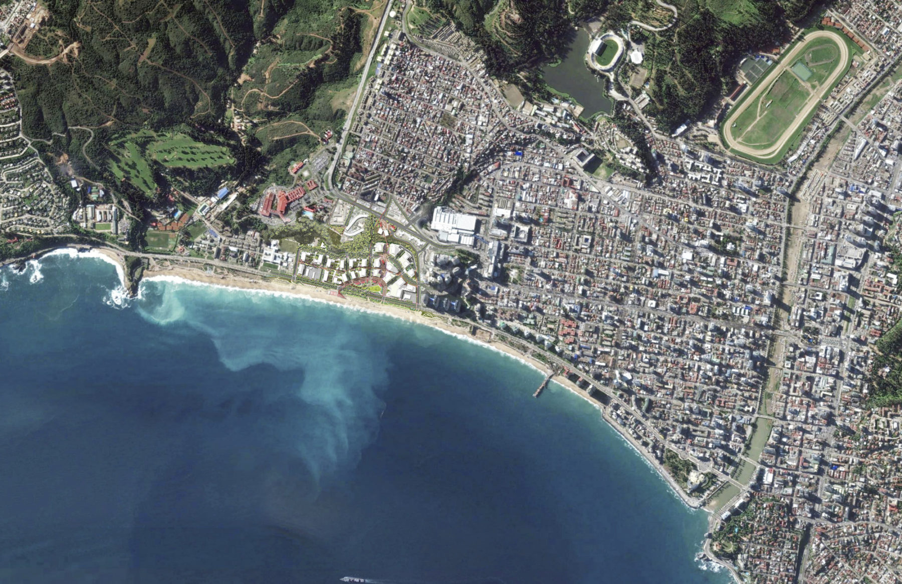
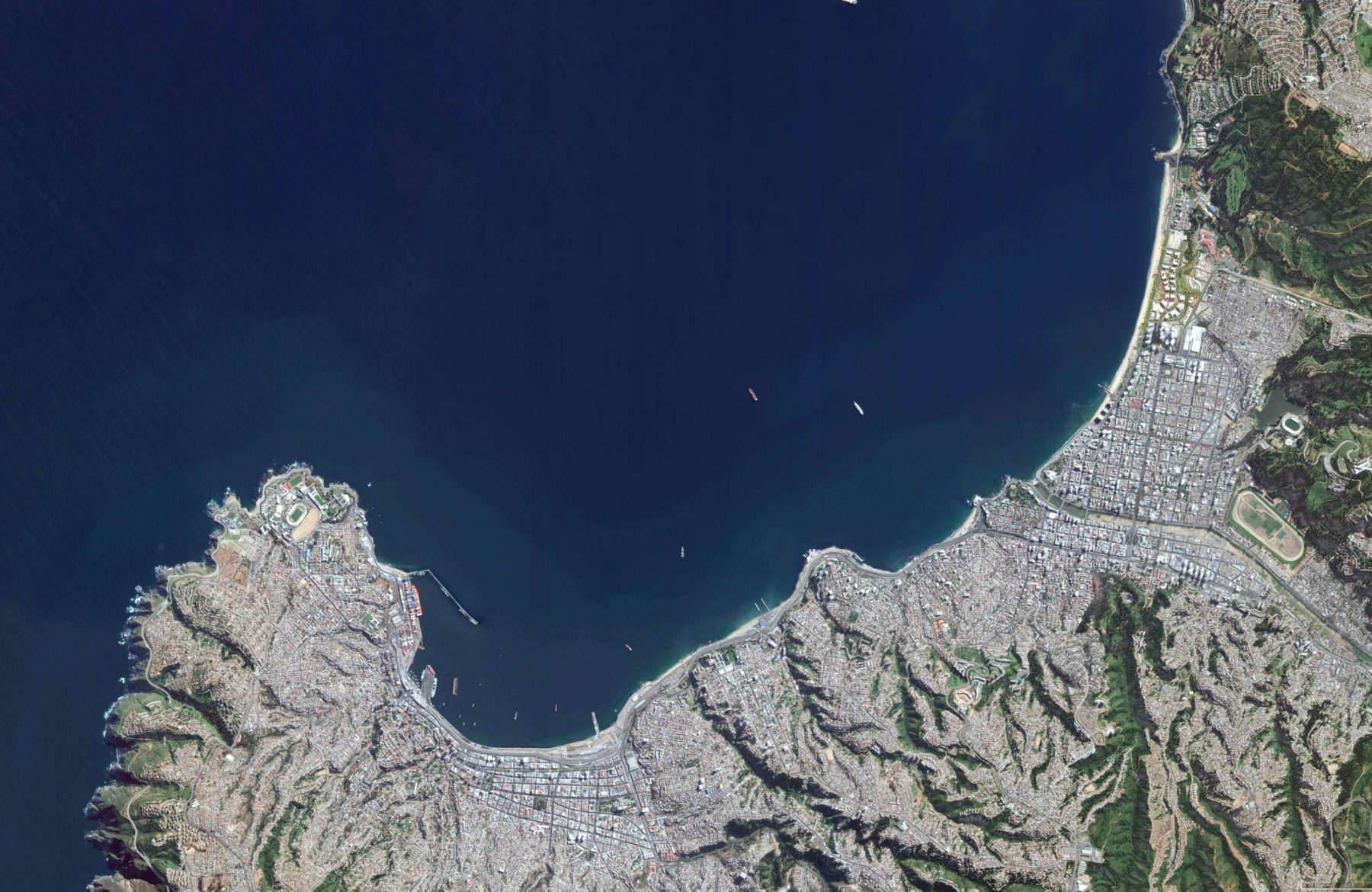
The site is not far from the heart of downtown and sits along a prime stretch of waterfront
本项目反思城市现行的发展模式,旨在激活拉斯萨利纳斯的真正潜力,重塑比尼亚市民的生活轨跡。方案打破基地的物理界限,意图恢复当地的生态条件,让市民再有机会接触滨海环境和公共空间。项目工作框架以重现城市活力为目标,由社区、业主和设计团队携手合作构建。
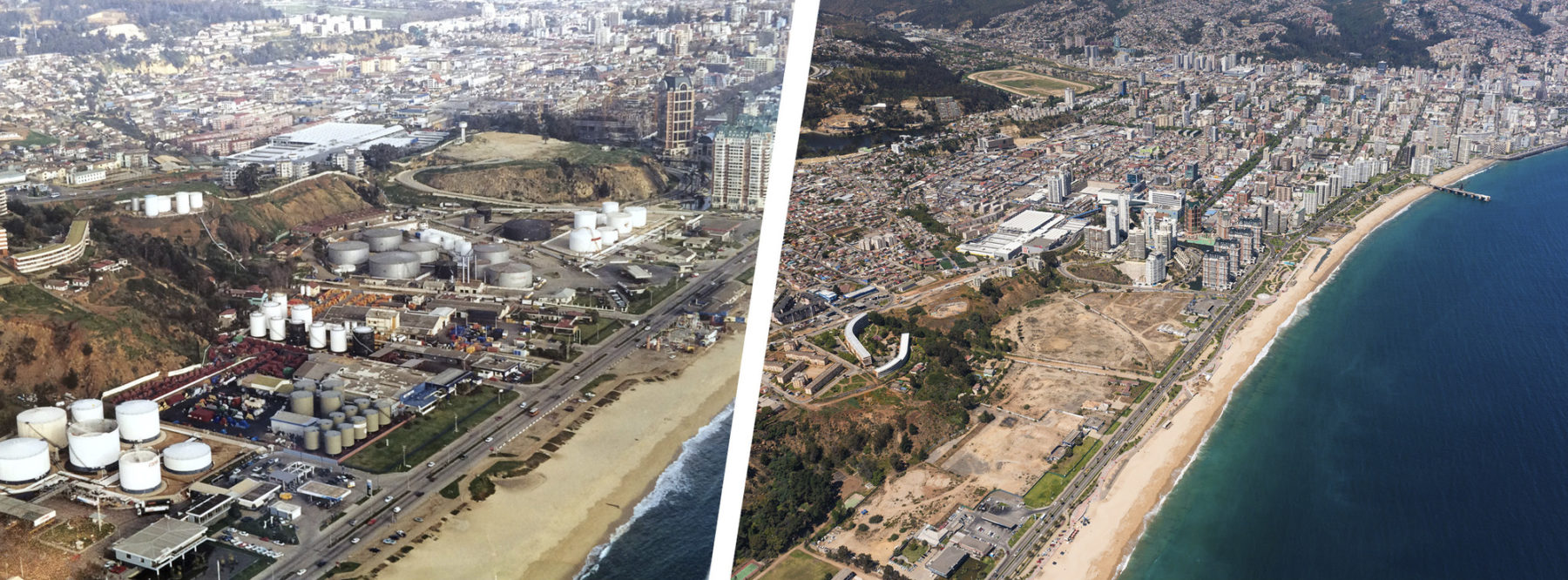
Transformation: before and after. Las Salinas is the third project in the world to have met or exceeded the v4 LEED ND Gold standard and the first in the Americas.
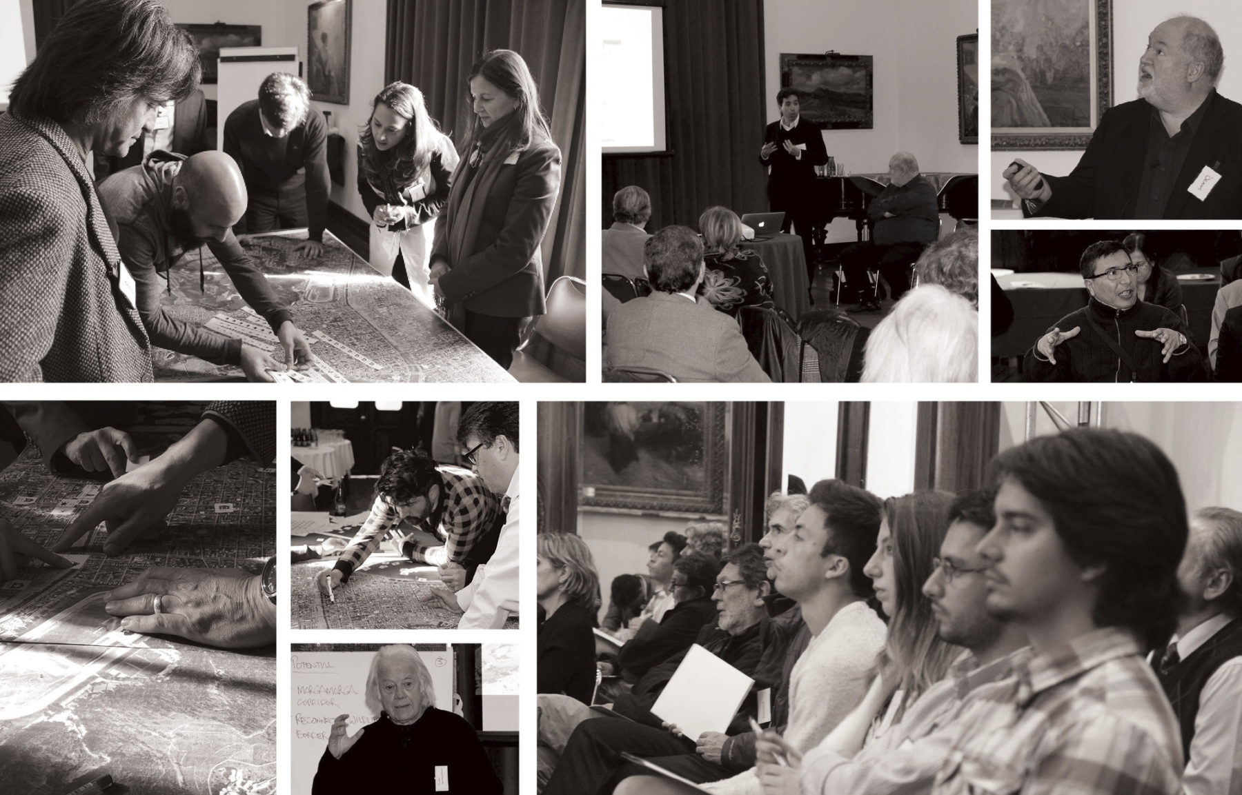
Through a series of Urban Dialogues, co-creation meetings that included activists, city officials, artists, academics etc, the design team exchanged ideas and engaged in systematic thinking on how to improve the quality of life in the city
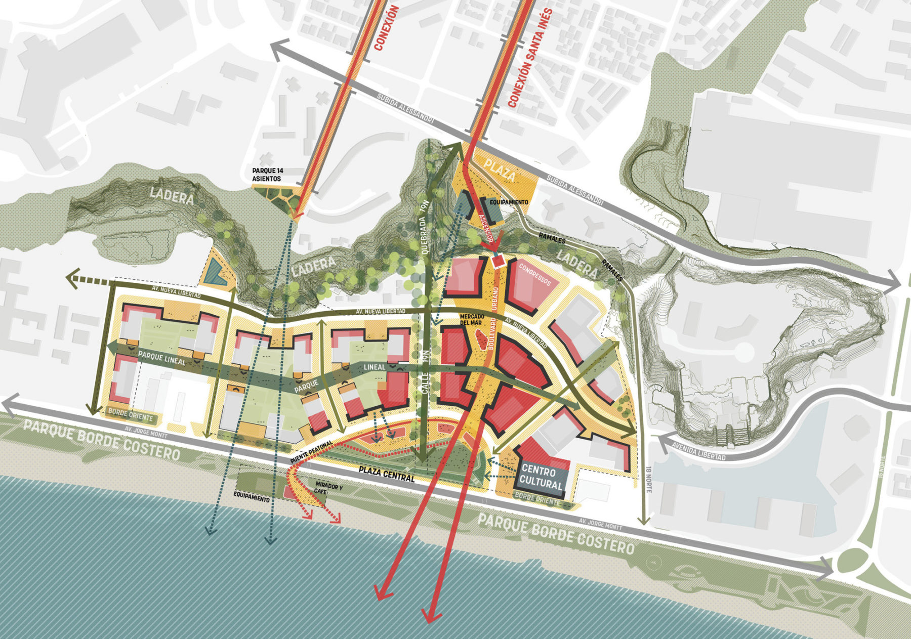
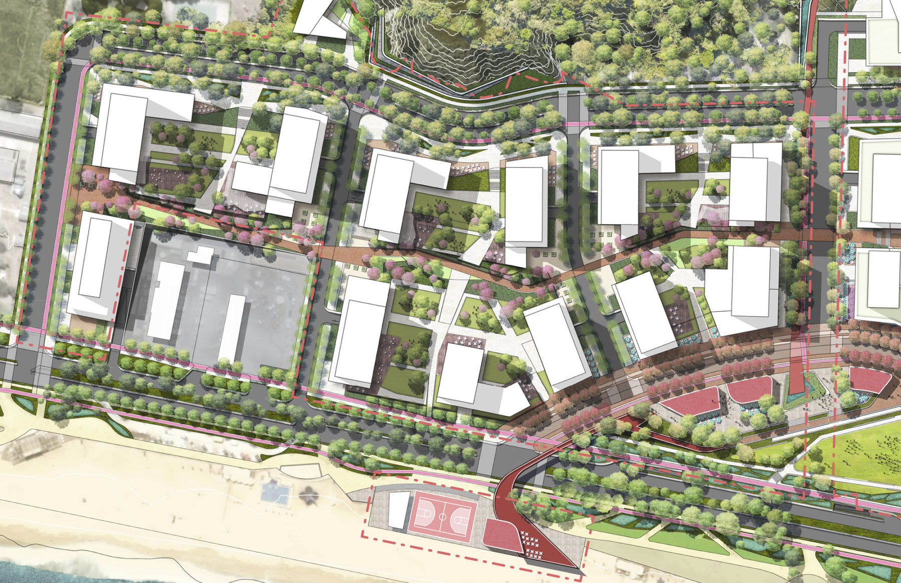
Site and city context
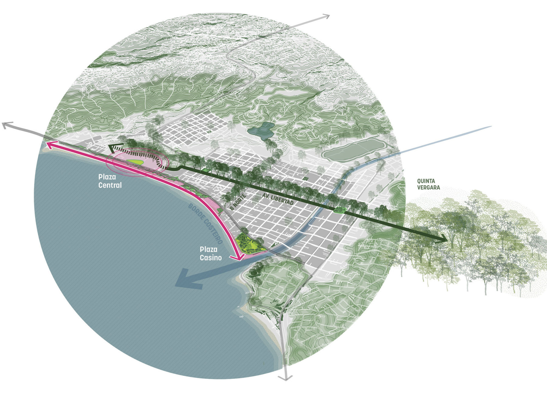
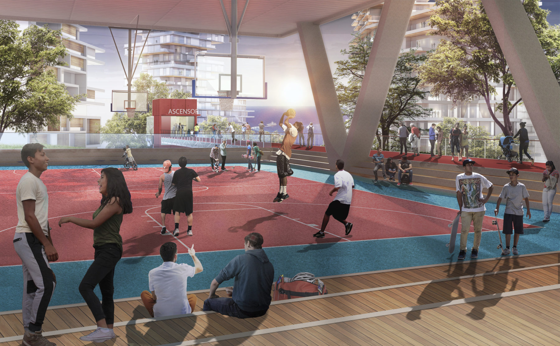
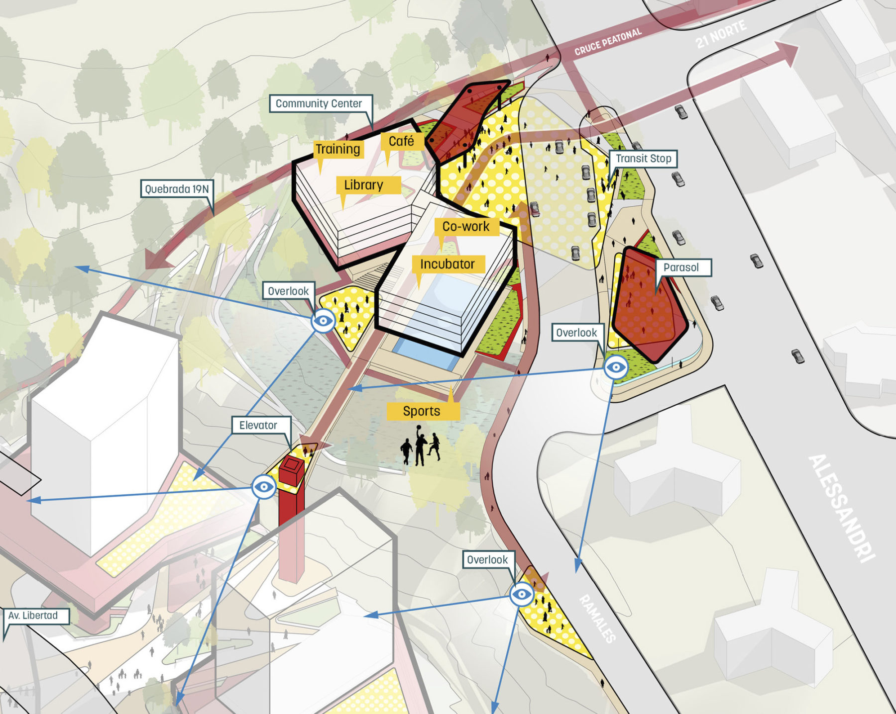
通过本次规划,一直与海边隔绝的山地区将重新与滨海区相连接。山顶的社区中心以及与之连通的半山人行电梯将服务于圣伊内斯的居民,社区中心为需要帮助的青少年提供康乐活动、职业培训服务、图书馆和灵活配置的公共空间。滨海地带的中央公园将作为社区珍贵的公共资源,通过一系列文化和公共功能促进社会融合,凝聚不同背景和阶层的群体。
A new Community Center will serve the broader community with access to recreation amenities and other social spaces
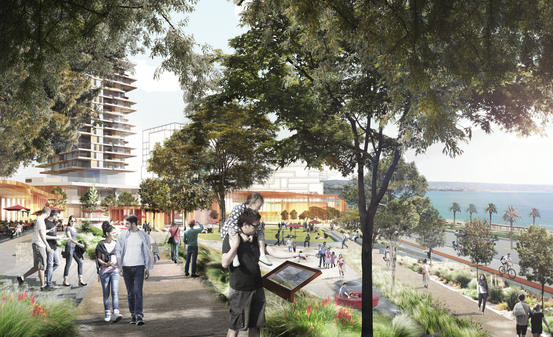
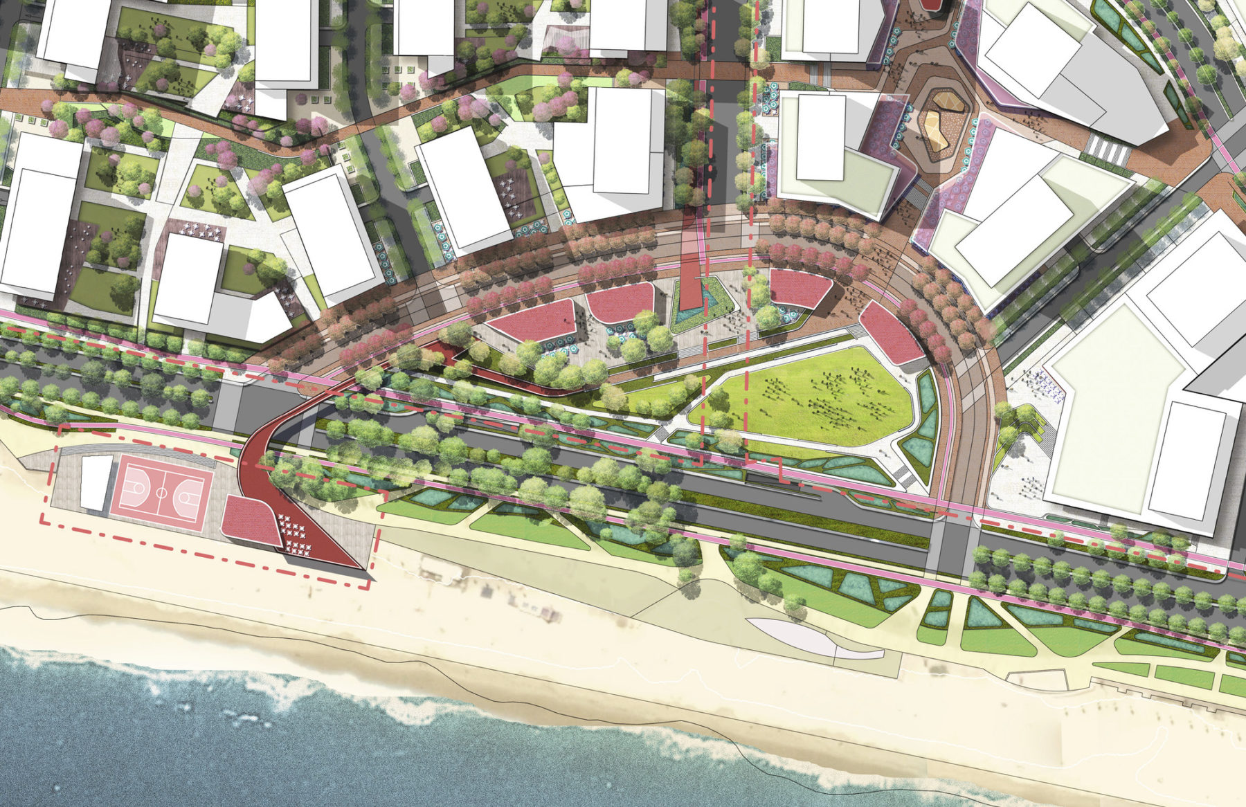
A Civic Gesture: The Central Park facing the Pacific Ocean is a civic gesture for the city and a return for the city and a return to Viña’s legacy of memorable public spaces
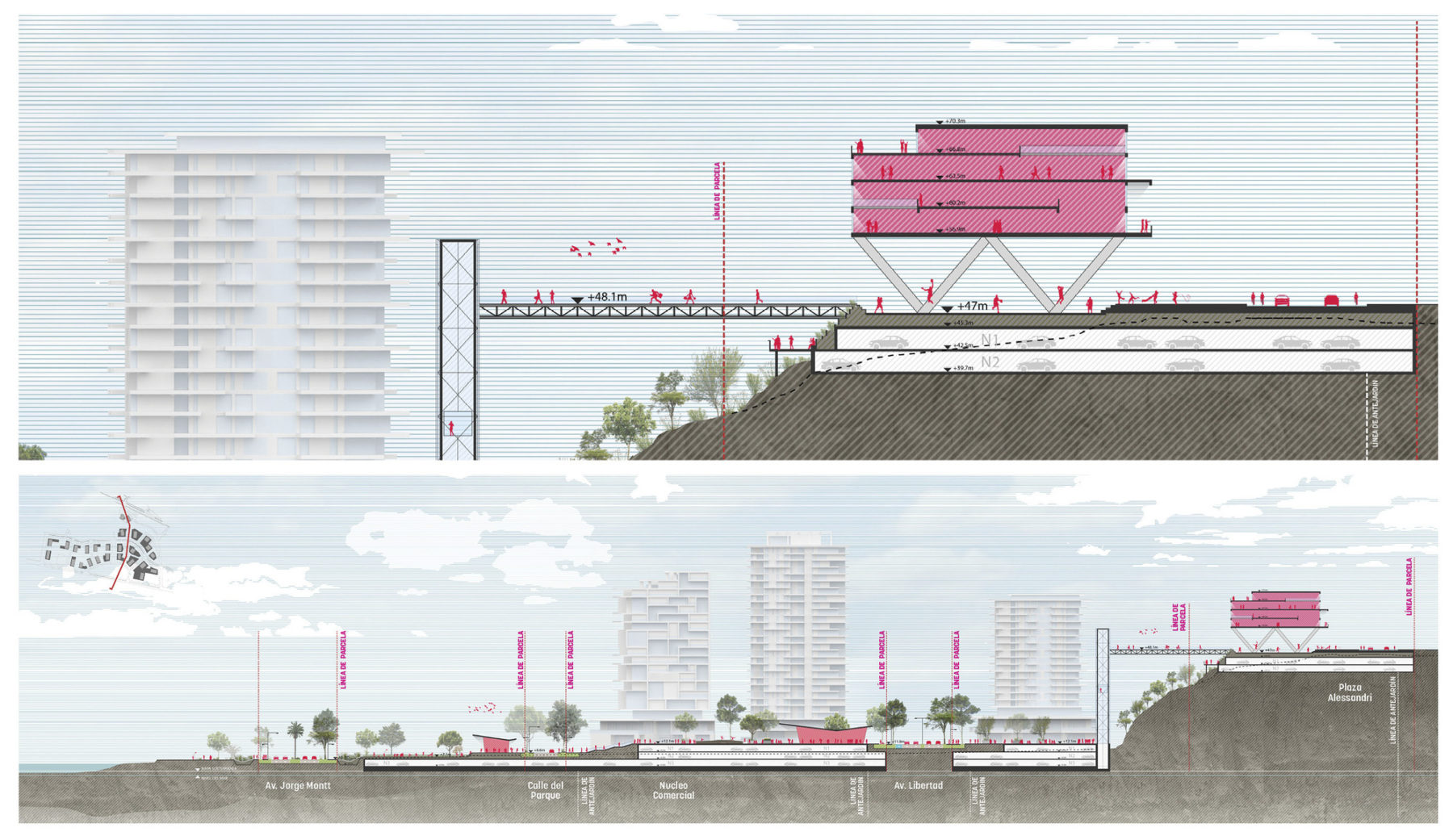
Engaging with Surrounding Communities: At the hilltop, a new Community Center connected to a public elevator provides a direct pedestrian linke to the sea, while creating a new activity hub for the Santa Inés Neighborhood
拉斯萨利纳斯将被改造为综合用途开发区,提倡开放、亲民而且可持续的城市发展模式。方案借由布局紧凑的街区以及畅通可达、生机蓬勃的公共空间,减少市民对私人交通的依赖;公用、文化、住宅、零售、办公和教育用途在拉斯萨利纳斯共冶一炉,促进社区的全方位发展;通过一系列活力动感的城市功能,行人能获得丰富的街道体验,以全新角度感受城市的魅力。
The framework creates new connections to the sea, re-engaging hillside neighborhoods that have historically been cut-off from the coast
A verdant and functional public realm network ties together the district and its urban context
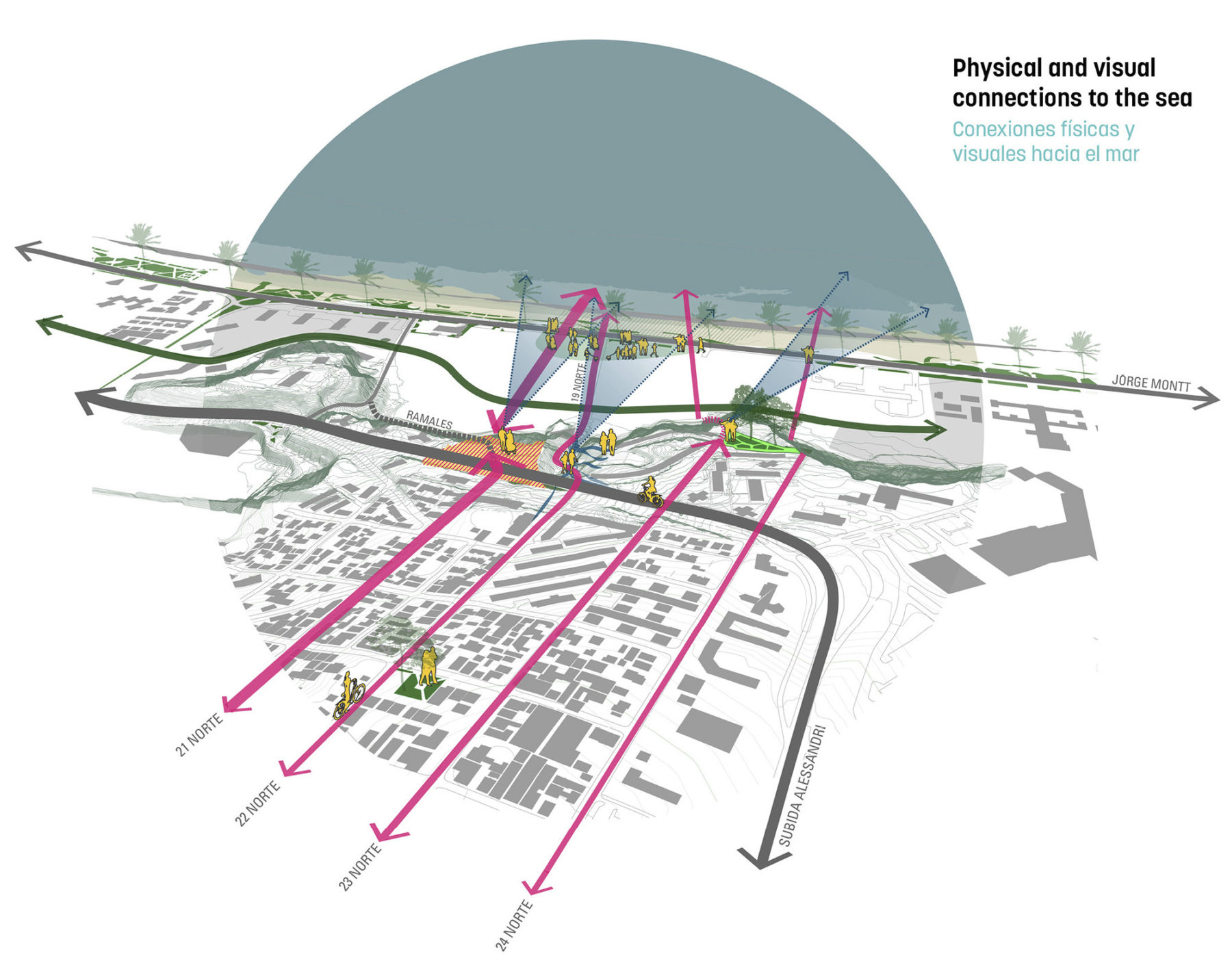
Visual and physical connections from the inland communities to the sea are a key driver for the plan
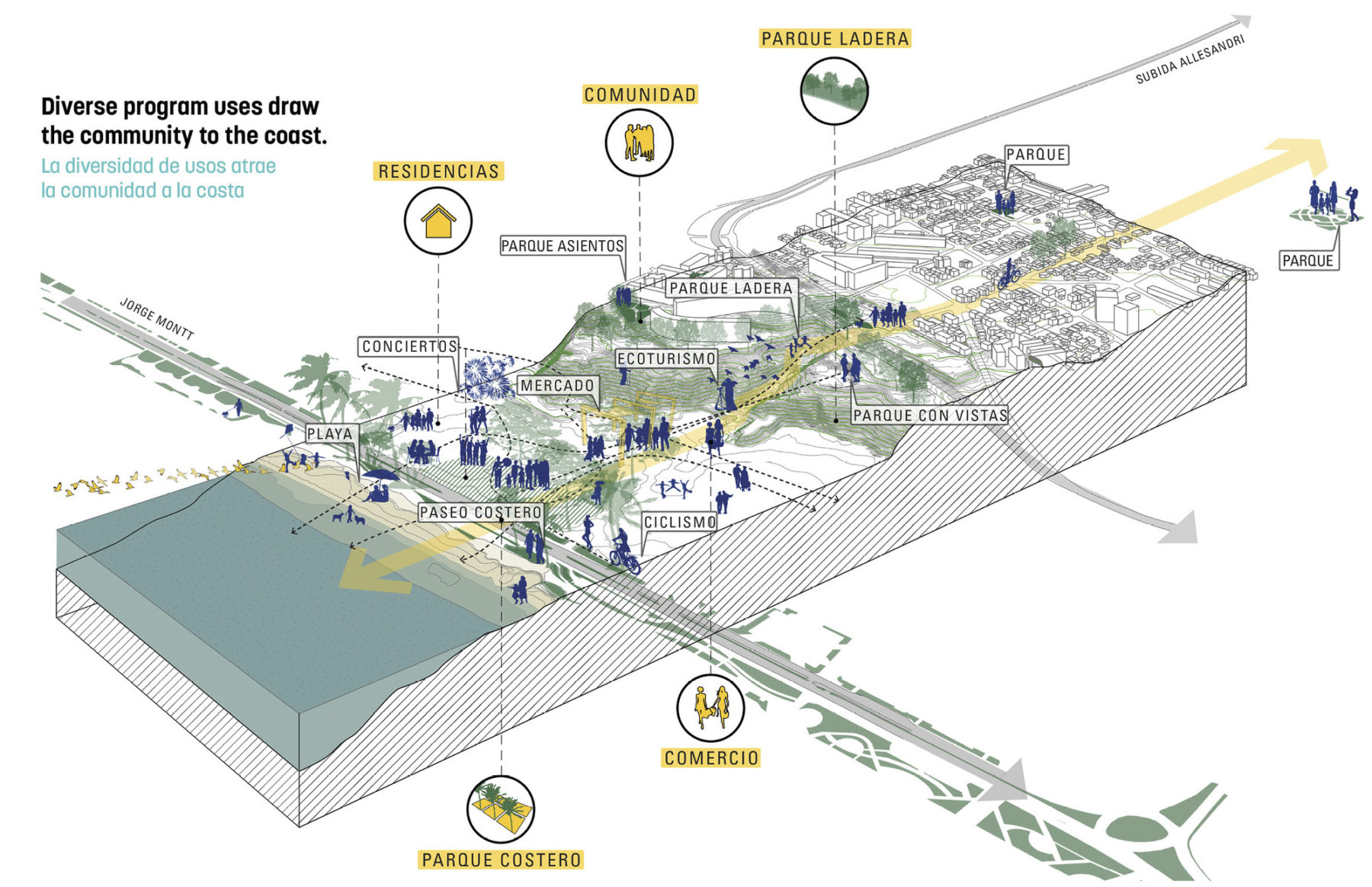
Diverse program uses draw the community to the coast
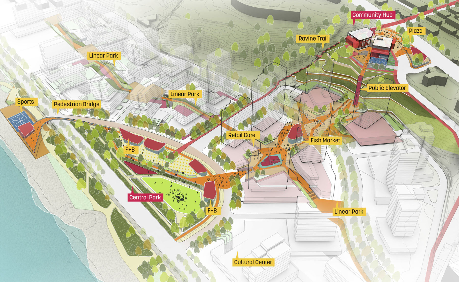
A fully accessible and interconnected public realm network promotes greater social integration among Viñamarinos. A pedestrian spine and regenerated ravine trail draws the Santa Inés community to a new public park on the Pacific Ocean coastline.
A network of verdant public spaces
The framework creates new connections to the sea, re-engaging hillside neighborhoods that have historically been cut-off from the coast
A verdant and functional public realm network ties together the district and its urban context
Visual and physical connections from the inland communities to the sea are a key driver for the plan
Diverse program uses draw the community to the coast
A fully accessible and interconnected public realm network promotes greater social integration among Viñamarinos. A pedestrian spine and regenerated ravine trail draws the Santa Inés community to a new public park on the Pacific Ocean coastline.
A network of verdant public spaces
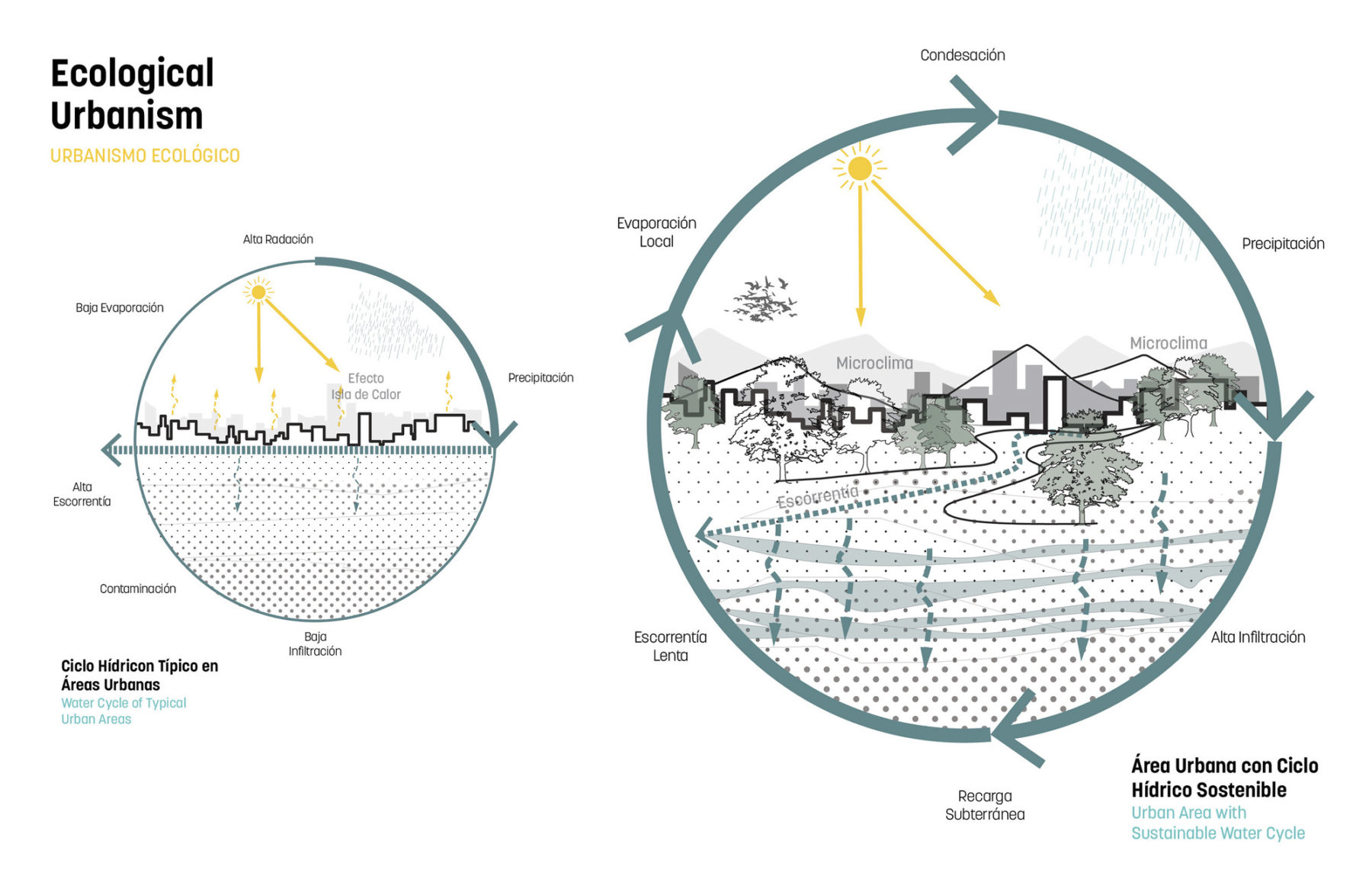
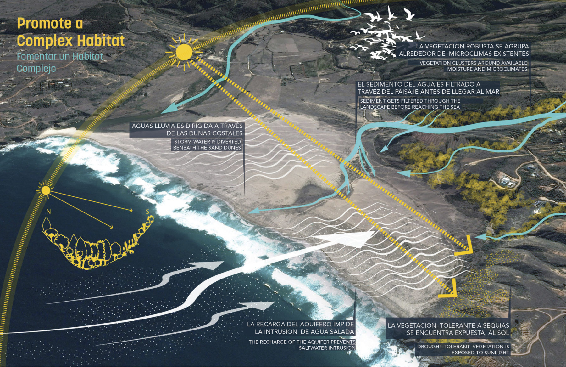
为构建可持续发展的未来,并强化基地现场不可或缺的景观基础设施和生态系统设施,设计团队从大自然寻找灵感,深入研究智利的海岸景观。方案从不同层次探讨规划形式和功能,意图在基地上各个生态系统之间建立联系,加强场地抵御环境变化的能力,最终在雨水管理、养分循环、碳排放、微气候、花粉传播和物种散布等不同范畴达致协调效果。
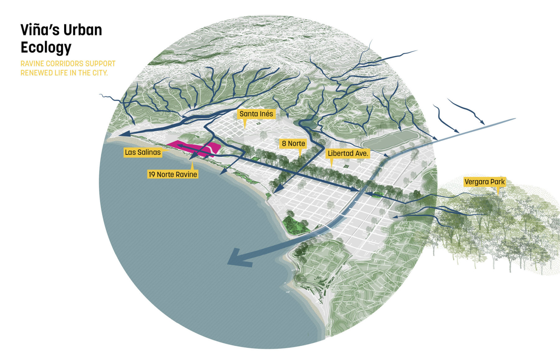
Largely ignored by recent development, the deterioration of ravines and river corridors have undermined the historic garden city quality of Viña. At Las Salinas, the 19N ravine presents a unique regenerative opportunity.
Ecological urbanism
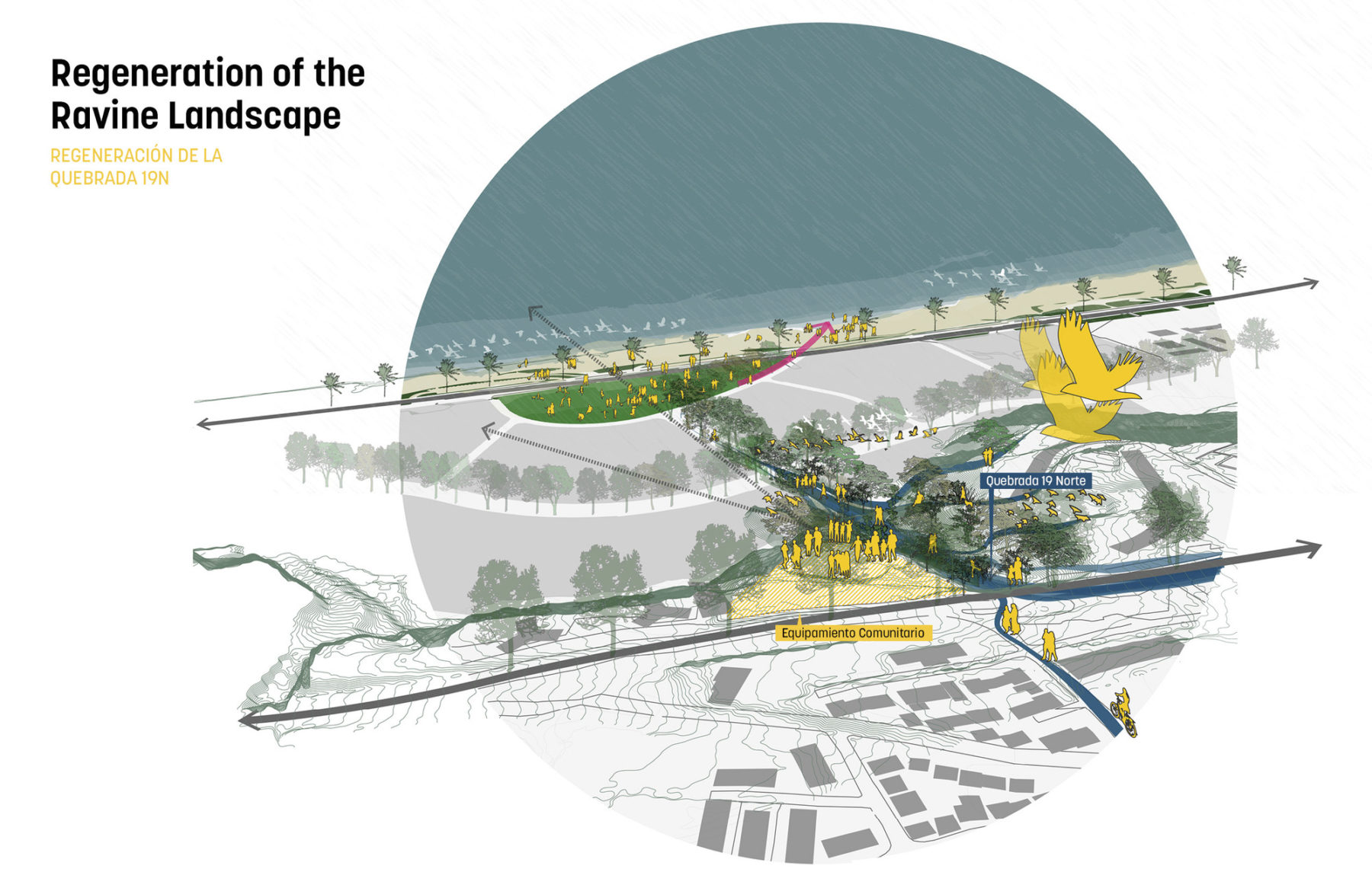
Regeneration of the ravine landscape

The regenerated 19 Norte ravine and community path restores a vital ecological system at the site while showcasing the benefits of a working landscape
The regeneration of the ravine corridor extends through the neighborhood street and brings the energy of the Ladera (hillside) to the heart of the community
Largely ignored by recent development, the deterioration of ravines and river corridors have undermined the historic garden city quality of Viña. At Las Salinas, the 19N ravine presents a unique regenerative opportunity.
Ecological urbanism
Regeneration of the ravine landscape
The regenerated 19 Norte ravine and community path restores a vital ecological system at the site while showcasing the benefits of a working landscape
The regeneration of the ravine corridor extends through the neighborhood street and brings the energy of the Ladera (hillside) to the heart of the community
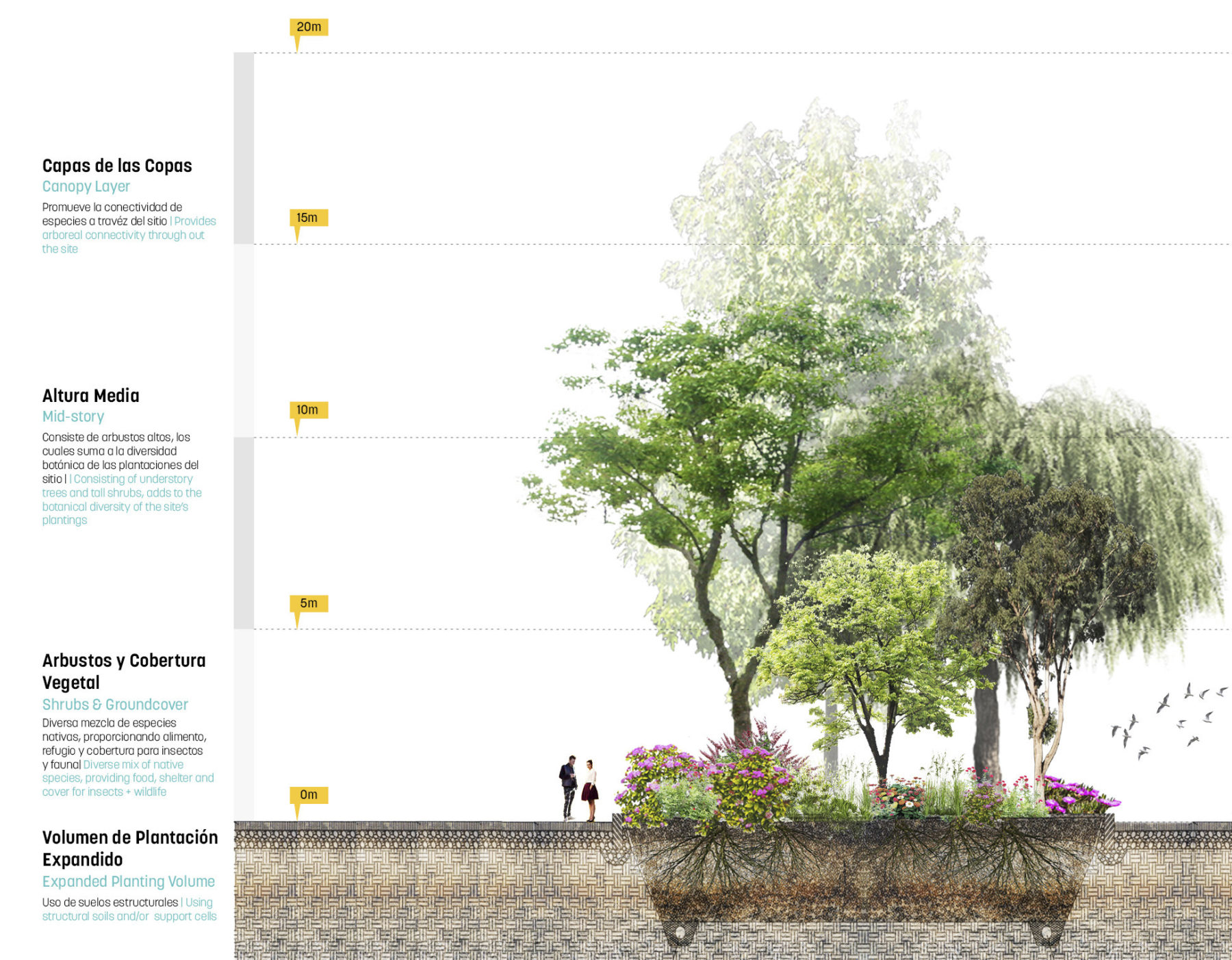
方案通过各种措施强化山地景观,同时重视建成环境生态活动的丰富性。有别于一般城市景观规划策略,拉斯萨利纳斯开发区并没有在物种挑选策略上设限,反而力求容纳多样化的、结构较复杂的原生植物品种,悉心应对开发区所形成的微气候和栖息地。沟谷廊道的修复措施就充分示范了自然系统与城市发展的整合共通。
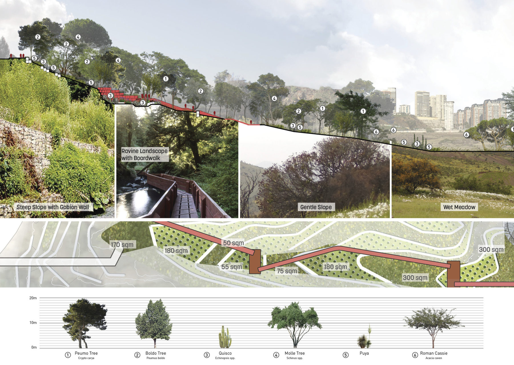
Diversity of vegetation
In-depth research of the Chilean coastal landscape informed strategies to regenerate the site’s ecological function and essential services
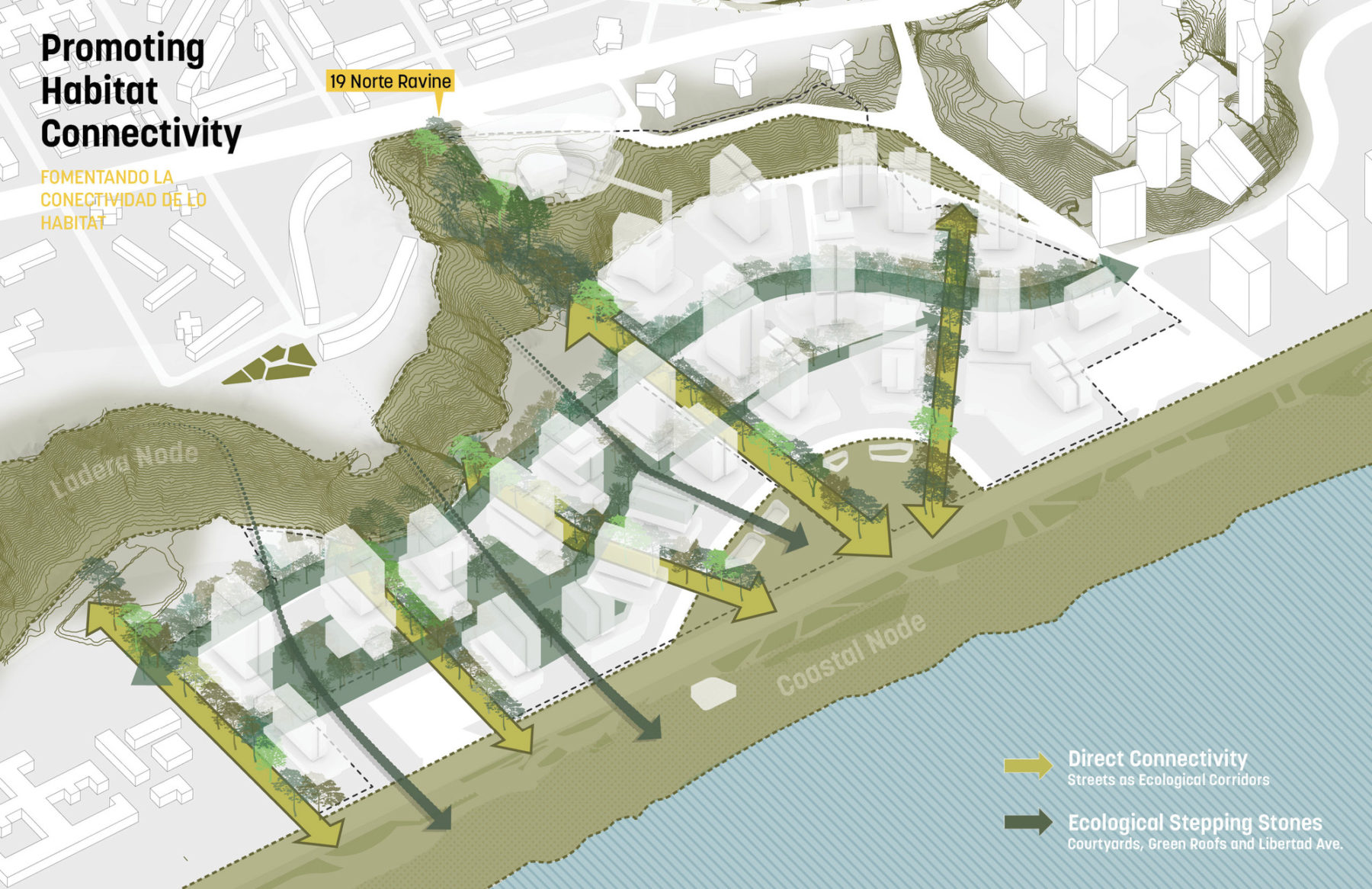
A system of Ecological Corridors and Stepping Stones provides strong connectivity between the escarpment and coastal habitat nodes
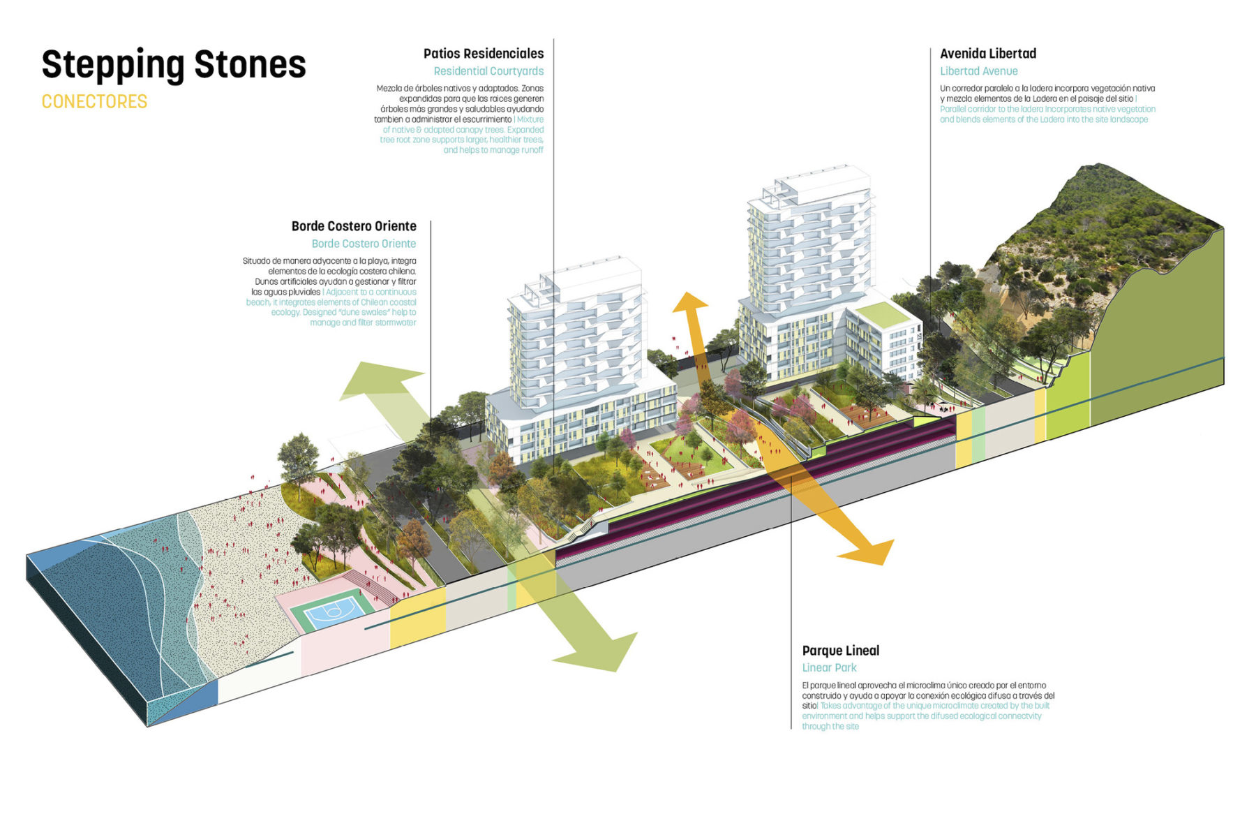
The Ladera (hillside) habitat is drawn into the neighborhood by a continuous tree canopy along Libertad Avenue. Green roofs and courtyards function as stepping stones between the escarpment and coastal landscape.
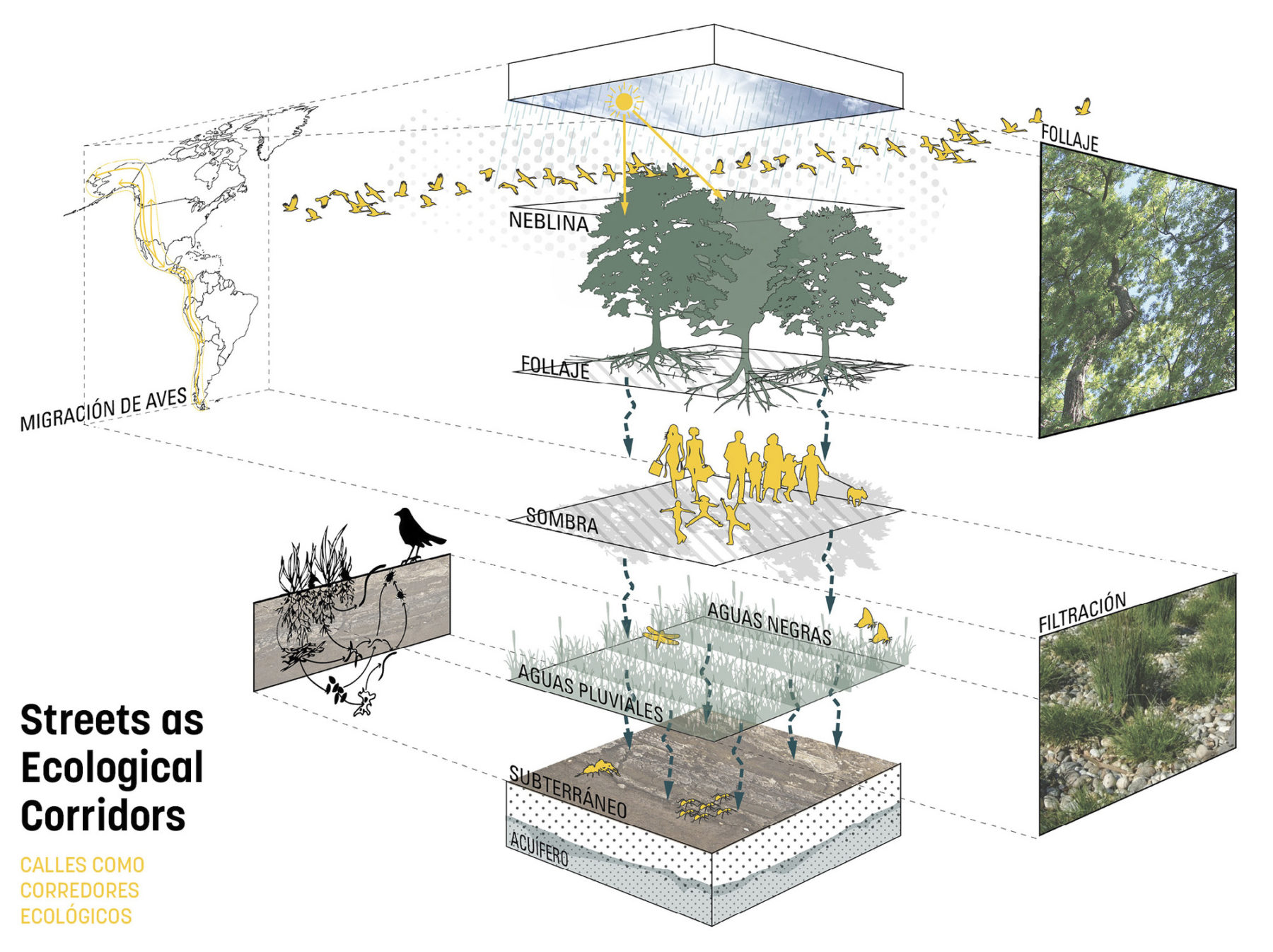
Streets as ecological corridors
Street as corridors for habitat connectivity and ecological function
Diversity of vegetation
In-depth research of the Chilean coastal landscape informed strategies to regenerate the site’s ecological function and essential services
A system of Ecological Corridors and Stepping Stones provides strong connectivity between the escarpment and coastal habitat nodes
The Ladera (hillside) habitat is drawn into the neighborhood by a continuous tree canopy along Libertad Avenue. Green roofs and courtyards function as stepping stones between the escarpment and coastal landscape.
Streets as ecological corridors
Street as corridors for habitat connectivity and ecological function
The landscape framework represents a departure from formal and monocultural boulevards by creating a biodiverse tree canopy
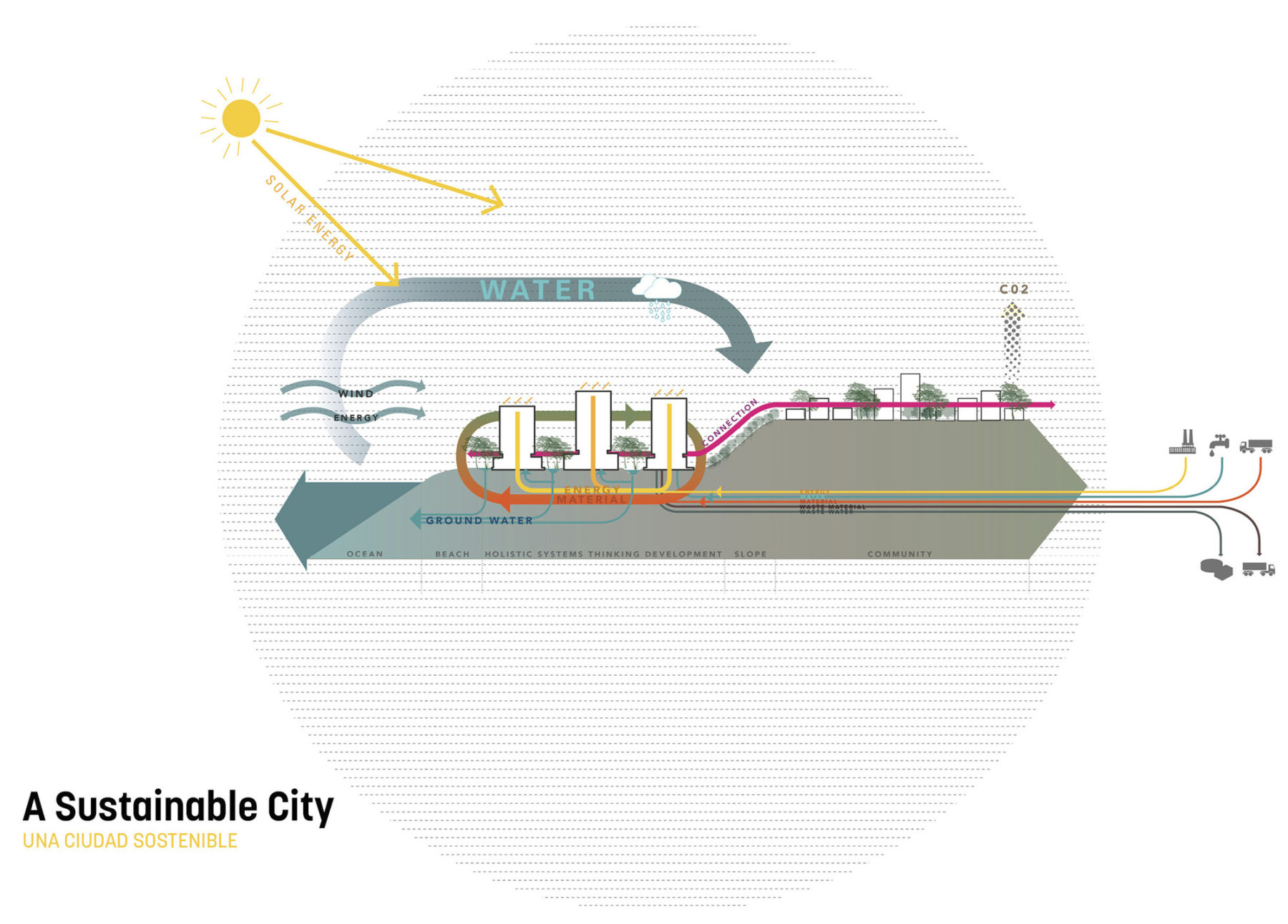
Sasaki’s multilayered approach to form and function takes into account connectivity and resilience of site systems, which in turn regulate stormwater, nutrients, carbon, microclimate, pollination, and species dispersal
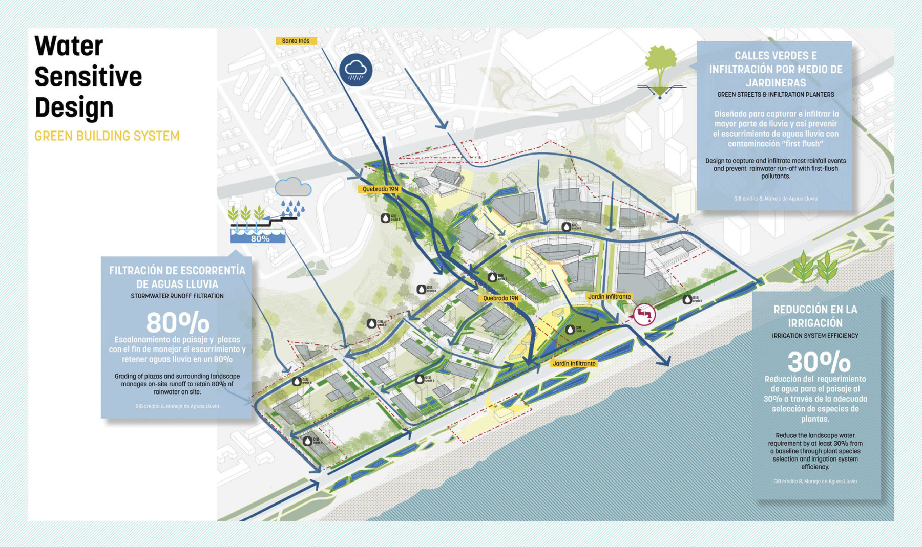
Climate change has led to a dramatic reduction in rainfall in coastal Chile. Water-sensitive design strategies reduce potable water demand, increase rainfall infiltration, and prevent saltwater intrusion of the coastal aquifer.
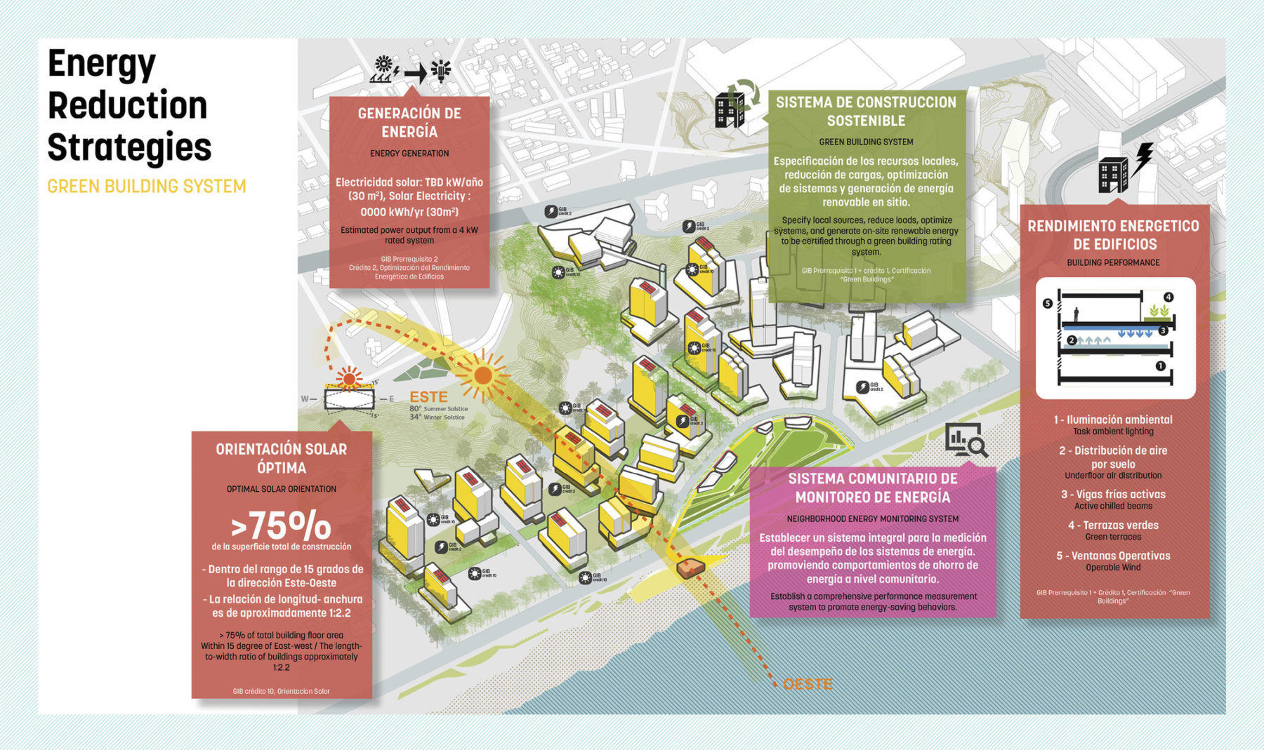
Orientation of buildings create a highly energy efficient urban form while design guidelines define performance parameters for future development. An energy monitoring system will be implemented at the district level to promote behavioral shifts for energy savings.
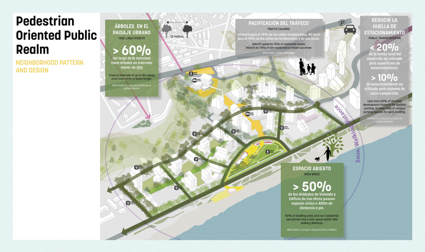
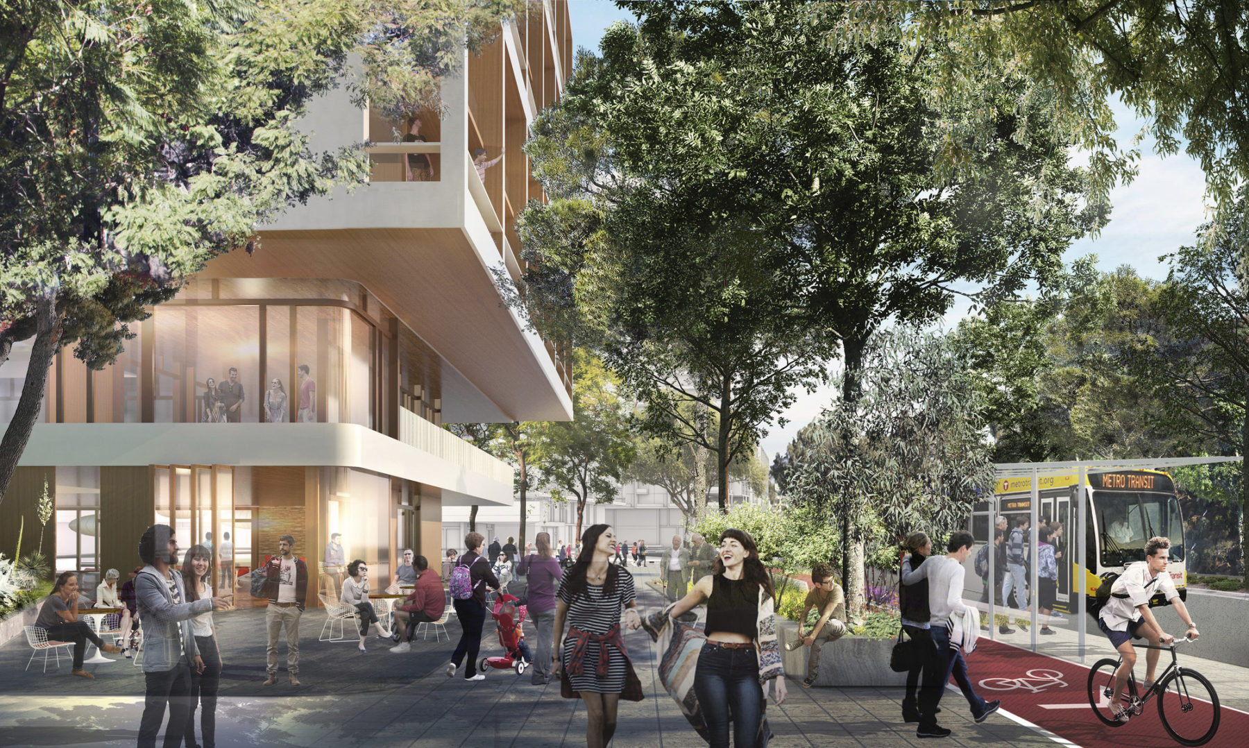
Pedestrian-oriented public realm
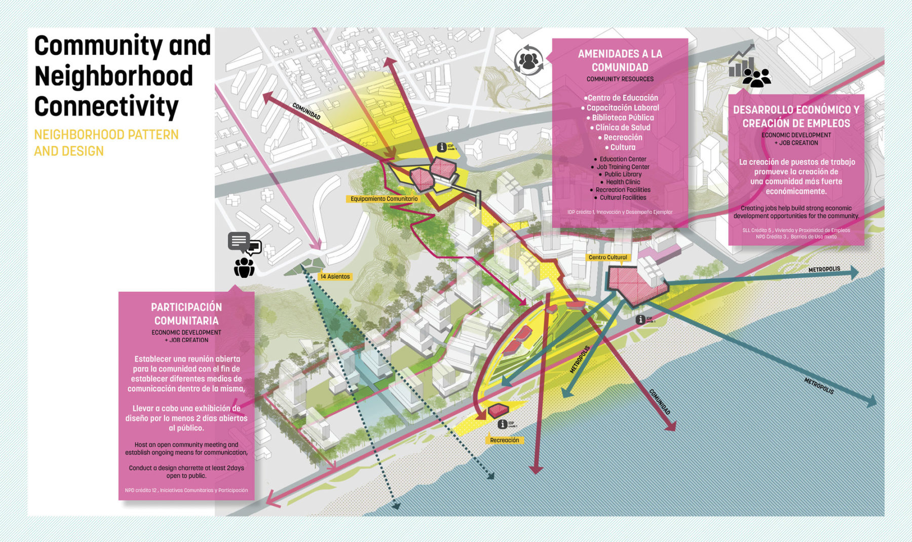
Community, neighborhood, and connectivity
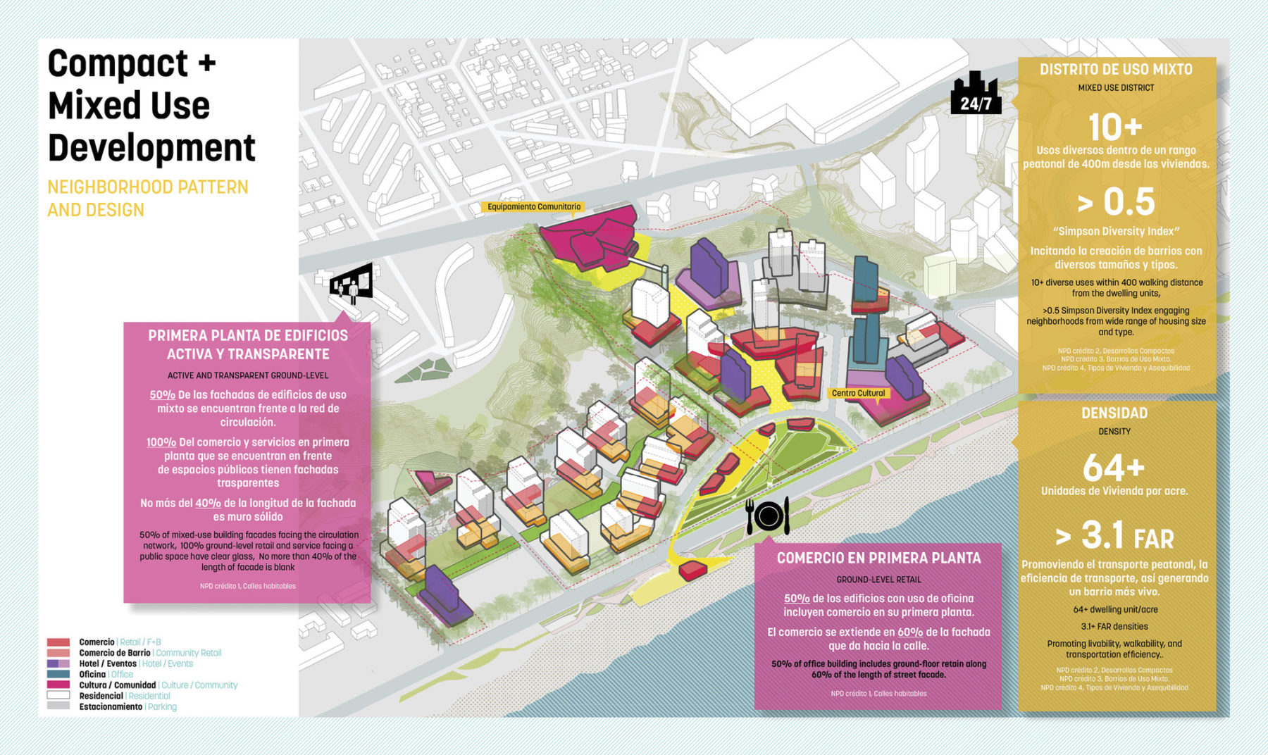
Compact and mixed use development
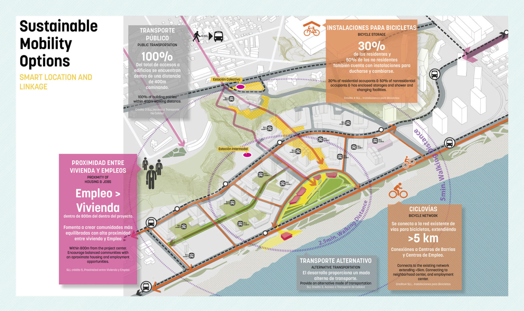
Sustainable mobility options
Sasaki’s multilayered approach to form and function takes into account connectivity and resilience of site systems, which in turn regulate stormwater, nutrients, carbon, microclimate, pollination, and species dispersal
Climate change has led to a dramatic reduction in rainfall in coastal Chile. Water-sensitive design strategies reduce potable water demand, increase rainfall infiltration, and prevent saltwater intrusion of the coastal aquifer.
Orientation of buildings create a highly energy efficient urban form while design guidelines define performance parameters for future development. An energy monitoring system will be implemented at the district level to promote behavioral shifts for energy savings.
Pedestrian-oriented public realm
Community, neighborhood, and connectivity
Compact and mixed use development
Sustainable mobility options
借由绿意盎然、功能实用的公共空间网络,开发区与周边的城市环境无缝连接。与自由大道(Libertad Avenue)并排的长方形公园可以让人们尽情享受公共空间带来的乐趣。公园不但通过各种游戏空间和阶梯式座席提供多元化的休闲方式,也化身别具特色的过渡区域,将行人从周边的居民导向街区的中心活动地带。
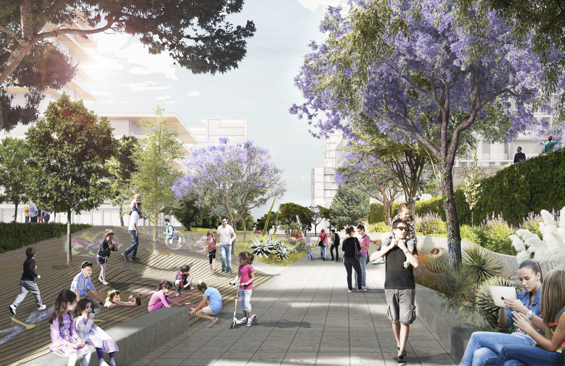
A park is envisioned as a social connector
Public uses along the waterfront democratize access for communities long-separated from the water’s edge
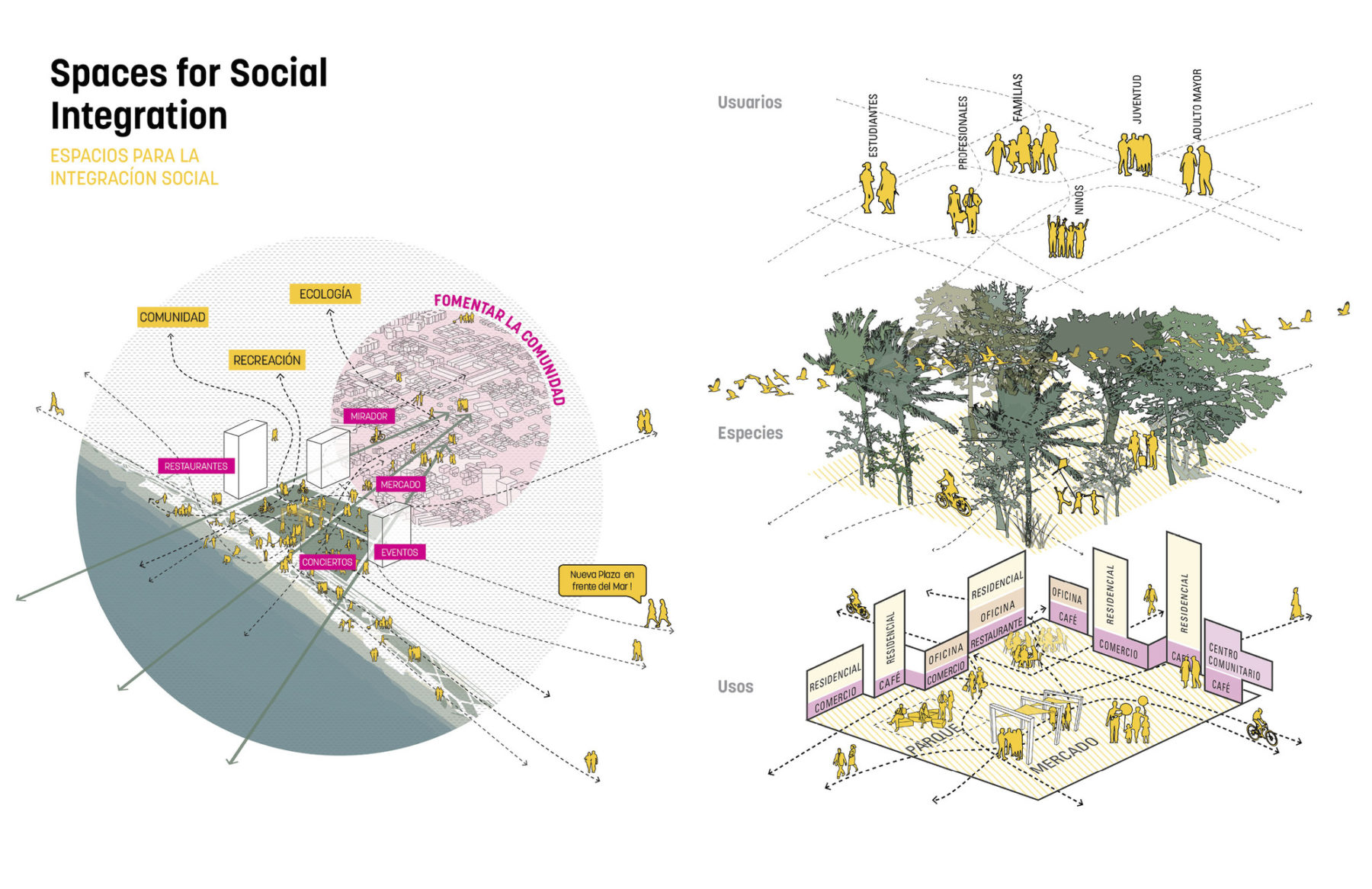
An exploded diagram of spaces designed for social integration
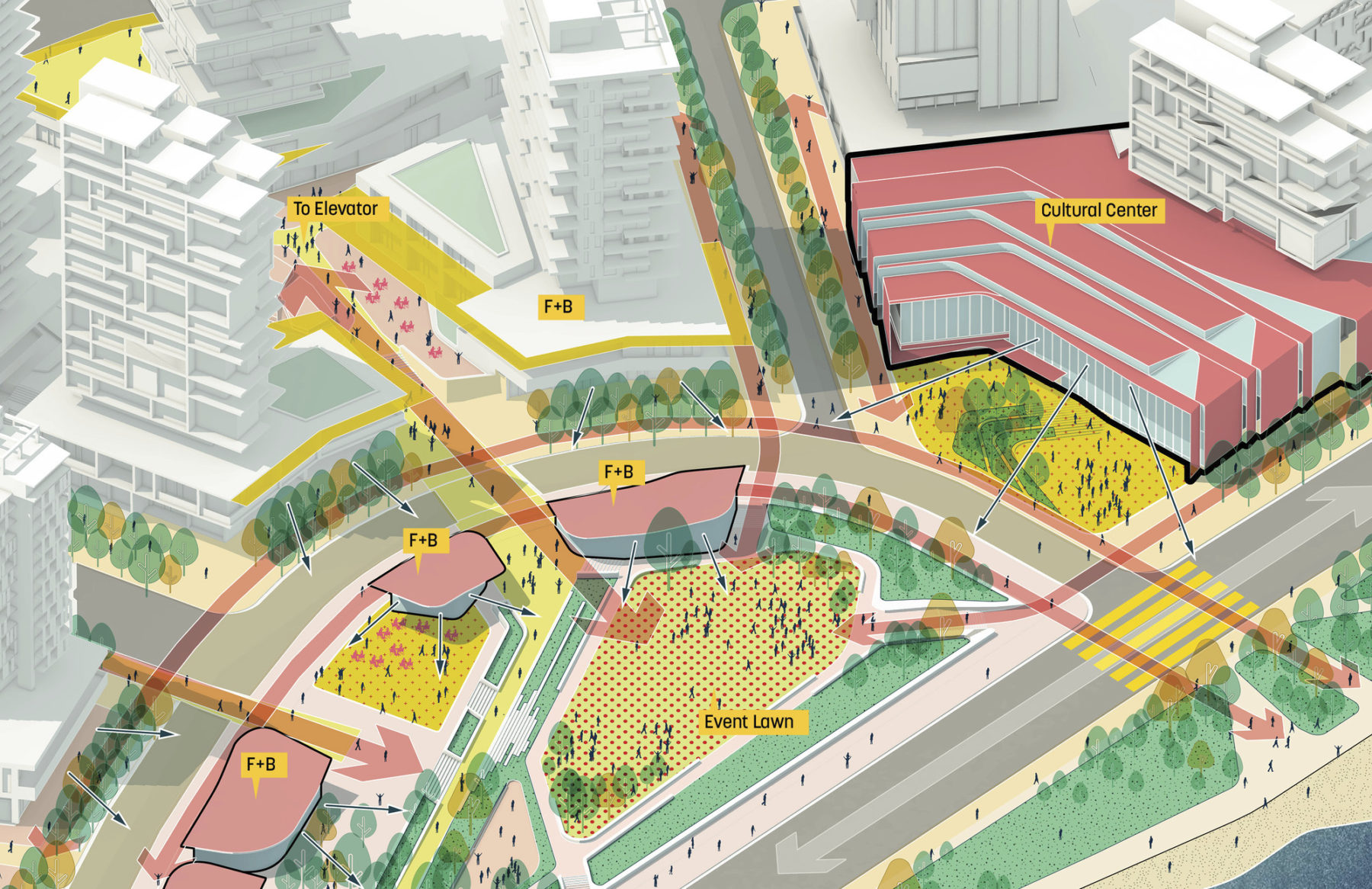
Framed by retail and cultural uses, the Central Park is able to host a range of civic activities that bring together the community of Viña. Cascading terraces create a neighborhood resilient to coastal storm surges.
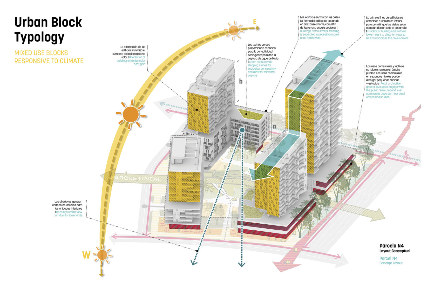
Mixed-use block typologies
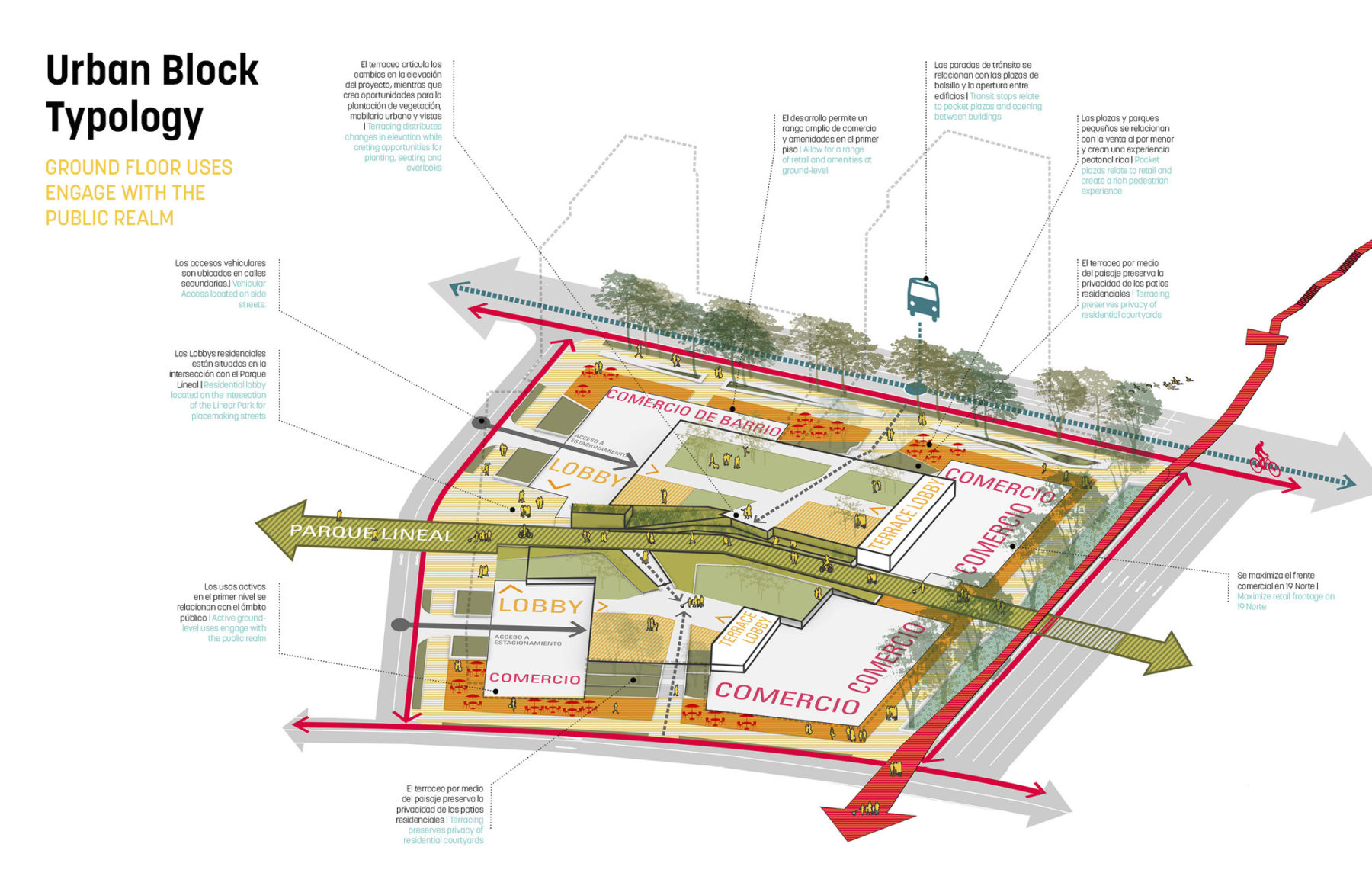
Program at the street level
Public uses along the waterfront democratize access for communities long-separated from the water’s edge
An exploded diagram of spaces designed for social integration
Framed by retail and cultural uses, the Central Park is able to host a range of civic activities that bring together the community of Viña. Cascading terraces create a neighborhood resilient to coastal storm surges.
Mixed-use block typologies
Program at the street level
为寻求良策改善城市生活,鼓励公众踊跃发表意见和参与讨论是项目的重要一环。借由一系列公众对谈会,设计团队、政府人员和当地市民就广泛议题持续交流意见,共同商讨如何有系统地改善比尼亚以至广域地区的城市生活质量。各方皆期待在传承比尼亚独有特色的基础上,建立一个具前瞻性且能抵御环境变化的发展框架,带领拉斯萨利纳斯以至整个城市迈向可持续的未来。
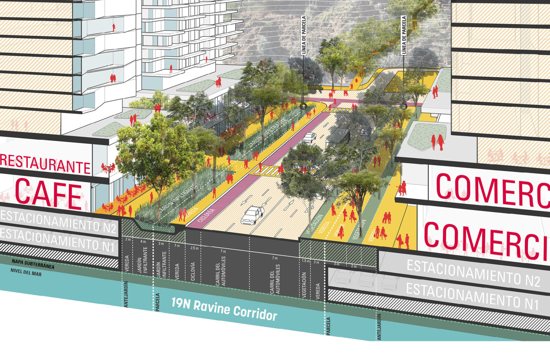
Plan detail
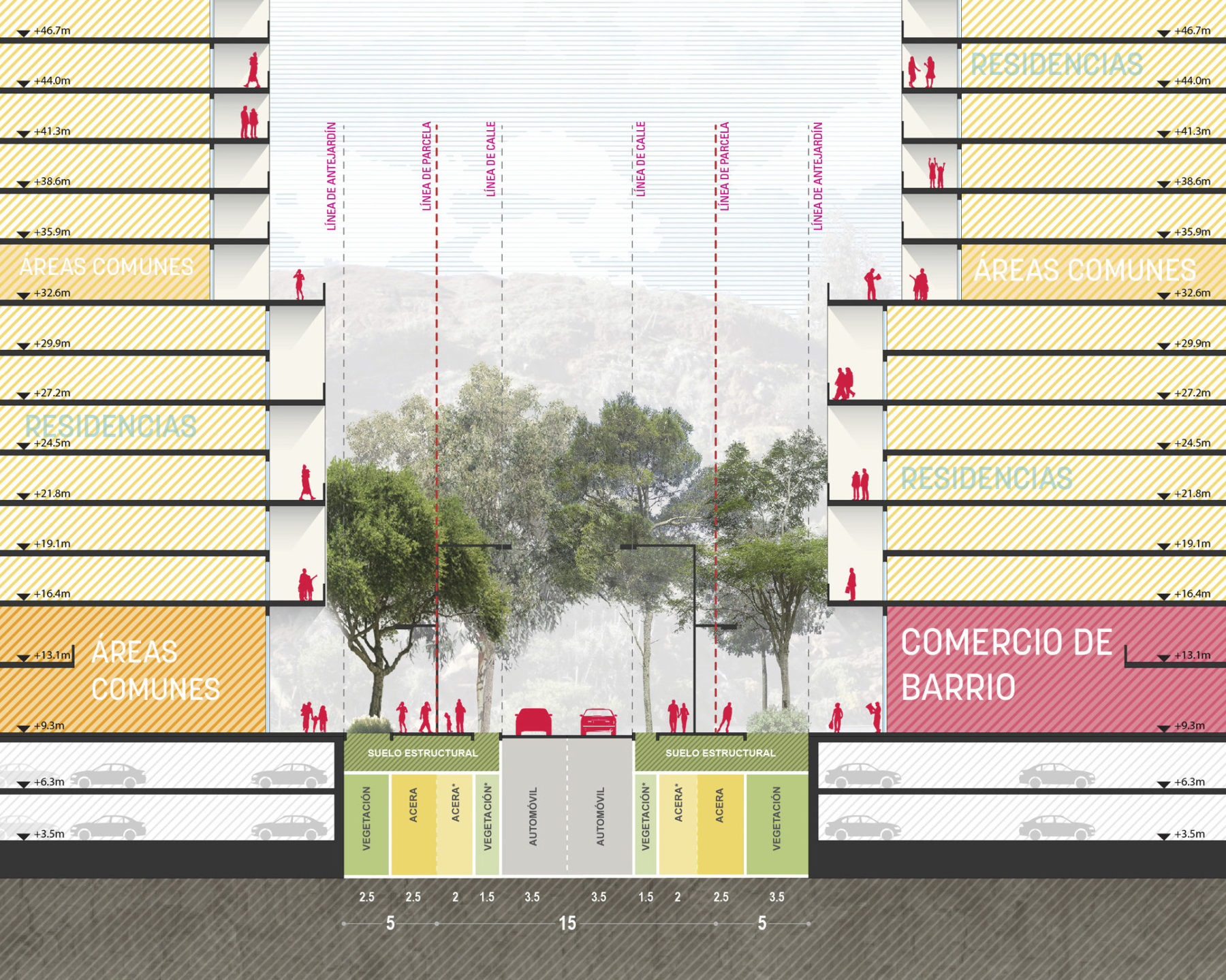
Street design
Las Salinas is redefining the trajectory of Viña, re-engaging the city with its social and ecological context
想了解更多项目细节,请联系 丹尼斯・派普斯.