波士顿气候变化应对策略
美国麻州波士顿市
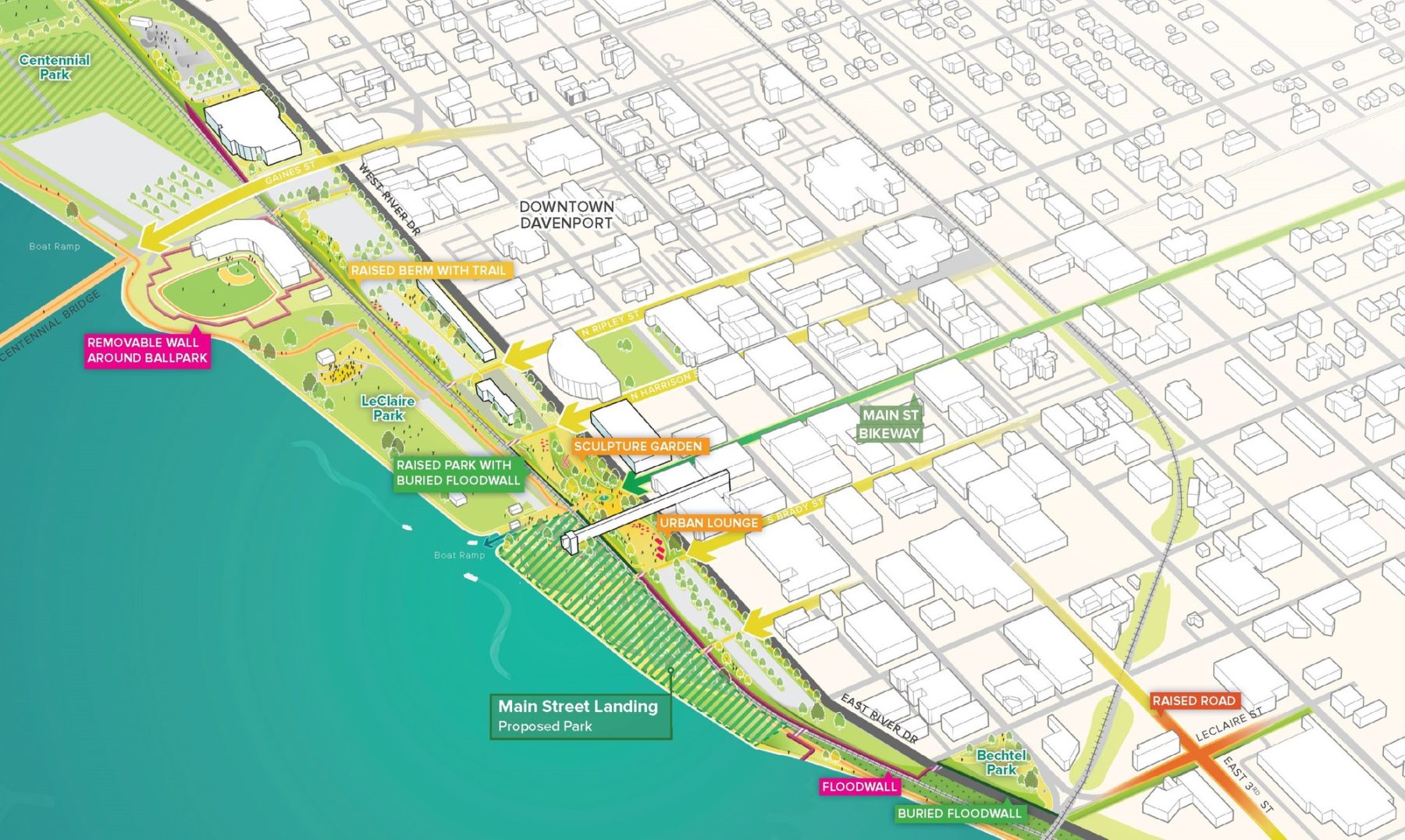
Along Downtown Davenport’s riverfront, the plan incorporates a line of protection into other public benefits, like an elevated open space or trail connector wherever possible
The City of Davenport, Iowa, experienced record flooding in 2019 when the Mississippi River flooded the city’s riverfront for 103 days of the year and reached a new record crest. The long-term detours, drains on city resources, and lack of access to the riverfront’s many public spaces galvanized the desire to create a long term Mississippi River Flood Resiliency Plan for Davenport’s beautiful 9-mile riverfront.
Together with engineering partners HR Green and Shive Hattery, Sasaki collaborated with the Davenport Public Works team and the community to develop a Resiliency Plan that identifies a mix of built structure and other solutions for flood mitigation.
The benefits of the plan, once implemented, will be transformational for Davenport. For example, if the plan’s recommendations had been in place since the year 2000, they would have greatly reduced or eliminated the city’s flood response activities for over 850 days in the Garden Addition neighborhood.
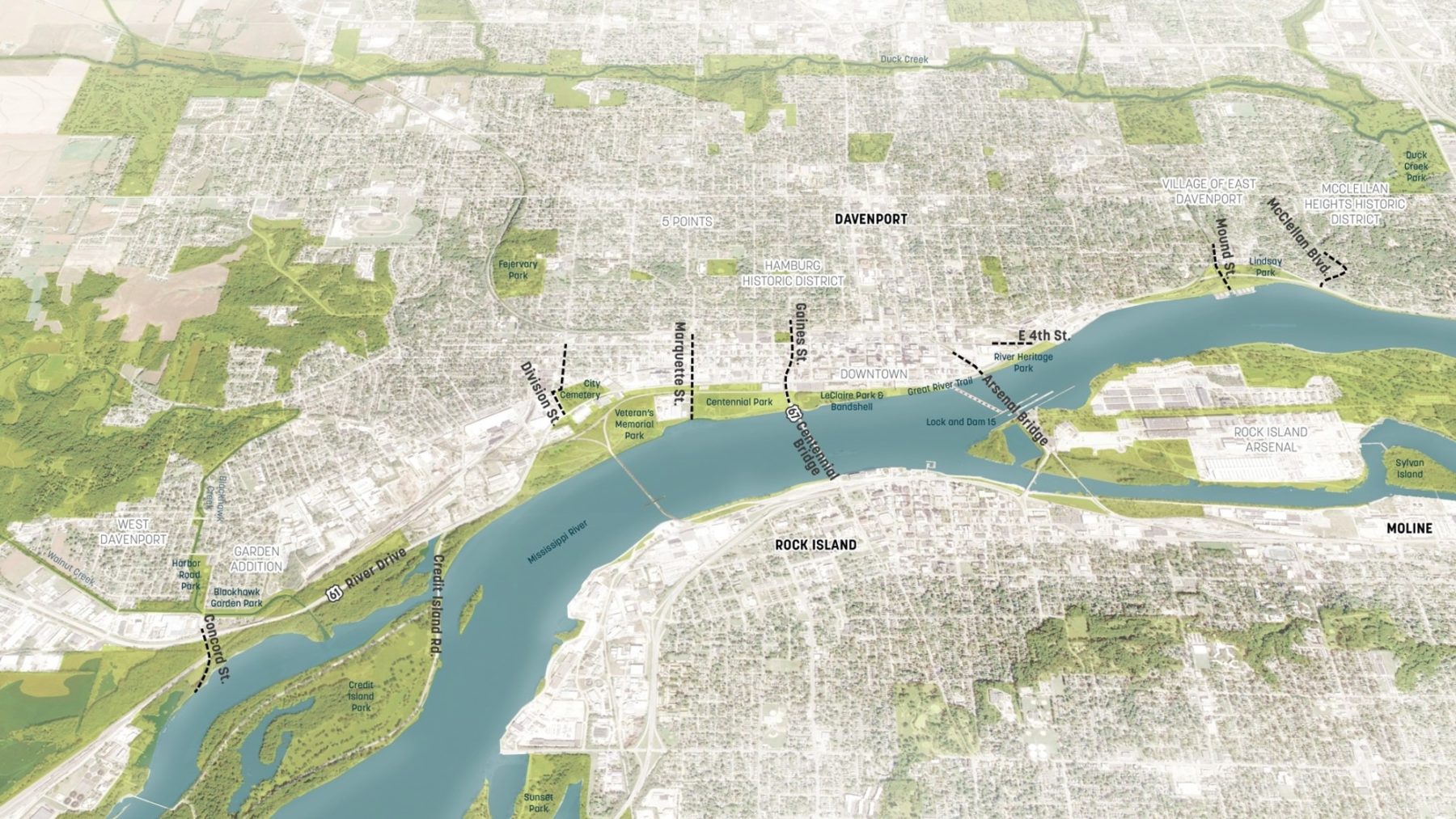
The study considered the full nine miles of the Davenport riverfront
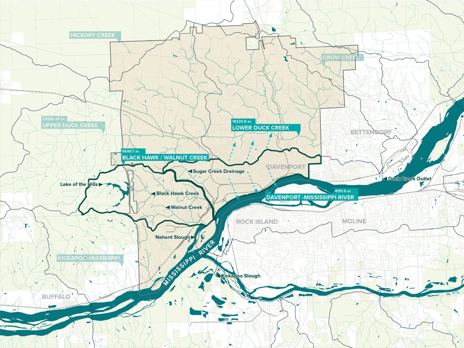
Analysis of the existing conditions was the starting point of the plan, including studying Davenport’s riverfront neighborhoods in the context of the primary watersheds and creeks that drain into the Mississippi River
The Resilience Plan includes a combination of non-structural approaches (like land use changes) and structural solutions (like riverfront berms, floodgates, or infrastructure approaches) that addresses both the immediate needs and prepares Davenport for larger flood events in the future.
The plan charts out three phases. Phase 1, also known as the “fix what’s broken and prepare for the future” phase, includes projects that offer an immediate return on investment in the form of increased resilience during low to moderate flood stages. Phase 2 outlines structural solutions that offer continuous protection along the river against flooding up to flood stage 22 (in the past 20 years, flooding has reached stage 22 for 7 days). Once completed, these solutions will provide reliable, permanent protection that requires far less emergency deployment in flood conditions. The final phase involves the replacement of temporary pump stations with permanent ones along the riverfront, which will improve response times and roadway access during flood events.
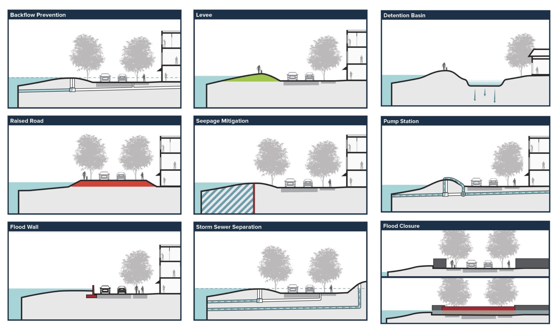
The plan draws from a toolbox of flood mitigation measures, both above and below ground, and matches them to the needs of the unique conditions across the riverfront
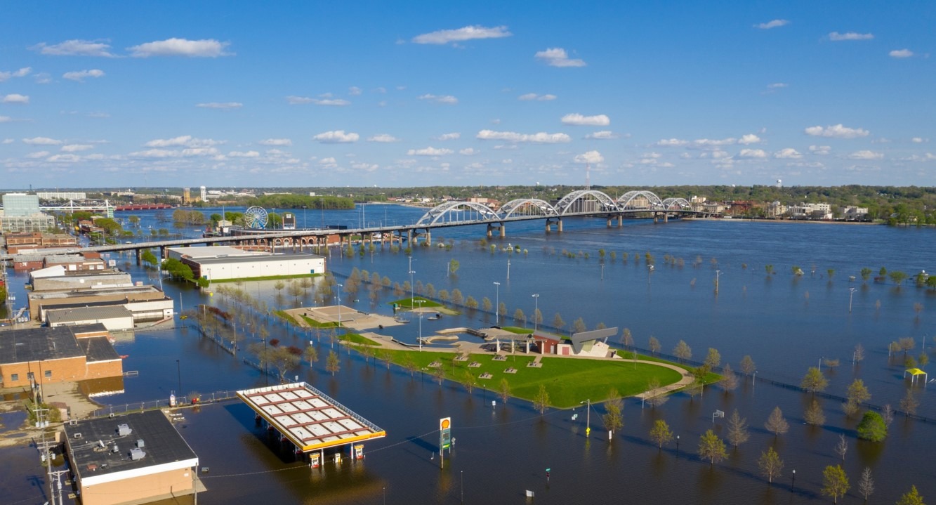
The 2019 record-setting flood in Davenport illuminated the challenges of recovering from flooding. Lessons learned from this event informed the plan, which identifies near-term mitigation strategies to address the next flooding emergency. (Image credit: City of Davenport)
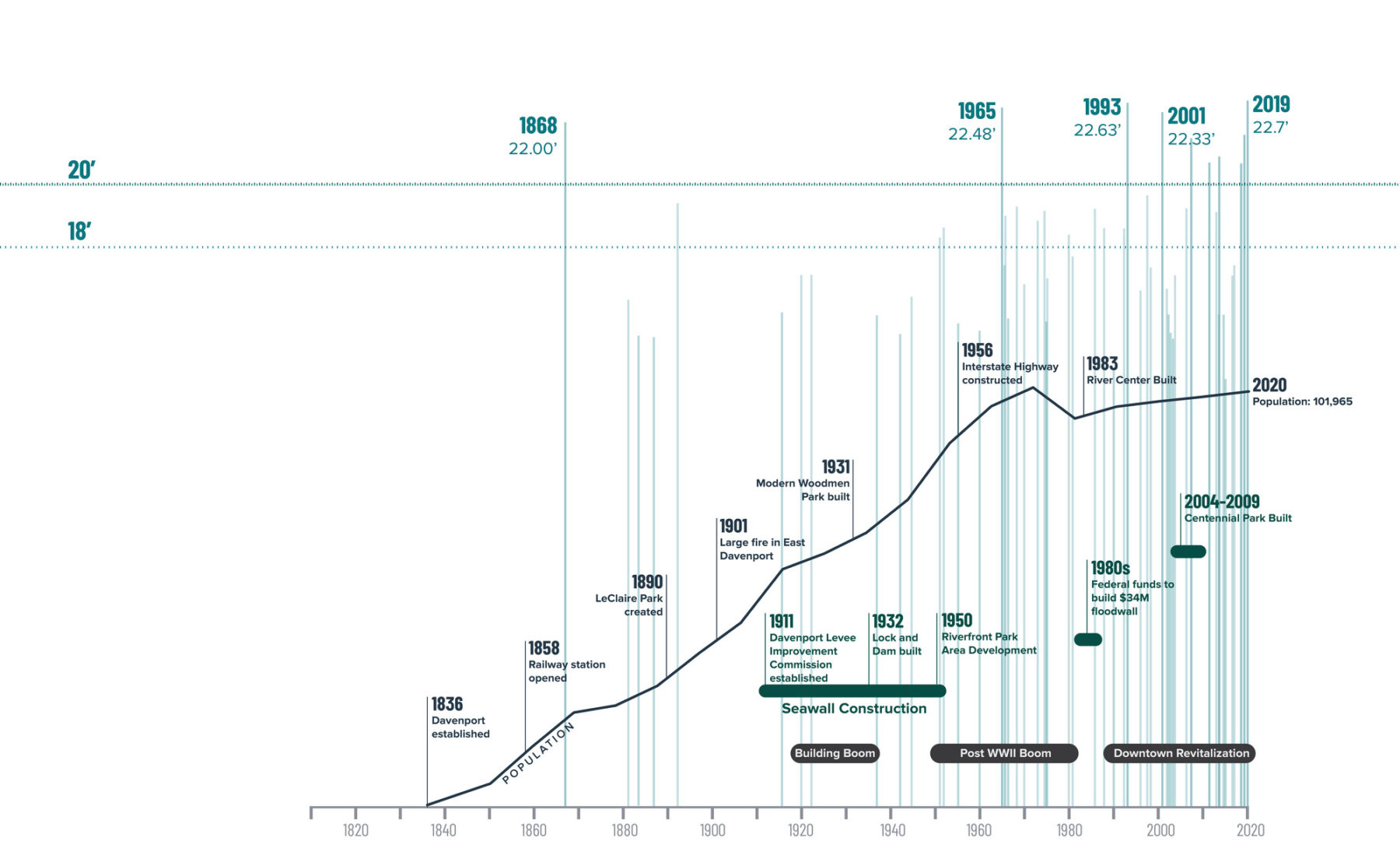
Though Davenport has been a city that has lived with the Mississippi River since its establishment, the frequency and intensity of floods increased significantly in the last 20 years. In addition to meeting immediate needs, the plan takes a long view, recommending mitigation measures that can be expanded to protect against higher flood elevations in the future.
Each stage of the planning process asked Davenport residents to express their ideas, based on their knowledge of their city and of the previous flood impacts. The emerging themes from the community and stakeholder feedback helped define the plan’s four guiding principles, which articulate the overarching values and goals that apply to all of the concepts included in the Resiliency Plan:
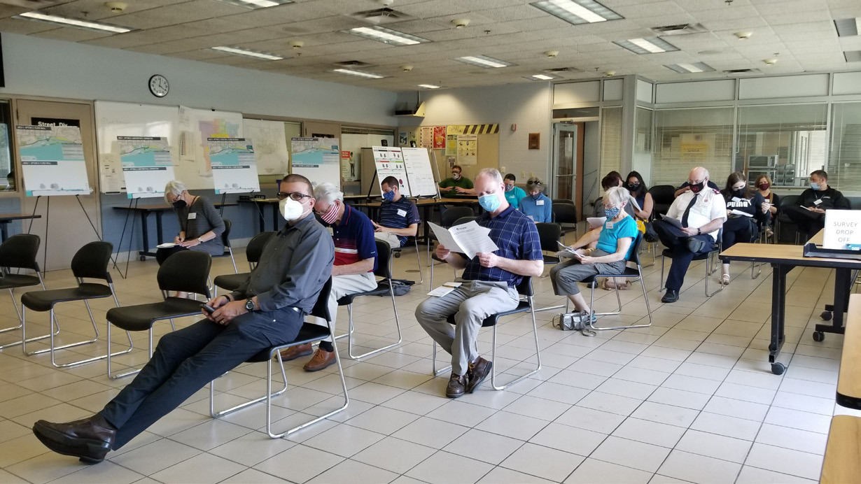
In addition to online surveys and focus group meetings, the planning process included smaller in-person gatherings with strategic attendance. Targeted invitations included: organizations focused on diversity, equity, and inclusion, community utility and response partners, neighborhood leaders, high school student newspapers, and local media.
In addition to overarching priorities, the community also guided the team’s understanding of what types of flood mitigation solutions would be right for Davenport. Residents’ priorities were rooted in the collective love for the riverfront as a key part of the city’s identity, as well as the recent first-hand experience of the challenges of a flood event.
There was strong desire for solutions that were permanent or required lower maintenance, so that they could be reliable for the long term, without requiring deployment during the dangerous conditions of a flood event. When asked about what the solution could look like, most participants desired to see a landscape approach (as opposed to a flood wall) to maintain and bolster the riverfront as a beautiful public space for the city.
To respond to the importance of both flood mitigation and the riverfront as a public space, the plan incorporates ideas that provide community benefits in addition to flood resilience. In the open space closest to Downtown Davenport, for example, the plan recommends the integration of a berm within an elevated plaza, to maintain views of the water and remain accessible during flooded conditions.
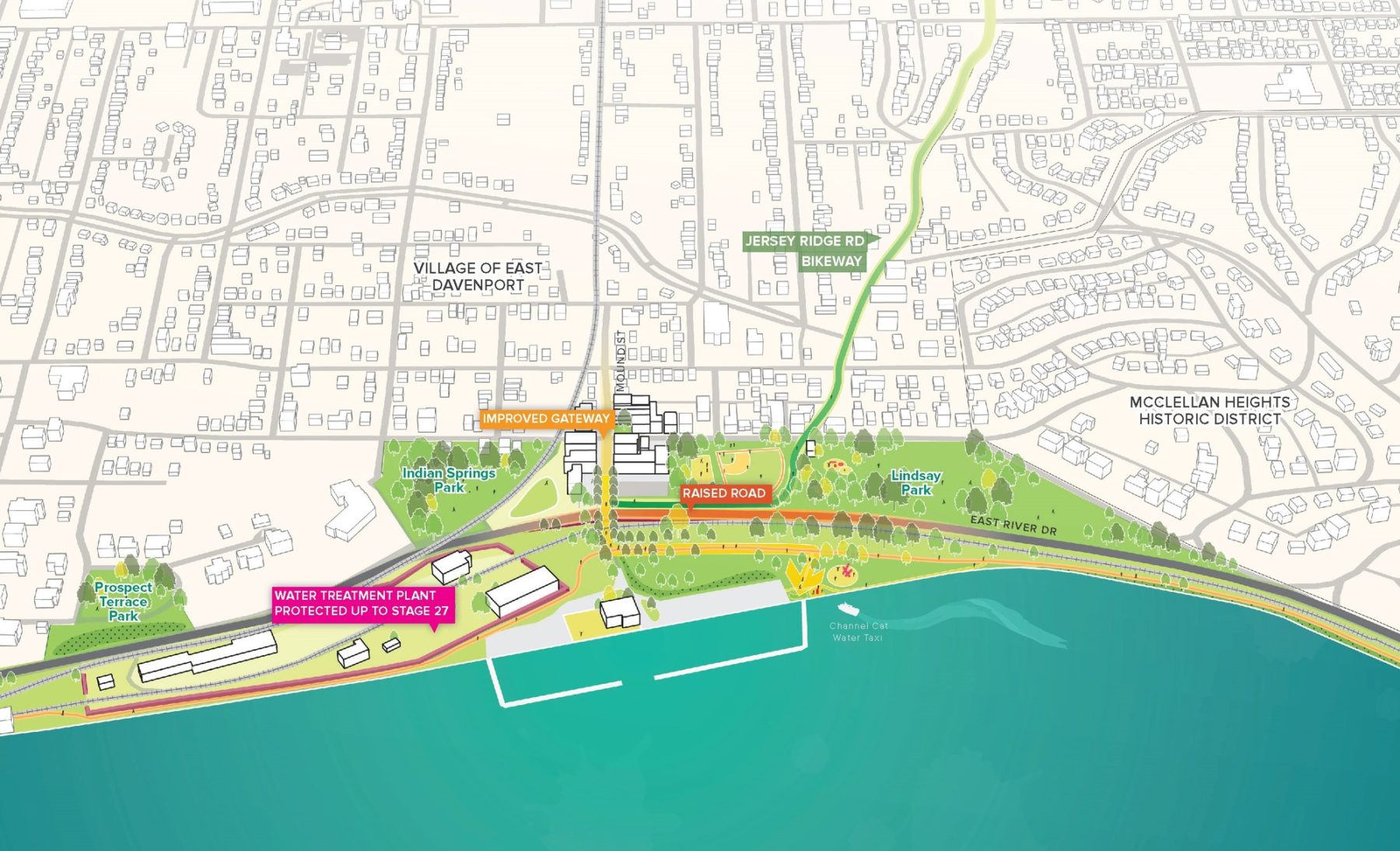
In the easternmost area of the plan, an elevated road acts as a flood barrier, maintains access to businesses during floods, and improves the neighborhood gateway experience
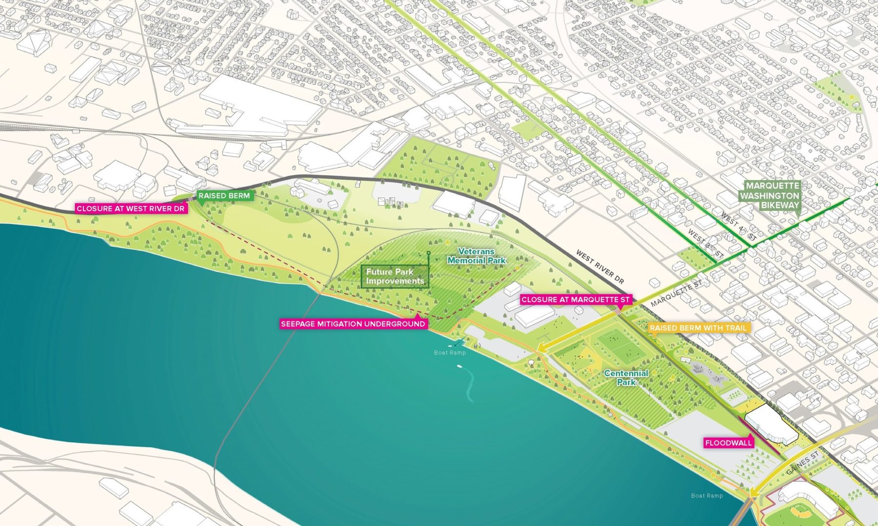
In areas where there is existing higher ground, like in Veterans Memorial Park, the plan maintains the height and instead provides mitigation measures underground
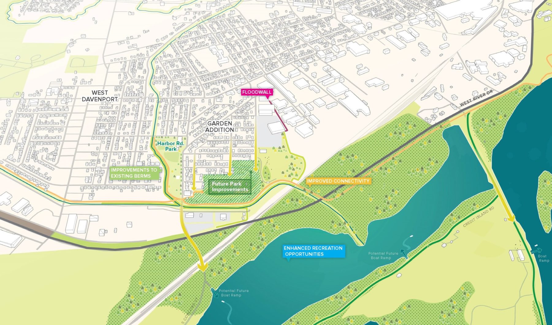
For the western neighborhood along Davenport’s riverfront, the plan’s recommendations address flooding from two sources—from the river as well as the two creeks that flow through the West End—while also improving connectivity to existing recreational activities
In the easternmost area of the plan, an elevated road acts as a flood barrier, maintains access to businesses during floods, and improves the neighborhood gateway experience
In areas where there is existing higher ground, like in Veterans Memorial Park, the plan maintains the height and instead provides mitigation measures underground
For the western neighborhood along Davenport’s riverfront, the plan’s recommendations address flooding from two sources—from the river as well as the two creeks that flow through the West End—while also improving connectivity to existing recreational activities
想了解更多项目细节,请联系 Zachary Chrisco.